Saint Vincent is another Caribbean destination to put on your bucket list. Get ready to enjoy a scenic tour along the leeward coast of this small yet stunning island in the Lesser Antilles.
Saint Vincent is another Caribbean destination to put on your bucket list. Get ready to enjoy a scenic tour along the leeward coast of this small yet stunning island in the Lesser Antilles.
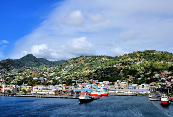
Various Amerindians lived on this island dating back to 150 AD. They called it Hairoun meaning Land of the Blessed. When Christopher Columbus sailed by during his third voyage on January 22, he was inspired by the Feast Day of Vincent of Saragossa to name the island Saint Vincent. Now it is your turn to discover this Lesser Antillean island in the eastern Caribbean Sea. Welcome to Kingstown, the biggest city with a population of 16,500 Vincentians.
Kingstown Bay, Kingstown, St. Vincent & Grenadines Enlarge/Slideshow See On Map Directions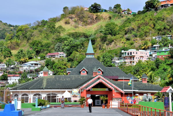
Saint Vincent is the largest island of an archipelago comprising the sovereign state of Saint Vincent and the Grenadines. The word largest is a relative term. This main island is only 18 miles long and 11 miles wide. You are disembarking at the SVG Cruise Ship Terminal in Kingstown, the capital city. This travel guide introduces you to a few nearby landmarks. Then, you are off on a scenic road trip along the Caribbean coastline. Print this guide in advance so a local taxi driver or guide can show you all of the island’s highlights.
SVG Cruise Ship Terminal, Kingstown, St. Vincent & Grenadines Enlarge/Slideshow See On Map Directions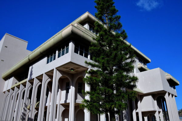
The Financial Complex is the tallest building in Kingstown at nearly 60 feet. It is also the most modernistic. Most of the five floors house the government of Saint Vincent and the Grenadines. On the fourth floor of the Administrative Centre is the prime minister’s office.
Financial Complex, Bay St, Kingstown, St. Vincent & Grenadines Enlarge/Slideshow See On Map Directions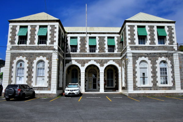
The French constructed a law court and legislative building on this site across from the market. In 1798, the British replaced it with this two-story structure for their House of Assembly and Law Courts. The court system for Saint Vincent and the Grenadines consists of eleven Magisterial Courts, the Family Court and the High Court. There is also an Eastern Caribbean Court of Appeals with jurisdiction over several Caribbean islands. Final appeals can be made to Her Majesty’s Privy Council in London.
Magistrates Court, Pauls Avenue & Halifax St, Kingstown, St. Vincent & Grenadines Enlarge/Slideshow See On Map Directions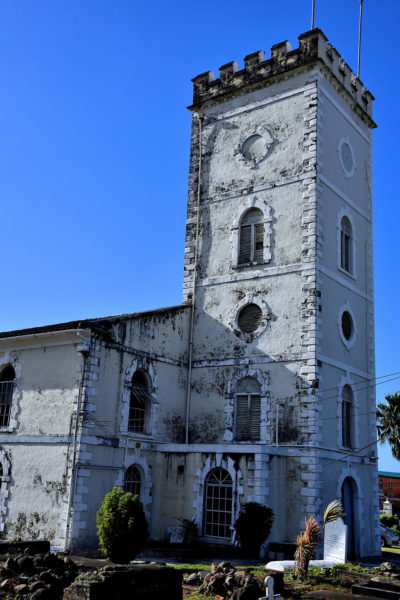
The British took control over Saint Vincent in 1763 and established St George’s Church in Kingstown two years later. Headstones in the yard reflect the names of some of the island’s earliest English settlers. In 1780, a hurricane destroyed the first Anglican church on this site. This Georgian replacement was constructed with lava stone and consecrated in 1820. The three bells within the tower were cast in Liverpool, England. In 1927, when the Diocese of the Windward Islands was formed, the church became St George’s Cathedral.
Kingstown Anglican Church, Grenville St, Kingstown, St. Vincent & Grenadines Enlarge/Slideshow See On Map Directions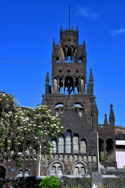
The Cathedral of Our Lady of the Assumption is an architectural surprise. This Mother Church of the Diocese of Kingstown is a proud testament to the struggles of Catholicism on the island. When the French arrived in the early 17th century, traveling Jesuit missionaries served the faithful on Saint Vincent and neighboring islands. The first permanent priests came in 1653. Tragically, they were murdered by the Caribs in 1701. They were replaced nine years later. However, the British expelled them in 1784 after defeating the French. Finally, in 1815, the first Catholic church was built here. The current St. Mary’s Cathedral was constructed during the 1930s.
Assumption Cathedral, North River Road, Kingstown, St. Vincent & Grenadines Enlarge/Slideshow See On Map Directions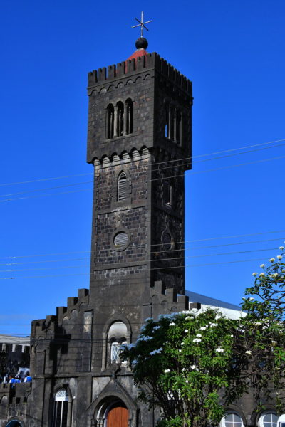
Adjacent to the main structure of Assumption Cathedral is the Madonna Tower. The magnificent bell tower reaches 100 feet. On top is a great observation platform for views of Kingstown and the harbor. The facades of both buildings display a unique blend of Moorish, Georgian, and Romanesque architecture.
Assumption Cathedral, North River Road, Kingstown, St. Vincent & Grenadines Enlarge/Slideshow See On Map Directions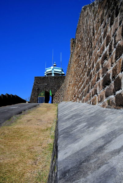
The Seven Years’ War ended in 1763 with the Treaty of Paris. As part of the agreement, France ceded many colonies in the Americas to Great Britain including Saint Vincent. The British immediately began building a fortification near Kingstown. They named it Fort Charlotte in honor of King George III’s wife. During the 43 years of construction – from 1763 until 1806 – the island witnessed several battles between the British and Indigenous people. Most noteworthy were the First Carib War (1769 – 1773) and battles with the Black Caribs (1793 – 1796). In between these events, the British lost control of Saint Vincent to the French from 1779 and 1783. In short, the colonial years during the second half of the 18th century were tumultuous at best.
Fort Charlotte, Edinboro Road, Clare Valley, St. Vincent & Grenadines Enlarge/Slideshow See On Map Directions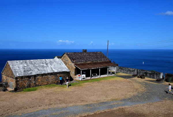
As the military value of Fort Charlotte waned, the property was repurposed several times. Among the institutions housed at the retired fortress were a poor house, mental hospital, leper colony and women’s prison. There are many more fascinating details about Fort Charlotte at the museum inside the old officers’ barracks. You can also admire cannons dating back to the early 19th century. Notice several of these guns point inland. These were positioned to defend from attacks by the Garifuna.
Fort Charlotte, Edinboro Road, Clare Valley, St. Vincent & Grenadines Enlarge/Slideshow See On Map Directions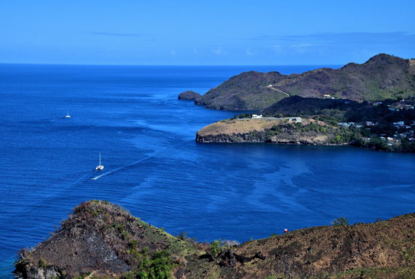
Fort Charlotte was built on top of Berkshire Hill overlooking the Caribbean Sea. The height of 525 feet provides panoramic views of Kingstown Bay to the south. Shown here is Lowmans Bay in St. Andrew Parish.
Fort Charlotte, Edinboro Road, Clare Valley, St. Vincent & Grenadines Enlarge/Slideshow See On Map Directions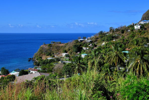
After visiting Fort Charlotte, drive back along Edinboro Road. It soon becomes Grenville Street. Look at this vista in your rearview mirror. Then, take a left at the intersection of the Leeward Highway. You are about to embark on a scenic road trip along the Caribbean coastline of Saint Vincent. The Leeward Highway heads north for less than 30 miles. The name highway is a misnomer. And the short distance will take longer than you think. The narrow road winds and twists along the rugged coast, passes several quaint villages, climbs mountain ridges and dips into lush valleys. There are also plenty of camera-worthy overlooks along the way plus a few tourist attractions. Plan on at least a half-day adventure.
Grenville Street & Leeward Hwy, Kingstown, St. Vincent & Grenadines Enlarge/Slideshow See On Map Directions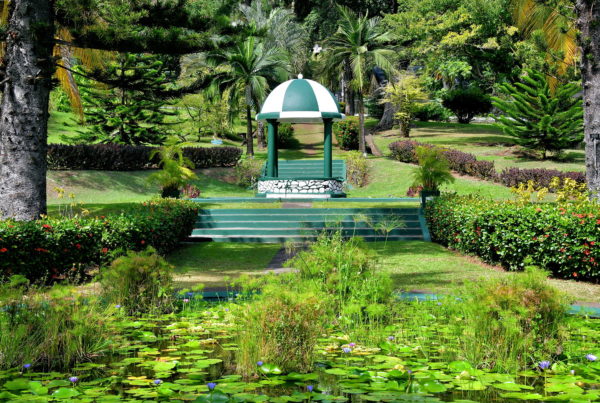
The Botanical Gardens are one of Saint Vincent’s most popular attractions. Tourists and locals alike meander along the paths crisscrossing the 20 acre property. They savor the manicured landscape filled with plants, trees and shrubs mixed with serenity. Founded in 1765, this is among the oldest public botanical gardens in the Western Hemisphere. Founders Robert Melville (British Caribbean Islands governor) and George Young (a military surgeon) collected plants from across the Caribbean and as far away as China. Even Vice-Admiral William Bligh was helping by collecting breadfruit in 1789 when his crew staged a mutiny on the HMS Bounty. Also contained within the Botanical Gardens is the Nicholas Wildlife Aviary Complex. Their mission includes a breeding program for the Saint Vincent parrot, the country’s national bird.
Botanical Gardens, New Montrose, St. Vincent & Grenadines Enlarge/Slideshow See On Map Directions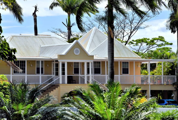
The government structure of Saint Vincent and the Grenadines is a parliamentary democracy and constitutional monarchy. The reigning monarch of the United Kingdom is the head of state. The office of governor-general is mostly ceremonial. The country’s main leader is the prime minister. This is the official residence of the prime minister. The property is located near the Botanical Gardens.
Prime Minister's Official Residence, To Largo Height, Kingstown, St. Vincent & Grenadines Enlarge/Slideshow See On Map Directions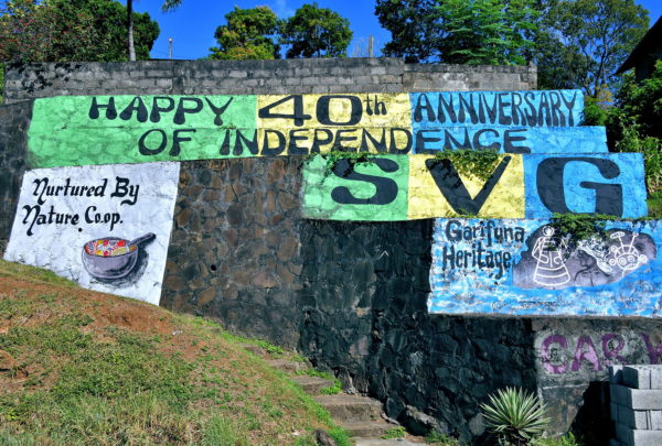
In 1969, Britain granted associate statehood status to Saint Vincent. This provided them with considerable government latitude. A decade later, St. Vincent and the Grenadines received their full independence. The event is celebrated each year on October 27. This painted sign along the Leeward Highway recognized four decades of the country’s independence.
Leeward Highway, Campden Park, St. Vincent & Grenadines Enlarge/Slideshow See On Map Directions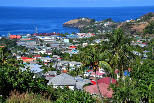
Cruise ships berth in Kingstown while commercial ships arrive in Campden Park. This is the island’s deep-water terminal for containers and breakbulk cargo. Notice the 100 ton Gottwald crane in the center of the main quay.
Campden Park Industrial Site, Campden Park, St. Vincent & Grenadines Enlarge/Slideshow See On Map Directions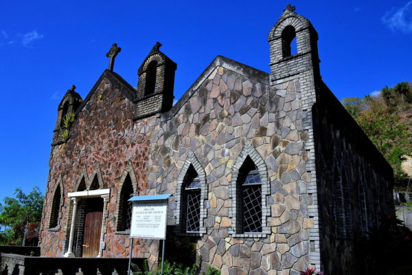
The Roman Catholic Diocese of Kingstown was designated by Pope John Paul II in 1989. The Mother Church is the Cathedral of Our Lady of the Assumption in Kingstown. There are also community churches in six parishes across the county. This is the Sacred Heart Church located in the Our Lady Queen of the Universe Parish. Less than 7% of Vincentians are Catholic.
Leeward Hwy, Pembroke, St. Vincent & Grenadines Enlarge/Slideshow See On Map Directions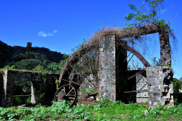
Similar to other Caribbean islands, many of the European settlers on Saint Vincent operated plantations. The primary crop was sugarcane. Also grown were coffee, tobacco, cocoa and cotton. Slaves were imported to work the fields until emancipation occurred in 1838. About 70% of today’s population is from African descent. You can still see remnants of plantations around the island. This decaying sugarcane mill is near Pembroke.
Leeward Hwy, Pembroke, St. Vincent & Grenadines Enlarge/Slideshow See On Map Directions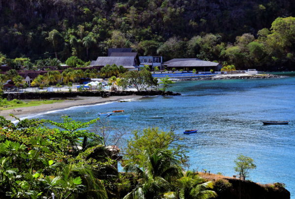
There are not an abundance of resorts and hotels on Saint Vincent. One of the standouts is Buccament Bay Resort. The five-star, all-inclusive property features over 100 rooms plus meals, pools, water sports and a golf course. Most surprising is the white beach along Buccament Bay. The rest of the western side of Saint Vincent has black sand.
Buccament Bay Resort, Buccament, St. Vincent & Grenadines Enlarge/Slideshow See On Map Directions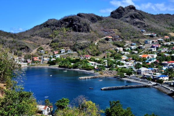
The Arawaks lived along Layou Bay long before Columbus discovered the island. They left behind primitive etches in rocks dating back to 300 to 600 AD. The Amerindian artwork can be admired a short distance from the Leeward Highway at the Layou Petroglyph Park. Layou was an early French settlement. They abandoned their colony after continuous battles with the Caribs (they called themselves Kalina). Once the British took control of the island in 1763, the land around Layou was devoted to sugarcane plantations predominately managed by three estates. Today, the small village has a population of about 150 people.
Layou Bay, Leeward Hwy, Layou, St. Vincent & Grenadines Enlarge/Slideshow See On Map Directions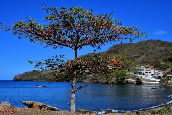
Interrupt your road trip for a relaxing stroll along the shore of Layou. The groomed beach and bayside scenery are magnificent. This pleasant ambiance is the result of a lot of hard work. During the late 1990s, this waterfront was virtually destroyed by three significant storms. A major restoration project was launched and completed in 2006.
Layou Bay, Leeward Hwy, Layou, St. Vincent & Grenadines Enlarge/Slideshow See On Map Directions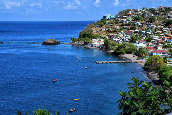
Step out of your car and savor this elevated view of Barrouallie. You will immediately understand why the earliest French settlers selected this idyllic spot in 1719. They quickly established plantations in the area manned by African slaves. Soon, Barrouallie evolved into the epicenter for sugarcane. This booming economy came to a crashing halt for two reasons. The slaves were freed in 1838. At the same time, sugarcane prices dropped when Europe began relying on their own sugar beets.
Leeward Hwy, Barrouallie, St. Vincent & Grenadines Enlarge/Slideshow See On Map Directions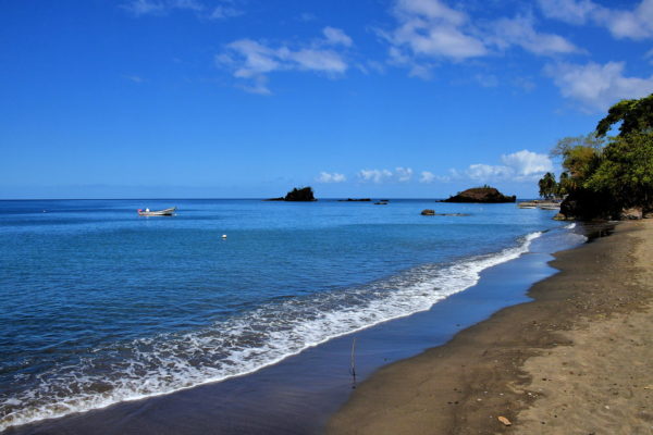
If you have the time, drive down into Barrouallie and park near the shore. Chances are you will have the beach to yourself. Tourists rarely visit here. Admire the two islets accenting the seascape. You might also see fishermen returning home. They specialize in catching blackfish. This is a type of pilot whale. The village has a population of about 1,000 people and is the capital of St. Patrick Parish. At one time, Barrouallie was the capital of Saint Vincent and the Grenadines.
Leeward Hwy, Barrouallie, St. Vincent & Grenadines Enlarge/Slideshow See On Map Directions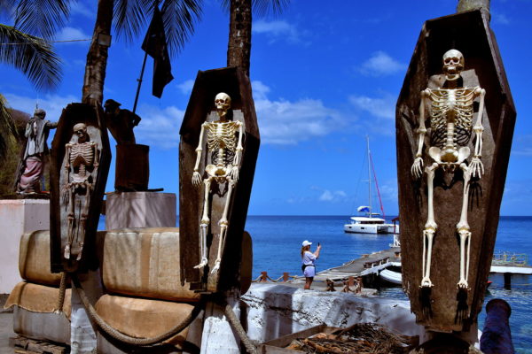
A visit to Wallilabou Anchorage is a must if you are a fan of Walt Disney’s Pirates of the Caribbean. This is the where the blockbuster series began with the first movie “The Curse of the Black Pearl.” Filming at this location occurred from October, 2002 until March, 2003. The setting at Wallilabou Bay represented Port Royal on the island Tortuga. This was the landing for Captain Jack Sparrow and his crew aboard the Interceptor. The set was also used for the next two films, “Dead Man’s Chest” (2006) and “At World’s End” (2007). You will be thrilled to tour several of the buildings and docks used in the movie.
Wallilabou Anchorage, Leeward Highway, Wallilabou, St. Vincent & Grenadines Enlarge/Slideshow See On Map Directions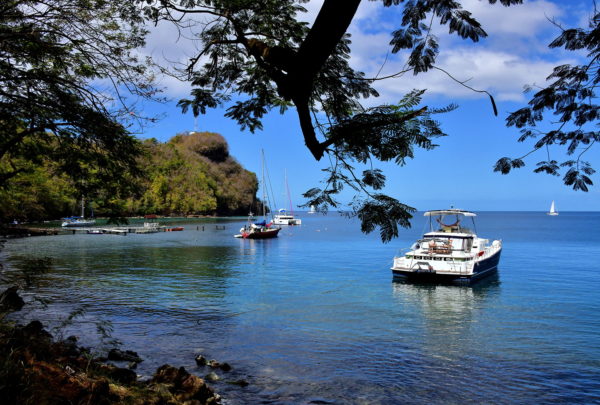
After exploring the Pirates of the Caribbean movie set, linger awhile to admire the beauty of Wallilabou Bay. Watch as anchored pleasure boats gently sway in the Caribbean Sea. You can arrange for a snorkeling, diving or sightseeing adventure. Or grab a bite to eat or sip a cocktail at the boutique hotel on the left. The Wallilabou Anchorage Hotel also displays several props from the Pirate of the Caribbean film series.
Wallilabou Bay, Leeward Highway, Wallilabou, St. Vincent & Grenadines Enlarge/Slideshow See On Map Directions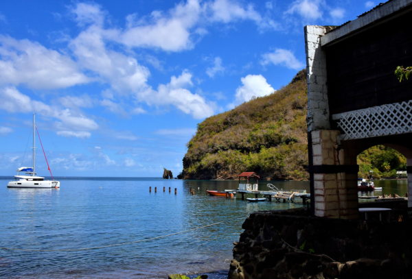
At the northern entrance of Wallilabou Bay is a stone arch. These waters are a great place for snorkeling if you brought your own gear. Sailors of the Caribbean and Jack Sparrow wannabes will also be delighted to learn there is a custom office at Wallilabou Anchorage. You can sail into the bay, arrange for mooring and spend a night or two at this famous movie setting.
Wallilabou Anchorage, Leeward Highway, Wallilabou, St. Vincent & Grenadines Enlarge/Slideshow See On Map Directions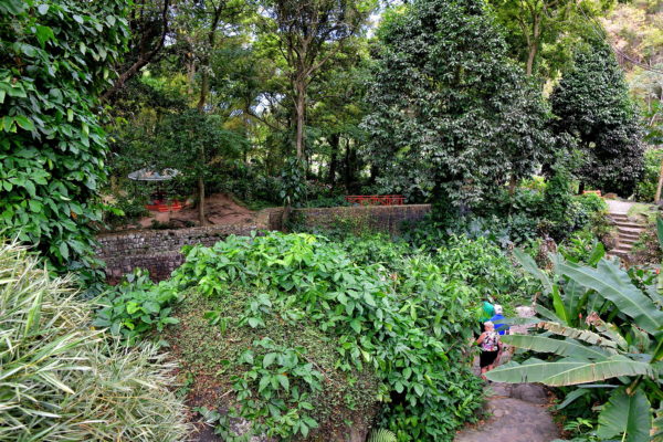
A former cocoa and cotton plantation has been converted into Wallilabou Heritage Park. The tourist attraction offers a winding, easy-to-walk path through a lush garden filled with forest vegetation and enormous Samaan trees. Rest awhile in the gazebo and enjoy crossing the stone arch bridge. Bring your binoculars so you can watch all of the birds. Wallilabou Heritage Park is a perfect place to stretch your legs during your driving tour. A small café and restrooms are also available.
Wallilabou Heritage Park, Leeward Highway, Wallilabou, St. Vincent & Grenadines Enlarge/Slideshow See On Map Directions
A visual highlight of Wallilabou Heritage Park is this small waterfall. Trickling over the edge is the Wallilabou River. The scene is peaceful to watch. And the thick canopy of trees will keep you cool even on a hot afternoon.
Wallilabou Heritage Park, Leeward Highway, Wallilabou, St. Vincent & Grenadines Enlarge/Slideshow See On Map Directions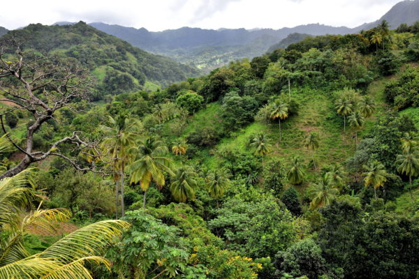
Most of your inland drive through St. Patrick Parish is mountainous. The narrow ridges have an average elevation of about 650 feet. The peaks exceed 2,000 feet in the center of the island. Nestled between these cornrows of rock are lush valleys. The tropical temperatures (the average high is 85°) and abundant rainfall up to 150 inches a year (summer is the wet season) are optimal conditions for a spectacular rainforest.
Leeward Highway, St. Patrick Parish, St. Vincent & Grenadines Enlarge/Slideshow See On Map Directions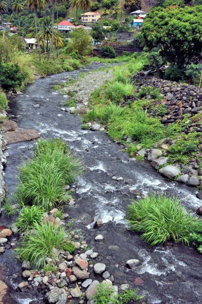
The babbling and shallow Cumberland River is placid while winding through the rocks toward Spring Village. But on Christmas Eve and Christmas Day of 2013, a catastrophic flash flood roared through this riverbed after a torrential rainfall of up to 12 inches. Several people were killed. The damages equaled 15% of the country’s GDP. Reconstruction of the catchment, plus the 85 foot long Spring Village Bridge you are driving over, was financed by the Government of Mexico. The project was finished in 2018.
Cumberland Bridge, Leeward Hwy, Spring Village, St. Vincent & Grenadines Enlarge/Slideshow See On Map Directions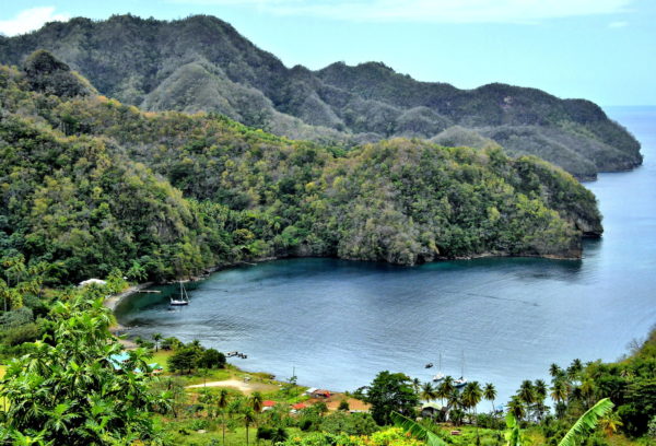
The beach along Cumberland Bay is one of the most appealing on the Caribbean side of Saint Vincent. The horseshoe cove delivers calm waters for swimmers. It is also deep enough to allow pleasure boats to anchor near shore. Plus, the Cumberland Beach Recreational Park provides plenty of amenities. There is a restaurant and bar on site. Other services include restrooms, showers and a laundry. So, take a break from your road trip, don your bathing suit and go for a refreshing dip.
Cumberland Bay, Leeward Hwy, Cumberland, St. Vincent and the Grenadines Enlarge/Slideshow See On Map Directions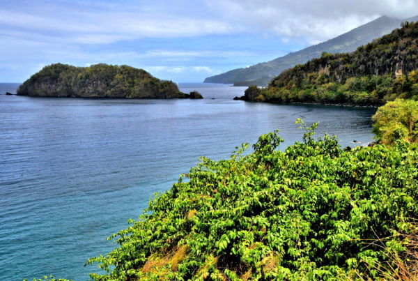
You are now being treated to the coastal panoramas of St. David Parish. With a size of 50 square miles, it is the second largest of the five parishes on the island of Saint Vincent. An estimated 6,700 people live in this gorgeous North Leeward section. On the left is Chateaubelair Islet. In 1987, this 4.5 square mile cay was designated as a National Wildlife Reserve. A thick forest extends up the 466 foot elevation, creating a haven for birds, lizards and other fauna. This is one of the 35 protected areas in Saint Vincent and the Grenadines.
Chateaubelair Islet, Chateaubelair Bay, Chateaubelair, St. Vincent & Grenadines Enlarge/Slideshow See On Map Directions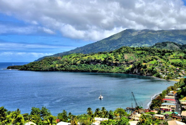
Chateaubelair Bay is a picturesque setting for the island’s fourth largest town. About 750 Vincentians call this quaint fishing village home. They also call it Chateau. Chateaubelair is the capital of St. David Parish.
Chateaubelair Bay, Chateaubelair, St. Vincent & Grenadines Enlarge/Slideshow See On Map Directions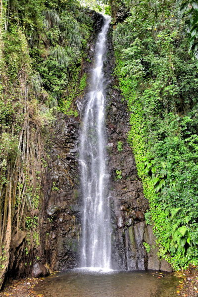
Saint Vincent has a few marvelous waterfalls. They are along rivers originating in the mountain regions of St. Patrick and St. David Parishes before flowing toward the leeward coast. Dark View Falls is an easy one to access. Actually, there are two waterfalls in this park – one above the other. Especially convenient are the changing rooms on site if you want to swim in the pool below the falls. Picnic tables are also available.
Dark View Falls, Leeward Hwy, Chateaubelair, St. Vincent & Grenadines Enlarge/Slideshow See On Map Directions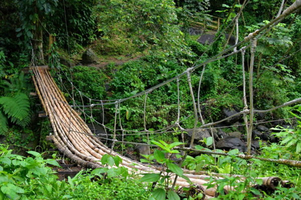
The pair of plunging cascades at Dark View Falls are the obvious main attraction. But equally appealing is the rainforest. Delightful shades of green will encircle your every step along the path. There are also two bridges over the Richmond River before reaching the falls. One is a typical footbridge. A more fun option is walking across this bamboo bridge. Yes, footing is a bit tricky and the span will sway a bit so watch your step. On the other side is an open field in the middle of giant bamboo grove.
Dark View Falls, Leeward Hwy, Chateaubelair, St. Vincent & Grenadines Enlarge/Slideshow See On Map Directions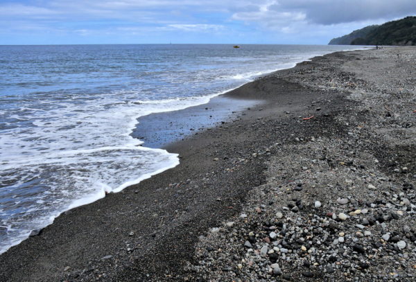
The end of your road trip along the Caribbean coastline brings you to Richmond Beach. The sweeping shoreline consists of course black sand and polished, multicolored stones. You will see locals shoveling the material into piles. The rocks are used for building construction and street repairs. Richmond Beach is also the end of the Leeway Highway. North of here is La Soufrière. The 4,049 foot, active stratovolcano caps the top of Saint Vincent. Soufrière has erupted five times since the early 18th century; twice in the 1970s. The most destructive event occurred in 1902 when more than 1,600 people were killed. Serious hikers will be interested in the La Soufriere Cross Country Trail. The coast-to-coast hike takes about six hours.
Richmond Beach, Leeward Hwy, Richmond, St. Vincent & Grenadines Enlarge/Slideshow See On Map Directions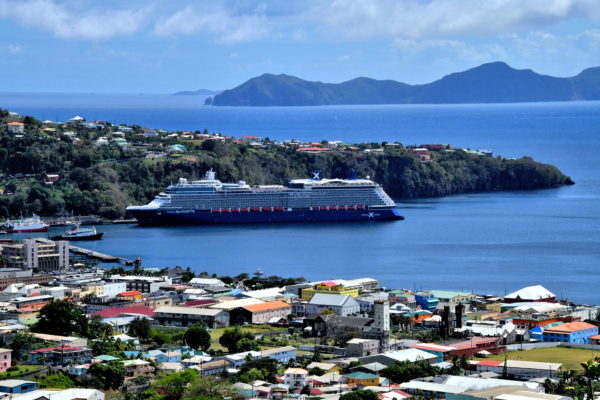
You know your Saint Vincent road trip is coming to an end when you see your cruise ship waiting for you at the terminal. Soon, you will be back on board and telling your fellow passengers about your exciting day in port. If you are vacationing in Saint Vincent, consider visiting some of the smaller islands of the Grenadines. There are 32 of them in the chain positioned south of Saint Vincent. Nine of the islands are inhabited. In the background is Bequia, the country’s second largest island. There are about 5,000 people living on this seven square mile island. A regular ferry service leaves Kingstown to make the seven mile journey to Bequia, the Island of the Clouds.
Enlarge/Slideshow