Hobart, TAS, Australia

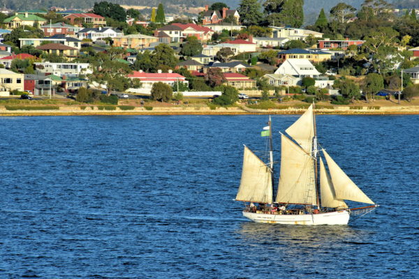
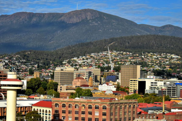
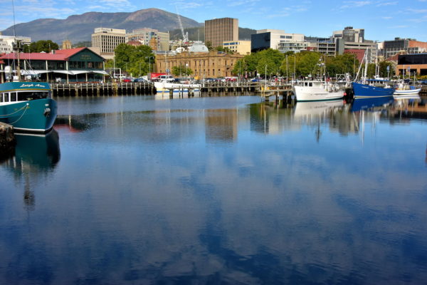
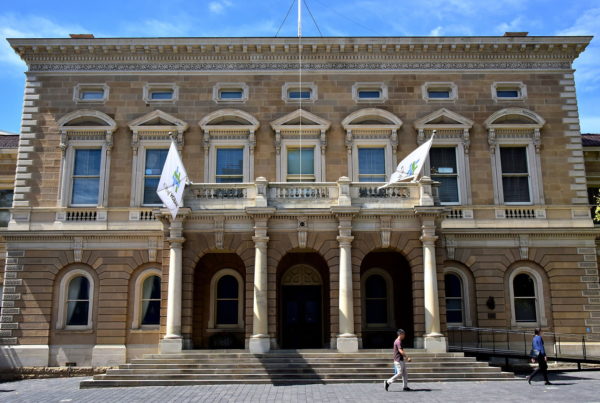
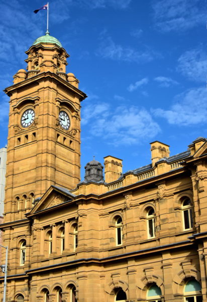
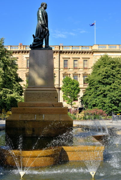
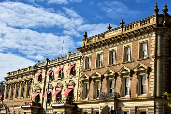
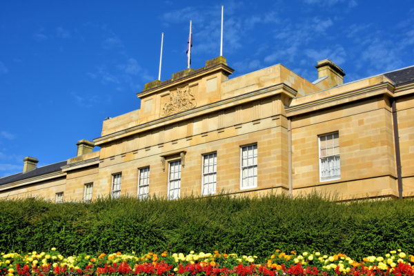
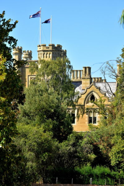
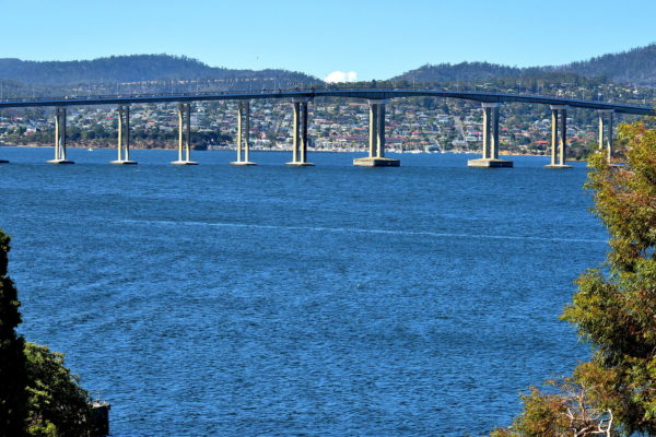
Hobart was founded as a British penal colony in 1804 on the west bank of the Derwent River at the world’s second deepest natural harbor. The city is the capital of Tasmania – one of six Australian states – located at the southeast corner of the island.

Share this
Schooner on Derwent River in Hobart, Australia - Encircle Photos

1 Schooner on Derwent River in Hobart, Australia

It is easy to understand why Captain David Collins selected Sullivans Cove – named after the Under Secretary to the Colonies – for an English settlement in 1804. He christened the new colony Hobart Town. The location at the estuary of the Derwent River provided for inland transportation upstream for 120 miles. More important, this is a deep, natural harbor. The port is protected by Storm Bay as it widens downstream and flows beyond the Tasman Peninsula into the ocean. Explorer Sir John Hayes named the river in 1793. It means “valley thick with oaks.” The tall ship is the SV Rhona H, built in 1942. It is one of several schooner sightseeing craft available from Hobart’s waterfront.

Derwent River, Hobart TAS 7000, Australia
Enlarge/Slideshow See On Map Directions
Cityscape of Hobart, Australia - Encircle Photos

2 Cityscape of Hobart, Australia

If you arrive at Hobart aboard a cruise ship, you will be treated to this cityscape as you berth at Macquarie Wharf No 2. Welcome to the capital of Tasmania. Since the former Hobart Town began as a British penal colony, it has grown to 225,000 residents. The namesake was Robert Hobart, 4th Earl of Buckinghamshire. Lord Hobart was the Secretary of State for War and Colonies when Hobart was settled in 1804. In the foreground is the Port of Hobart along Sullivans Cove. In the background is Mount Wellington. Just below the broadcast towers at the 4,170 foot summit are the Organ Pipes, a cliff of dolerite columns.

Macquarie Wharf No 2, Hunter St, Hobart TAS 7000, Australia
Enlarge/Slideshow See On Map Directions
Hobart Port Tower in Hobart, Australia - Encircle Photos

3 Hobart Port Tower in Hobart, Australia

Hobart’s main port for commercial, Navy and passenger vessels consists of six terminals called Macquarie Wharf. Controllers manage the maritime traffic guided by pilot boats from atop Hobart Port Tower. Its elevation of 135 feet provides a commanding view of Sullivans Cove and the Derwent River.

Hobart Port Tower, Hunter St, Hobart TAS 7000, Australia
Enlarge/Slideshow See On Map Directions
H. Jones & Co. Factory in Hobart, Australia - Encircle Photos

4 H. Jones & Co. Factory in Hobart, Australia

As you disembark from your cruise ship at Macquarie Wharf, notice the brick warehouse with the words “IXL. Jams, H. Jones & Co, Ltd.” This was part of a large factory complex established by Henry Jones in 1891. The brand became Australia’s leader for jams and marmalade by the time it was purchased by Coca-Cola Amatil in 2005. The historic site is now the Henry Jones Art Hotel, located on Hunter Street. This was Hunter Island when Lieutenant-Governor David Collins landed here in 1804 with the First Fleet of convicts and settlers.

47 Hunter St, Hobart TAS 7000, Australia
Enlarge/Slideshow See On Map Directions
Victoria Dock along Franklin Wharf in Hobart, Australia - Encircle Photos

5 Victoria Dock along Franklin Wharf in Hobart, Australia

A walk along Franklin Wharf is a walk back into Hobart’s origin. Since its founding in 1804, fishermen used Constitution Dock to harbor their fleet and sell their fresh catch. In the 1840s, it was expanded into Fisherman’s Dock, now the adjacent Victoria Dock. On the other side of Franklin Wharf are a marina and several piers including one for the ferry terminal. They all face the scenic Sullivans Cove. This waterfront promenade is a delight to explore.

Franklin Wharf, Hobart TAS 7000, Australia
Enlarge/Slideshow See On Map Directions
Heading South Sculpture along Franklin Wharf in Hobart, Australia - Encircle Photos

6 Heading South Sculpture along Franklin Wharf in Hobart, Australia

Seals and Penguins is a bronze sculpture by Stephen Walker along Franklin Wharf. It is part of an ensemble called Heading South. These waterfront artworks memorialize Hobart’s role as the launching point for several 19th century Antarctic expeditions. The first maritime explorer was James Clark Ross, a captain of the Royal Navy. His two ships – the HMS Terror and HMS Erebus – set sail from this point to the Antarctic in 1840.

Franklin Wharf, Hobart TAS 7000, Australia
Enlarge/Slideshow See On Map Directions
1902 Custom House in Hobart, Australia - Encircle Photos

7 1902 Custom House in Hobart, Australia

At the turn of the 20th century, the Parliament of Tasmania had occupied most of the custom house built in 1840. So, a new Customs House was commissioned along Davey Street. The grand, Classical Revival façade of Tasmania’s first federal building became part of a complex. The historical structures include the Commissariat Store (1810), the Private Secretary’s Cottage (1815) and the Bond Store by architect David Lamb (1824). The Tasmanian Government purchased these in 1977. There are now part of the Tasmanian Museum and Art Gallery.

19 Davey St, Hobart TAS 7000, Australia
Enlarge/Slideshow See On Map Directions
Tasmanian Museum and Art Gallery in Hobart, Australia - Encircle Photos

8 Tasmanian Museum and Art Gallery in Hobart, Australia

The mission of the Tasmanian Museum and Art Gallery is to safeguard Tasmania’s natural and cultural heritage. Australia’s second oldest museum was established in 1843 and opened on Macquarie Street twenty years later. Their collection has swelled to over 800,000 items including artifacts of early Tasmanian people, plants and animals to artworks, photographs and crafts reflecting the state’s heritage and history. Walk beneath this arched entrance on Dunn Place for a fascinating understanding and appreciation of Tasmania. Admission is free.

Dunn Place, Hobart, TAS 7000, Australia
Enlarge/Slideshow See On Map Directions
Hobart City Hall in Hobart, Australia - Encircle Photos

9 Hobart City Hall in Hobart, Australia

The name Hobart City Hall is a misnomer. This is not a government building, although it is managed by the Hobart City Council. Since it opened in 1915, this has been an auditorium and event center. It hosts concerts, exhibitions and is rentable for private functions.

Hobart City Hall, 57-63 Macquarie St, Hobart TAS 7000, Australia
Enlarge/Slideshow See On Map Directions
Hobart Town Hall in Hobart, Australia - Encircle Photos

10 Hobart Town Hall in Hobart, Australia

Hobart’s metropolitan area is managed by five local government areas. The largest is the City of Hobart with about 50,000 people. The headquarters for their city council is Hobart Town Hall. Construction began in 1864 after the Government House that occupied this prominent land on Macquarie Street was torn down. The Neo-Renaissance façade by architect Henry Hunter was finished in 1866. Inside is a lush, Victorian auditorium with an ornate ceiling, crystal chandeliers, an 1868 pipe organ from Suffolk, England and seating for 300.

50 Macquarie St, Hobart TAS 7000, Australia
Enlarge/Slideshow See On Map Directions
General Post Office in Hobart, Australia - Encircle Photos

11 General Post Office in Hobart, Australia

The handsome, Edwardian Baroque style of the General Post Office was created by Alan Cameron Walker, a prolific 19th century architect who designed many of Hobart’s landmarks. In 1906, a year after it became operational, the Queen Victoria Clock Tower was added thanks to £1,465 in public donations. The chimes are similar to Big Ben at the Palace of Westminster. GPO is located along Macquarie Street, the main thoroughfare through Hobart’s Central Business District and a showcase for some of the city’s finest Georgian architecture.

Hobart GPO, Macquarie Street & Elizabeth Street, Hobart TAS 7000, Australia
Enlarge/Slideshow See On Map Directions
Colonial Mutual Life Building in Hobart, Australia - Encircle Photos

12 Colonial Mutual Life Building in Hobart, Australia

Colonial Mutual Life Assurance Society Limited was founded in Melbourne in 1873 and grew rapidly in Australia. While this Hobart landmark was being constructed in the early 1930s, a sister CML structure was built in Adelaide, South Australia. Look closely at the 115 foot roofline to appreciate the eagle-like gargoyles along the parapet. You will also notice the chevrons etched into the Art Deco facade. The financial services firm Colonial Limited had an international presence before being acquired in 2000.

18 Elizabeth St, Hobart TAS 7000, Australia
Enlarge/Slideshow See On Map Directions
Sir John Franklin Statue at Franklin Square in Hobart, Australia - Encircle Photos

13 Sir John Franklin Statue at Franklin Square in Hobart, Australia

This public square created in 1866 is named after the man depicted in the statue. Sir John Franklin was the Lieutenant-Governor of Van Diemen’s Land from 1837 until 1843. His legacy was established as a Rear-Admiral in the English Royal Navy. He conducted three expeditions to chart the Arctic coastline. Part of his epitaph on the stone pedestal reads, “Not here! The white north has thy bones.” In 1845, his two vessels became icebound in the Northwest Passage. Franklin and his crew died near King William Island. The ships were finally uncovered in 2014 and 2016.

Franklin Square, 70 Macquarie St, Hobart TAS 7000, Australia
Enlarge/Slideshow See On Map Directions
Historic Franklin Square Offices in Hobart, Australia - Encircle Photos

14 Historic Franklin Square Offices in Hobart, Australia

Franklin Square Offices is a multiplex of historic Tasmanian government buildings initiated by Van Diemen’s Land Lieutenant-Governor William Sorell in 1823. This is a list of the major, 19th century structures, their completion dates and architects. Court House in 1825 by Colonial Architect David Lambe with an extension in 1836; Police Offices in 1835 and Public Offices in 1841 by John Lee Archer; Fire Proof Building in 1856 and Supreme Court in 1860 by William Pordan Kay; Conversion of Court House to Post Office with portico added in 1860; Executive Council Offices in 1884 and Deed Building in 1894 by William Waters Eldridge. Fourteen more expansions occurred duringt the 20th century. These structures are now the headquarters for the Tasmanian Department of Treasury & Finance.

21 Murray St, Hobart TAS 7000, Australia
Enlarge/Slideshow See On Map Directions
National Mutual Life Building in Hobart, Australia - Encircle Photos

15 National Mutual Life Building in Hobart, Australia

National Mutual Life Association of Australasia was founded in Melbourne in 1869. During its period of high growth, it commissioned Alan Cameron Walker to build their Hobart offices. The façade of the 1906 structure deserves close inspection. The bas-reliefs among the pilasters feature lions. This theme is continued with two lion sculptures clasping monogrammed shields. They flank the company’s logo of a lion and a unicorn above the entrance on Macquarie Street. National Mutual was acquired by T&G Mutual Life in 1983.

119 Macquarie Street, Hobart TAS 7000, Australia
Enlarge/Slideshow See On Map Directions
St. David’s Cathedral Bell Tower in Hobart, Australia - Encircle Photos

16 St. David’s Cathedral Bell Tower in Hobart, Australia

Anglican services in Hobart date back to 1804. Their first church collapsed after a couple of years. The second St. David’s was built in 1823 and was designated a cathedral when Hobart became a city in 1842. Construction of the current St. David’s Cathedral – with its Neo-gothic design by George Frederick Bodley – required 68 years. It was finished in 1936 after ten bells were installed in this crenelated tower. The heaviest one weights 1.2 tons.

23 Murray St, Hobart TAS 7000, Australia
Enlarge/Slideshow See On Map Directions
St. David’s Cathedral Nave in Hobart, Australia - Encircle Photos

17 St. David’s Cathedral Nave in Hobart, Australia

After walking inside of St. David’s Cathedral, your eye immediately travels along the lancet arches, sandstone columns and Tasmanian blue gum ribbed vault toward the high sanctuary. Above it is an elegant wood screen depicting the crucifixion. This cross was hand-carved in Oxfordshire, England in 1916. On the right is the Bishop’s Cathedra, a replica of the chair used by Queen Victoria during her coronation in 1838. The tall wooden pulpit was added in 1909. Encircling this gorgeous nave are stained glass windows.

23 Murray St, Hobart TAS 7000, Australia
Enlarge/Slideshow See On Map Directions
T&G Mutual Life Building in Hobart, Australia - Encircle Photos

18 T&G Mutual Life Building in Hobart, Australia

T&G Mutual Life Assurance Society was established in Victoria in 1876. The initials stood for “Temperance General.” This yellow, Art Deco facade with its sleek clock tower was produced by the architectural firm A & K Henderson. The insurance company commissioned 20, nearly identical buildings across Australia and New Zealand from 1925 until 1938. Six of them remain standing in Australia. Interestingly, both the Melbourne and Hobart offices are located on Collins street. The namesake is David Collins, the first Lieutenant Governor of Van Diemens Land, the original named for Tasmania. After merging in 1999, T&G became AXA Asia Pacific.

117 Collins Street, Hobart TAS 7000, Australia
Enlarge/Slideshow See On Map Directions
Joker Mural Harrington Lane in Hobart, Australia - Encircle Photos

19 Joker Mural Harrington Lane in Hobart, Australia

Muralist enthusiasts will enjoy Hobart’s street art. Two of the best places to visit are Kemp Street and Harrington Lane where this rendition of The Joker can be seen beside his comic book archrival Batman. Numerous city walls have been used as a canvas by painters ranging from amateurs wielding a spray can, to local favorites like Jamin, to international talent including Smug. The Urban Art Walls project, sponsored by the City Council, also commissions artists to contribute to its outdoor gallery.

Harrington Lane, Hobart TAS 7000, Australia
Enlarge/Slideshow See On Map Directions
19th Century Architecture on Murray Street in Hobart, Australia - Encircle Photos

20 19th Century Architecture on Murray Street in Hobart, Australia

This trio of handsome, 19th century buildings is on Murray Street at the intersection of Macquarie Street. On the right is the Derwent & Tamar Building. The assurance company started in 1838 and is the sole survivor of four insurance companies established in Hobart. Their former headquarters were designed by Henry Hunter, built upon the old Hobart Gaol (jail) and finished in 1877. In the middle was Hobart Savings Bank, founded by draper (cloth salesman) George Washington Walker in 1845. The bank’s headquarters, which marketed to the lower class, opened in 1859. Its neighbor on the left was a Masonic temple named the Freemasons Hall Company when it was finished in 1874. The street’s namesake is Captain John Murray, the third Commandant of Hobart Town from 1810 until 1812.

Murray Street & Macquarie Street, Hobart TAS 7000, Australia
Enlarge/Slideshow See On Map Directions
Parliament House of Tasmania in Hobart, Australia - Encircle Photos

21 Parliament House of Tasmania in Hobart, Australia

After Tasmania separated from New South Wales in 1825, the independent colony established a Legislative Council and met in the Government House (demolished in 1858). In 1841, the council moved to the newly finished Custom House designed by John Lee Archer. He was the civil engineer and colonial architect plus a magistrate for Van Diemen’s Land from 1827 until 1852. Since 1904, the Parliament of Tasmania’s House of Assembly and Legislative Council have occupied this entire radiant, bronze-colored edifice on Salamanca Place.

1 Salamanca Pl, Hobart TAS 7000, Australia
Enlarge/Slideshow See On Map Directions
St David’s Park in Hobart, Australia - Encircle Photos

22 St David’s Park in Hobart, Australia

St David’s Park is located near the Parliament House and Salamanca Place. This tree-lined tract with green lawns and paved paths is the perfect place for a romantic stroll. You would never guess when entering through a gate supported by lion capitals – carved by Richard Patterson in 1884 – that this was Tasmania’s first cemetery. About 900 people were buried here from 1804 until 1872. Many of their headstones were converted into a memorial wall when this old burial ground was converted to a park after being purchased by the city in 1919 and designed in 1926.

1 Sandy Bay Rd, Hobart TAS 7000, Australia
Enlarge/Slideshow See On Map Directions
Salamanca Place in Hobart, Australia - Encircle Photos

23 Salamanca Place in Hobart, Australia

Facing Princes Wharf is Salamanca Place, named after a 1812 battle during the Peninsular War. This row of sandstone warehouses built in the 1830s have been converted into an entertainment center featuring a theatre, hotel, restaurants, cafes, taverns, galleries and boutique shops. An inner courtyard named Salamanca Square offers similar options. If you are in Hobart on a Saturday, make sure to experience Salamanca Market. This very popular outdoor event is an exciting network of over 300 local merchants and artisans selling their crafts, art and farm products.

Salamanca Place, Hobart TAS 7000, Australia
Enlarge/Slideshow See On Map Directions
Battery Point in Hobart, Australia - Encircle Photos

24 Battery Point in Hobart, Australia

Hobart Town quickly prospered as a British settlement after being founded by Lieutenant-Governor David Collins in 1804. It was soon believed to be vulnerable to attack by European enemies. So, they began building coastal defenses. The first battery of six guns was finished in 1818. Previously named Mulgrave Battery, it is now the prestigious neighborhood of Battery Point. This inner-city suburb only has 2,000 residents. Yet they live in some of the finest Georgian and Victorian homes in Tasmania. The best way for architecture fans to reach Battery Point is to climb Kelly’s Steps from Salamanca Place. The staircase was created in 1839.

Hampden Road & De Witt Street, Battery Point TAS 7004, Australia
Enlarge/Slideshow See On Map Directions
Narryna Heritage Museum in Hobart, Australia - Encircle Photos

25 Narryna Heritage Museum in Hobart, Australia

Captain Andrew Haig arrived in Hobart Town in 1824 aboard his cargo ship, The Snipe. After purchasing land, he moved to New Zealand for nine years. When he returned, he built a warehouse along Salamanca Place to facilitate his shipbuilding and maritime trade. In 1837, he commissioned this Georgian sandstone home in Battery Point. Since 1955, Narryna has been a museum with period furnishings reflecting the lifestyle of the colonial upper class. Narryna Heritage Museum is one of two Hobart House Museums on Hampden Road. They are operated by the Tasmanian Museum and Art Gallery.

103 Hampden Rd, Battery Point TAS 7004, Australia
Enlarge/Slideshow See On Map Directions
St George’s Anglican Church in Hobart, Australia - Encircle Photos

26 St George’s Anglican Church in Hobart, Australia

St George’s Anglican Church was built in 1838 on Kermode’s Hill, the summit of Battery Point. Its Neoclassical style and sandstone construction are still impressive. St George’s is one of 13 Tasmanian churches designed by John Lee Archer from 1828 through 1844 while he was the colonial architect for Van Diemen’s Land. The tower was added in 1847 based on the work of James Blackburn. He arrived in Hobart in 1833 as a convict for forgery and became a prolific architect in Hobart after being pardoned in 1841. The tower’s bright light helped so many sailors navigate the Derwent River at night that it became known as the Mariners’ Church. While admiring this historic landmark, look to your left to appreciate the parsonage dating form 1896.

30 Cromwell St, Battery Point TAS 7004, Australia
Enlarge/Slideshow See On Map Directions
Sandy Bay in Hobart, Australia - Encircle Photos

27 Sandy Bay in Hobart, Australia

Sandy Bay is a suburb of 12,000 residents near an inlet of the Derwent River. It is also a marina for a yacht club and a sailing club at either end of the beach. The waterfront park – both kid and dog friendly – is the Errol Flynn Reserve. Its namesake is the swashbuckling, womanizing and sometimes scandalous Hollywood actor who starred in movies from 1932 until his death in 1959. He was born nearby in 1909. Flynn lived in Battery Park until 1925 when he left for boarding school. In the background is Mount Nelson. Located on top since 1811 is the Signal Station. It offers panoramic views of the bay and surrounding high-end suburb.

Short Beach, 12 Marieville Esplanade, Sandy Bay TAS 7005, Australia
Enlarge/Slideshow See On Map Directions
Sandy Bay Homes in Hobart, Australia - Encircle Photos

28 Sandy Bay Homes in Hobart, Australia

Aficionados of vintage homes will enjoy strolling around the inter-city suburb of Sandy Bay. Many were built during the Victorian era and have been lovingly maintained. A few date back to Colonial times while others were built in the early 1900s. Many are surrounded by walls and/or tall vegetation. These originated from the early 1820s when hawthorn hedges were imported and sold as a means for British settlers to mark their properties while securing privacy.

20 Marieville Esplanade, Sandy Bay TAS 7005, Australia
Enlarge/Slideshow See On Map Directions
Hobart Cenotaph in Hobart, Australia - Encircle Photos

29 Hobart Cenotaph in Hobart, Australia

Hobart Cenotaph is a 75 foot tall, granite obelisk which pays tribute to Tasmanian soldiers who have died in service since 1914. Near the base is the inscription, “Lest We Forget.” Leading up to the cenotaph is a groomed mall lined with cedar trees named Soldier’s Memorial Avenue. The war memorial is located on land previously called Queens Battery, one of many coastal artillery positions created by British colonists in the early 19th century and operational until 1923.

Anzac Parade, Queens Domain TAS 7000, Australia
Enlarge/Slideshow See On Map Directions
Government House in Hobart, Australia - Encircle Photos

30 Government House in Hobart, Australia

During the early 19th century, Colonel David Collins had the distinction of being the first lieutenant governor of three British colonies. They later became Australian states: New South Wales in 1788, Victoria in 1803 and Van Diemens Land (now Tasmania) in 1804. His official living quarters in Hobart was a shack. The second government house – previously located near today’s Franklin Square – was torn down in 1858 after the current governor’s residence in Queen’s Domain was finished. This Gothic Revival design by architect William Pordon Kay resembles a castle. Government House is perched on a hill overlooking the Royal Botanic Gardens. The 37 acres of the Tasmania governor’s estate includes a manicured English garden.

7 Lower Domain Rd, Queens Domain TAS 7000, Australia
Enlarge/Slideshow See On Map Directions
Tasman Bridge in Hobart, Australia - Encircle Photos

31 Tasman Bridge in Hobart, Australia

Tasman Bridge replaced its predecessor when it opened for traffic in 1965. The concrete girder structure spans 4,580 feet and connects the west and east banks of the Derwent River. It has five lanes to accommodate over 100,000 cars a day plus two pedestrian walkways. At 198 feet, it is tall enough for the passage of most ships. However, auto traffic is stopped for large vessels in recognition of a disaster in 1975 when an ore carrier struck the bridge’s pylons, sending four cars plunging into the water.

Tasman Bridge, Montagu Bay TAS 7018, Australia
Enlarge/Slideshow See On Map Directions
TOP