Westman Islands, Iceland

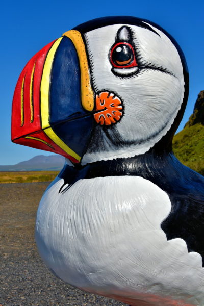
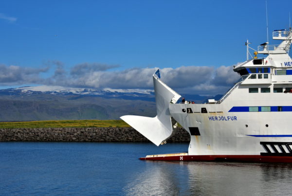
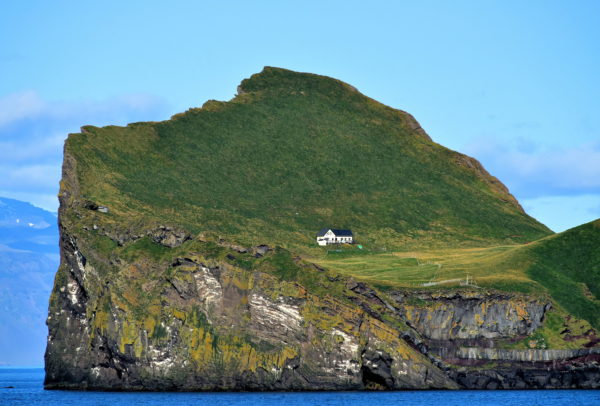
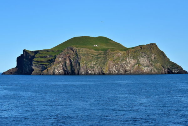
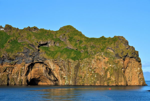
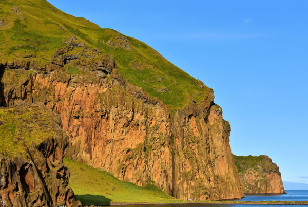
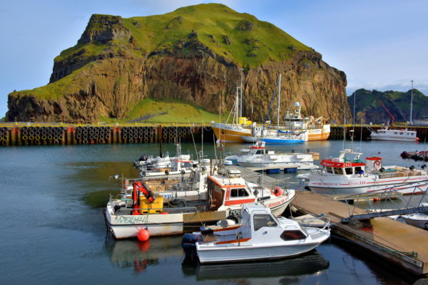
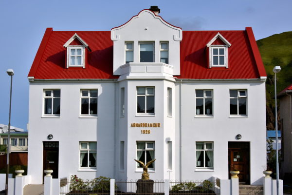
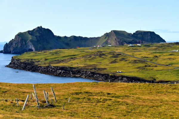
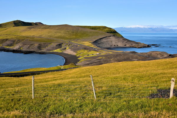
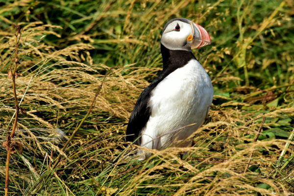
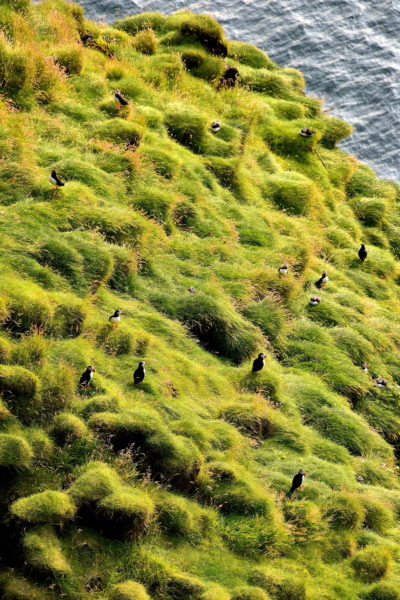
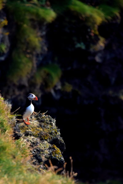
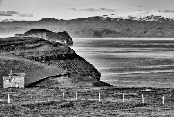
Westmann Islands is an archipelago off of Iceland’s southern coast. Vestmannaeyjar is the only town on Heimaey, the largest island of the 15 islands created by millenniums of volcanic eruptions. Their two marketing phrases are “Pompeii of the North” and “Puffin Capitol of the World.”

Share this
Puffin Statue Advertising Westman Islands at Seljalandsfoss, Iceland - Encircle Photos

1 Puffin Statue Advertising Westman Islands at Seljalandsfoss, Iceland

After enjoying the Seljalandsfoss waterfall, watch for this puffin statue as you leave the parking lot but before getting back onto Route 1. Next to this adorable bird are information boards about the Westman Islands. This Icelandic archipelago is better than the description. So go ahead … drive a couple blocks west on Route 1 and turn left on Landeyjahafnarvegur (Route 254). You are about to have a wonderful time seeing the Westman Islands and exploring the town of Vestmannaeyjar. If you miss this statue, don’t worry. There are more on the island. Plus the puffin image is on street signs, gift stores and artwork.

Þjóðvegur & Þórsmerkurvegur, Iceland
Enlarge/Slideshow See On Map Directions
Herjólfur Ferry to Westman Islands, Iceland - Encircle Photos

2 Herjólfur Ferry to Westman Islands, Iceland

Herjólfur ferry makes daily trips from the Landeyjahöfn terminal along Iceland’s southern coast to the Westman Islands. The schedule is dependent on the season and weather. You can purchase tickets minutes before departure. However, it is best to make reservations in advance and arrive about a half hour early. The voyage is comfortable, scenic and a short 35 minutes. Alternatively, you can fly from the nearby Bakki Airport or from Reykjavík. The cost is considerably higher.

Landeyjahöfn, Iceland
Enlarge/Slideshow See On Map Directions
Lone House on Elliðaey Island in Westman Islands, Iceland - Encircle Photos

3 Lone House on Elliðaey Island in Westman Islands, Iceland

Westman Islands consists of 15 islands. The third largest and perhaps most intriguing is Elliðaey. The 110 acre islet was formed by volcanic activity 5,000 to 6,000 years ago. Ellidaey has been uninhabited since 1960 when the last of five families moved away. Then what is the single house perched at the base of the green cliff named Mount Bjargholl? A hunting lodge. It was built in 1953 by the Elliðaey Hunting Association. This retreat has no water, electricity or other amenities except a sauna. Members thoroughly enjoy the scenic solitude after a day of puffin hunting.

Elliðaey, Iceland
Enlarge/Slideshow See On Map Directions
Bjarnarey Island in Westman Islands, Iceland - Encircle Photos

4 Bjarnarey Island in Westman Islands, Iceland

Just southwest of Elliðaey is the neighboring isle of Bjarnarey. Measuring 76 acres, Bear Island is the fourth largest in the Westman archipelago. The 538 foot elevation of the Bunki crater is a dramatic backdrop for a single lodge. Obviously, some people prefer isolation with their panoramic view.

Bjarnarey, Iceland
Enlarge/Slideshow See On Map Directions
Klettsvík Bay on Heimaey in Westman Islands, Iceland - Encircle Photos

5 Klettsvík Bay on Heimaey in Westman Islands, Iceland

As your ferry approaches Heimaey Harbour, you sail around Ystiklettur, one of the island’s Northern Cliffs formed about 10,000 to 12,000 years ago. This promontory stands 686 feet over the oval-shaped Klettsvík Bay. This cove is where Keiko, the male orca who stared in the 1993 movie “Free Willy,” lived from 1998 until freed in 2002. In 2019, the bay became the world’s first open sea beluga whale sanctuary. The first two residents were Little Grey and Little White. The beluga whales were captured in Russian waters and performed at a zoo in Shanghai before being shipped over 6,200 miles from China to Iceland.

[63.449363, -20.248240]
Enlarge/Slideshow See On Map Directions
Heimaklettur on Heimaey in Westman Islands, Iceland - Encircle Photos

6 Heimaklettur on Heimaey in Westman Islands, Iceland

The next landmass before docking is Heimaklettur. At 915 feet, the mount is the tallest in the Westman Islands. The craggy escarpment towers over the ferry as it sails by. Home Rock is very popular among adventurous tourists. The trailhead is at Eiðisvegur Street on the north side of the harbor across from where you dock. A very unusual feature is the series of wooden ladders used to climb towards the top. But after 30 or more minutes, your reward is a spectacular view of Vestmannaeyjar and the surrounding islands.

Heimaklettur, Iceland
Enlarge/Slideshow See On Map Directions
Heimaey Harbour on Heimaey in Westman Islands, Iceland - Encircle Photos

7 Heimaey Harbour on Heimaey in Westman Islands, Iceland

For over 1,000 years, Heimaey Harbour has been a fishing port. In 1973, this natural inlet was threatened to be sealed off during the Eldfell eruption. Ingenuity and daring save it. For four months, townspeople used pumps, hoses and pipes to pour seawater – up to 250 gallons per second – onto the advancing lava flow. In contrast to that chaos, this section of Heimaey is now serene with Heimaklettur in the background. If you want to learn more about this eruption, then visit the Eldheimar museum. Also nearby is a Norwegian stave church, a replica of the Haltdalen church built in Iceland during the late 12th century.

Básaskersbryggja 8, 900 Vestmannaeyjar, Iceland
Enlarge/Slideshow See On Map Directions
Guido Van Helten Mural on Heimaey in Westman Islands, Iceland - Encircle Photos

8 Guido Van Helten Mural on Heimaey in Westman Islands, Iceland

If you appreciate good murals, then stroll around the Heimaey Harbour to find several excellent pieces of outdoor art. This one was painted by Australian-born street artist Guido Van Helten. His specialty is rendering realistic faces from vintage photos from the Reykjavík Museum of Photography and similar sources. The genre has been called “hyperrealist portraits.” This is an image of local woman Halla Svavarsdóttir. More of Guido’s street art decorates Reykjavík plus major cities in other countries.

Básaskersbryggja 8, 900 Vestmannaeyjar, Iceland
Enlarge/Slideshow See On Map Directions
Rebuilding After 1973 Eruption on Heimaey in Westman Islands, Iceland - Encircle Photos

9 Rebuilding After 1973 Eruption on Heimaey in Westman Islands, Iceland

In 1973, the Eldfell volcano spewed over 220 million tons of molten materials onto Vestmannaeyjar. The eruption destroyed more than 400 homes in 30% of the town. Many of houses were buried under ten to 30 feet of pumice and ash. The majority of the 5,300 residents safely evacuated and later spent years rebuilding. Yet many people never returned. The population is now about 4,200 people.

Strandvegur 18, Vestmannaeyjabær, Iceland
Enlarge/Slideshow See On Map Directions
Geodesic Dome on Heimaey in Westman Islands, Iceland - Encircle Photos

10 Geodesic Dome on Heimaey in Westman Islands, Iceland

This geodesic dome is without question the most unusual building in Vestmannaeyjar. From a distance, it appears to have historic or cultural significance. Nope. Vöruval is a convenience store. But its design is effective at attracting tourists.

Vesturvegur & Skólavegur, Vestmannaeyjabær, Iceland
Enlarge/Slideshow See On Map Directions
Birth of Psyche Relief on Heimaey in Westman Islands, Iceland - Encircle Photos

11 Birth of Psyche Relief on Heimaey in Westman Islands, Iceland

Einar Jónsson was a celebrated Icelandic artist. During the first half of the 20th century, he specialized in dramatic renderings of people in spiritual and mythological settings. This bas-relief in town center is titled, “Birth of Psyche.” The piece personifies earth, fire, wind and water. Jónsson created the sculpture in 1918. The art was gifted to the people of Heimaey in 1984 to commemorate the eruption a decade earlier. If you are intrigued by his work, you will enjoy the Einar Jónsson Art Museum in Reykjavík. Also experience the free sculpture garden to see 26 of his bronze castings similar to Fæðing Sálar shown here.

Vesturvegur & Skólavegur, Vestmannaeyjabær, Iceland
Enlarge/Slideshow See On Map Directions
Stakkagerðistún on Heimaey in Westman Islands, Iceland - Encircle Photos

12 Stakkagerðistún on Heimaey in Westman Islands, Iceland

This central neighborhood of Vestmannaeyjar provides a sense of why locals call Heimaey “The Home Island.” Pictured is Stakkagerðistún, a family park and playground. Adjacent to it are Parliament House, Town Hall and Vestmannaeyjar Museum. Before the recreational area was created in 2003, the land was the Stakkó cattle farm.

Stakkagerðistún, Kirkjuvegur, Vestmannaeyjabær, Iceland
Enlarge/Slideshow See On Map Directions
Giantess Sculpture on Heimaey in Westman Islands, Iceland - Encircle Photos

13 Giantess Sculpture on Heimaey in Westman Islands, Iceland

This large white sculpture resembling a waving polar bear is titled, “Tröllkerlingin.” The sculpture of “Giantess” was created in 1975 by artist Ásgrím Sveinsson. Some resources call this public artwork “Troll Woman.” Local children love playing on it. If you would like to see more of this Icelandic sculptor’s work, visit Ásmundarsafn in Reykjavík. The museum and sculpture garden was the artist’s home before he died in 1982.

Stakkagerðistún, Kirkjuvegur, Vestmannaeyjabær, Iceland
Enlarge/Slideshow See On Map Directions
Arnardrangur House on Heimaey in Westman Islands, Iceland - Encircle Photos

14 Arnardrangur House on Heimaey in Westman Islands, Iceland

Arnardrangur faces the northern edge of Stakkagerðistún. The home was built for Ólafur Ó. Lárusson in 1928. He was a physician at the Vestmanna Hospital until 1951. A few years later it became a health care center until 1971. It now serves as headquarters for the island’s Red Cross and Lions Club.

Hilmisgata 11, Vestmannaeyjabær, Iceland
Enlarge/Slideshow See On Map Directions
Scenic Drive on Heimaey in Westman Islands, Iceland - Encircle Photos

15 Scenic Drive on Heimaey in Westman Islands, Iceland

The drive to Stórhöfði at the southern tip of Heimaey is easy and short. The island is only five square miles and four miles long. Enjoy the scenic journey past a few livestock farms and across grass-covered lava fields shaped by cliffs plunging into the sea. The mountainscape in the background is part of the Northern Cliffs. Norðurklettar was created over 10,000 years ago. This mountain range is part of a submarine volcanic system stretching for over 400 miles with at least 80 craters.

Stórhöfði, Iceland
Enlarge/Slideshow See On Map Directions
Historic View of Heimaey in Westman Islands, Iceland - Encircle Photos

16 Historic View of Heimaey in Westman Islands, Iceland

This landscape shows two of Heimaey’s historic sites. The crescent-shaped bay is Ræningjatangi. Pirate’s Cove is where three Algerian ships landed in 1627. During the invasion called “The Turkish Raid,” the marauders looted the island, killed 36 and kidnapped 242 for the Algiers slave market. The 660 foot tall cone on the left is Eldfell. Fire Mountain was formed in 1973 when a 1.9 mile fissure opened across the island and spewed lava as high as 500 feet. Behind the camera are the island’s first lighthouse built in 1906 and a weather station. In 1991, it measured Iceland’s strongest wind speed of 137 miles per hour. Finally, a short distance away is Stórhöfði with the world’s largest population of puffins.

Stórhöfði, Iceland
Enlarge/Slideshow See On Map Directions
Atlantic Puffin at Stórhöfði on Heimaey in Westman Islands, Iceland - Encircle Photos

17 Atlantic Puffin at Stórhöfði on Heimaey in Westman Islands, Iceland

Sometimes it is unexplainable why a place or thing is high on your bucket list. So was my quest to photograph an Atlantic puffin while in Iceland. Immediately after disembarking the ferry to Heimaey, I drove my rental car to the southernmost tip off the island. The cliffs surrounding Stórhöfði hosts the world’s largest colony of common puffins from mid-April through August. These birds are adorable. Standing only eight inches tall with a 21 inch wingspan, their colorful beaks and triangular eyes accented with a red ring makes them appear like an animated Disney character.

Puffin Lookout, Stórhöfði, Iceland
Enlarge/Slideshow See On Map Directions
Puffin Colony at Stórhöfði on Heimaey in Westman Islands, Iceland - Encircle Photos

18 Puffin Colony at Stórhöfði on Heimaey in Westman Islands, Iceland

The Atlantic puffin is one of three species of this marvelous seabird. The other two – horned and tufted puffins – live in the North Pacific. The world’s population of common puffins is 10 to 11 million. 60% of them spend their breeding season in Iceland. The largest colony, about four million, nests at Stórhöfði on the southern end of Heimaey. Those grassy mounds are burrows. Their proximity to the water makes them prime puffin real estate. This headland was formed by an eruption about 6,000 years ago.

Puffin Lookout, Stórhöfði, Iceland
Enlarge/Slideshow See On Map Directions
Watchful Puffin at Stórhöfði on Heimaey in Westman Islands, Iceland - Encircle Photos

19 Watchful Puffin at Stórhöfði on Heimaey in Westman Islands, Iceland

Atlantic puffins spend most of their life at sea in isolation. Their plumage is the perfect camouflage. Their black backs make them hard to spot from flying predators and their white bellies hid them from underwater enemies. Each spring, the birds return to the cliff where they were born and find the previous year’s burrow and their mate. Although they are a social bird, it is typical to see one of the pair standing guard while the nest is built, during the 39 to 45 day incubation of their single egg and for an equal number of days during the chick’s fledging period. When the chick leaves the nest, it does not return for two to three years.

Puffin Lookout, Stórhöfði, Iceland
Enlarge/Slideshow See On Map Directions
Eastern Seascape of Heimaey in Westman Islands, Iceland - Encircle Photos

20 Eastern Seascape of Heimaey in Westman Islands, Iceland

As you descend Stórhöfði, savor this picturesque seascape of Heimaey. The eastern coast grew by almost a square mile during the 1973 eruption. Behind it on the left is the isle of Bjarnarey. Across the water on Iceland’s southern mainland is Eyjafjallajökull. A glacier covers the mountain’s 5,417 foot summit. This stratovolcano last erupted in 2010.

Stórhöfði, Iceland
Enlarge/Slideshow See On Map Directions
TOP