Encircle Utah

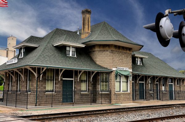
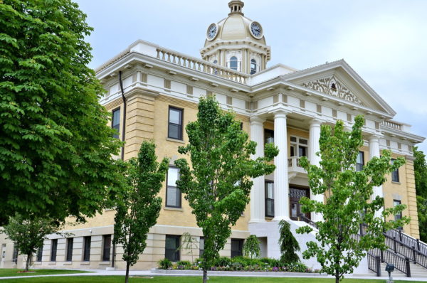
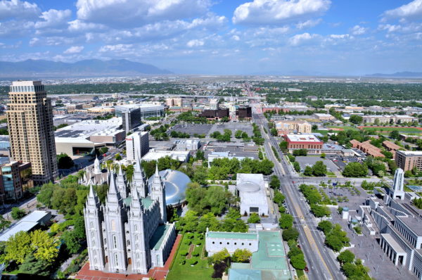
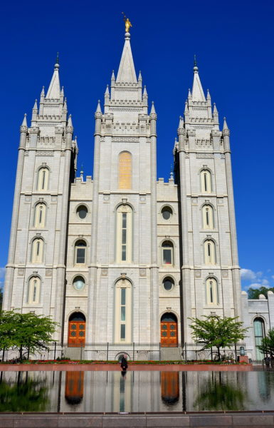
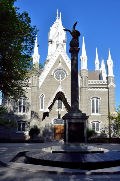
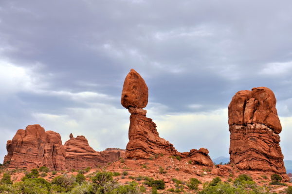
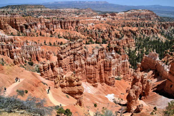
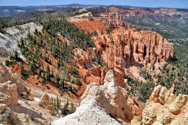
Encircle Utah: When entering northern Utah from either Idaho or Wyoming, there are two great towns to stretch your legs before arriving in the state’s capital, Salt Lake City. Then there are three must see national parks in the south: Arches, Bryce Canyon and Zion.

Share this
Old Train Depot in Brigham City, Utah - Encircle Photos

1 Old Train Depot in Brigham City, Utah

In 1869, the driving of the “Golden Spike” celebrated the completion of the Transcontinental Railway at Promontory Summit. The closest town to this historic site is Brigham City, Utah. When the Union Pacific Depot was built in 1907, women passengers were segregated on the north side of the ticket office. They were expected to be refined. Ladies were not allowed to spit, swear or smoke. On the south side, men were allowed to engage in this socially unacceptable behavior. After the Golden Spike Association renovated this historic station, it became a train museum.

833 W Forest St, Brigham City, UT 84302
Enlarge/Slideshow See On Map Directions
Box Elder County Courthouse in Brigham City, Utah - Encircle Photos

2 Box Elder County Courthouse in Brigham City, Utah

From the Union Pacific Depot, drive further on West Forest Street. Within six blocks, you will find Brigham Young Park and the William Knudsen Log Cabin. In 1855, this became the humble home of Scandinavian immigrants Wilhelm and Laura Knudsen. As you continue along Forest Street, the Box Elder County Courthouse comes into view. Local settlers toiled together to construct this first public building in 1857. The facilities contained a church, theater, town hall and a school. Thirty years later, the clock tower was added. In 1911, the façade received a Neoclassical design. Since 1987, Box Elder County Courthouse has served as the District Courtroom plus Judicial Chambers as well as the Recorder’s and Clerk’s Offices.

1 S Main St, Brigham City, UT 84302
Enlarge/Slideshow See On Map Directions
Municipal Building in Brigham City, Utah - Encircle Photos

3 Municipal Building in Brigham City, Utah

Adjacent to the courthouse is the former Municipal Building. The old City Hall and fire station dates back to 1909. This has been home to the Box Elder Chamber of Commerce since 1974. The organization is justifiably proud to advocate for the local community of nearly 20,000 residents. About 55,000 live in Box Elder County in northern Utah. Brigham City was first settled in 1851 and incorporated in 1867. The namesake is Brigham Young, the second leader of The Church of Jesus Christ of Latter-Day Saints and the founder of Salt Lake City. Young gave his last public sermon in Brigham City before dying in 1877.

6 N Main St, Brigham City, UT 84302
Enlarge/Slideshow See On Map Directions
Carnegie Library in Brigham City, Utah - Encircle Photos

4 Carnegie Library in Brigham City, Utah

Education was important to the early settlers of Brigham City. By 1870, they had lending libraries within four wards of schools run by The Church of Jesus Christ of Latter-day Saints. In 1898, these were centralized with 300 books housed in the new MIA Library and Free Reading Room. Then, with funding from philanthropist Andrew Carnegie – one of 3,500 library grants across the United States – the town built this Carnegie Library in 1915. The distinctive red-brick façade has a Prairie School design. The expanded Brigham City Library now has a collection of over 60,000 materials. It is located behind the old Municipal Building.

26 East Forest St, Brigham City, Utah 84302
Enlarge/Slideshow See On Map Directions
Brigham City Tabernacle in Brigham City, Utah - Encircle Photos

5 Brigham City Tabernacle in Brigham City, Utah

In 1865, Brigham Young selected the site for the Brigham City Tabernacle on Sagebrush Hill and then laid the cornerstone. After ravished by fire twice, the current Neogothic structure was dedicated in 1897. The dramatic spire is encircled with 16 pinnacles. The Mormon tabernacle was designed by Truman O. Angell. He was the brother-in-law of Bingham Young. Angell was also the architect for several famous LDS Church buildings in Salt Lake City including the Salt Lake Temple. In 2012, Box Elder Stake Tabernacle was replaced by the Brigham City Utah Temple directly across Main Street.

251 S Main St, Brigham City, UT 84302
Enlarge/Slideshow See On Map Directions
Brigham City Utah Temple in Brigham City, Utah - Encircle Photos

6 Brigham City Utah Temple in Brigham City, Utah

This precast concrete replacement for the Brigham City Tabernacle was dedicated in September of 2012. The Brigham City Utah Temple was the 14th Mormon temple in Utah. On top of the 165 foot central spire is the Angel Moroni. The 12 foot statue is covered in gold leaf. The angel was the guardian of the golden plates, the inspiration for Joseph Smith’s translation of the Book of Mormon. Karl A. Quilter created three versions of Angel Moroni. His sculptures crown most of The Church of Jesus Christ of Latter-day Saints temples around the world.

250 S Main St, Brigham City, UT 84302
Enlarge/Slideshow See On Map Directions
Old Couple Sitting in Union Station in Ogden, Utah - Encircle Photos

7 Old Couple Sitting in Union Station in Ogden, Utah

If you are self-employed and live west of the Mississippi River, chances are you have mailed or electronically sent your tax return and money to the Internal Revenue Service center in Ogden, Utah. The IRS is the town’s largest employer. If you are in the neighborhood, feel free to hand deliver your check. Afterwards, stop by the Union Station. Outside the building are classic locomotives dating back to 1881. Inside are three museums dedicated to trains, classic cars and Browning Firearms. Or just sit for a moment while you ponder how the government will spend your taxes.

2501 Wall Ave, Ogden, UT 84401
Enlarge/Slideshow See On Map Directions
Founding of Salt Lake City, Utah - Encircle Photos

8 Founding of Salt Lake City, Utah

“Here we will build a temple to our God.” Brigham Young spoke these words on July 24, 1847 after leading 3,000 Mormon pioneers from Nauvoo, Illinois to the Mexican-controlled Salt Lake Valley. The historic 1,300 mile exodus earned Young the nickname American Moses. The founder of Salt Lake City was also the first governor of the Utah Territory (1851- 1858). Yet Brigham Young’s major contribution came as the second president of The Church of Jesus Christ of Latter-day Saints from 1847 until 1877. Below is Temple Square, a five-block area surrounding Salt Lake Temple (lower left). This starts your walking touring of the major buildings of the LDS Church world headquarters.

50 E North Temple St, Salt Lake City, UT 84150
Enlarge/Slideshow See On Map Directions
Salt Lake Temple at Temple Square in Salt Lake City, Utah - Encircle Photos

9 Salt Lake Temple at Temple Square in Salt Lake City, Utah

Four days after Brigham Young ended the Mormon Exodus in 1847, he pointed to where he wanted a magnificent tribute to Jesus Christ built that “will endure through the millennium.” Construction began in 1843. Salt Lake Temple was dedicated 40 years later. It is the epicenter of the 10 acre Temple Square. It is also the largest LDS Church temple at 253,000 square feet. The quartz monzonite façade is filled with symbols. For example, the spires on the towers represent the Twelve Apostles. Two all-seeing eyes of God are in the center windows. There are also stones representing the earth, moon, sun, clouds, stars plus the Big Dipper. Collectively, they represent the universe and Heaven. On top is a 14 foot gilded statue of Moroni, the angel that inspired church founder Joseph Smith. Unfortunately, the Salt Lake Temple is not open for public tours.

Salt Lake Temple, Temple Square, Salt Lake City, UT 84150
Enlarge/Slideshow See On Map Directions
Assembly Hall at Temple Square in Salt Lake City, Utah - Encircle Photos

10 Assembly Hall at Temple Square in Salt Lake City, Utah

24 spires crown the Victorian Gothic design of the Salt Lake Assembly Hall. Finished in 1882, this is the second oldest LDS Church building in Temple Square. The exterior bricks were shaped from pieces of granite rejected during the construction of the Salt Lake Temple. The pillar silhouette is the Seagull Monument. It commemorates the Miracle of the Gulls. The event occurred in 1848 when the Mormon pioneers watched in horror as their first full crop was attacked by swarms of katydids (since called Mormon crickets). In answer to their prayers, seagulls miraculously arrived and gorged on the insects for two weeks, thus saving their crops. This is why the California gull is the state bird of Utah.

Assembly Hall, Temple Square, Salt Lake City, UT 84150
Enlarge/Slideshow See On Map Directions
Utah State Capitol Dome in Salt Lake City, Utah - Encircle Photos

11 Utah State Capitol Dome in Salt Lake City, Utah

The dome atop the Utah State Capitol Building rises an impressive 250 feet. It seems taller as the pinnacle of Capitol Hill. The Neoclassical design was created by German-born Richard K. A. Kletting. He began his architect career in Europe before moving to the United States in 1883. Kletting was responsible for over 25 major commercial and residential projects in Salt Lake City from 1882 through 1915. He has been called the Dean of Utah Architects.

350 State St, Salt Lake City, UT 84103
Enlarge/Slideshow See On Map Directions
Park Avenue in Arches National Park, Utah - Encircle Photos

12 Park Avenue in Arches National Park, Utah

Erosion was busy for millions of years creating the stunning formations in Arches National Park near Moab, Utah. The elements carved 2,000 arches into red sandstone along with rock towers and pinnacles, enormous fins and balancing boulders. An early example during your scenic drive is the Park Avenue Viewpoint. These monoliths have descriptive names such as Queen Nefertiti and Queen Victoria Rock. This is a stone courthouse fit for royalty. See the full Arches travel guide in this Encircle Photos website.

Park Avenue Trailhead, Arches Scenic Dr, Moab, UT 84532
Enlarge/Slideshow See On Map Directions
Balanced Rock in Arches National Park, Utah - Encircle Photos

13 Balanced Rock in Arches National Park, Utah

One of the most recognizable formations at Arches National Park is the Balanced Rock. The seemingly gravity-defying phenomenon appears shortly after nine miles on Arches Scenic Drive. You can gawk at the 128 foot tall oddity from the parking lot. Or get a closer look by walking a .3 mile loop trail. The statistics are staggering. The Entrada Sandstone on top is 55 feet tall and weighs 3,577 tons! The pedestal is composed of a softer Dewey Bridge mudstone and continues to erode. Someday, the giant boulder will come crashing down. A similar fate occurred to the sibling formation – Chip Off the Old Block – during the winter of 1975/76.

Balanced Rock Trailhead, Arches Scenic Dr, Moab, UT 84532
Enlarge/Slideshow See On Map Directions
Entering Red Canyon, Utah - Encircle Photos

14 Entering Red Canyon, Utah

If you are following your GPS on UT-12 headed west toward Bryce Canyon, you might think you arrived prematurely as gorgeous rock formations begin appearing. This is Red Canyon. It is about 14 miles from Bryce Canyon. Most people watch this art of nature whiz by their windows. Some make an occasional stop for photos. But Red Canyon is worthy of a leisurely visit. Admission is free, the crowds are sparse and the views are picturesque such as this escarpment named Sunset Cliffs. There are several turnouts along the way. This one is the trailhead for Thunder Mountain. The moderate to strenuous trail measures 7.9 miles.

Thunder Mountain Trailhead, Red Canyon, UT-12, Panguitch, UT 84759
Enlarge/Slideshow See On Map Directions
Sunset Point View of Bryce Canyon National Park, Utah - Encircle Photos

15 Sunset Point View of Bryce Canyon National Park, Utah

The vistas at Bryce Canyon National Park, Utah, take your breath away because the air is thin at elevations averaging 8,000 to 9,000 feet. They are also visually breathtaking. You will marvel at the grand, deep amphitheaters with colorful spires called hoodoos. There are 13 viewpoints along an 18 mile drive. Each lookout provides a unique perspective of grandeur. This stunning view is Sunset Point. Bryce Canyon can be exceptionally busy in the afternoon during peak summer months. Crowds also assemble for sunrises, sunsets and to count the stars filling the night sky.

Sunset Point, Rim Trail, Bryce Canyon, Bryce, UT 84764
Enlarge/Slideshow See On Map Directions
Grand Staircase Summit at Rainbow Point at Bryce Canyon, Utah - Encircle Photos

16 Grand Staircase Summit at Rainbow Point at Bryce Canyon, Utah

Rainbow Point is the summit of the Grand Staircase. The geological evolution extends for about 150 miles from the peak where you are standing to the Grand Canyon. The rock formations exposed at Bryce Canyon are the Claron Formation. Relatively speaking, they are the youngest layer of the Grand Staircase. They were created 56 to 34 million years ago. In contrast, the exposed rocks in the 6,000 foot deep Grand Canyon range in age from 200 million to nearly two billion years. Between these two points, there are 24 unique formations within five major “steps.” Bryce Canyon is called the Pink Cliffs. The other four are the Grey, White, Vermillion and Chocolate Cliffs. No wonder they call this overlook Rainbow Point.

Rainbow Point, Bryce Canyon, Bryce, UT 84764
Enlarge/Slideshow See On Map Directions
Erosion Lines in Cliff  at Zion National Park, Utah - Encircle Photos

17 Erosion Lines in Cliff at Zion National Park, Utah

In the center of the Grand Staircase between the Grand Canyon’s north rim and Bryce National Park is the 230 square miles of Zion National Park. Numerous hiking paths, a few scenic drives or a shuttle bus tour all provide inspiring views. You will enjoy seeing painted cliffs, canyons, rivers, arches, deserts, gorges, narrows and monoliths rising over 5,000 feet. Many rocks display these deep scars. The groves were created by erosion during the 100 million years it took to create this masterpiece of nature.

Zion National park, 1101 Zion – Mount Carmel Hwy, Springdale, UT 84737
Enlarge/Slideshow See On Map Directions
Red Rock Mesa in Kanab, Utah - Encircle Photos

18 Red Rock Mesa in Kanab, Utah

Picturesque red-rock mesas with clinging sagebrush encircle Kanab, Utah. The small town of 5,000 people is at the crossroads to several popular canyons in southern Utah and northern Arizona. Zion National Park is 41 miles to the northwest. Bryce Canyon is 79 miles to the northeast. The Grand Canyon North Rim is 80 miles south. And Antelope Canyon in Page, Arizona is 74 miles to the southeast. This is a great place to stretch your legs during a long drive or an overnight stop between parks.

1928 US-89, Kanab, UT 84741
Enlarge/Slideshow See On Map Directions
Scenic Adventures near Kanab, Utah - Encircle Photos

19 Scenic Adventures near Kanab, Utah

Nature lovers will love the scenic adventures awaiting you from Kanab. Consider hiking Buckskin Gulch. This is the world’s longest slot canyon at about 15 miles (shorter routes available). Or treat yourself to the stunning narrows through towering cliffs at Paria Canyon. This trail stretches 38 miles. On the bucket list for photographers is The Wave. You will be stunned by the swirling patterns etched into stone by water and wind during 145 million years. But good luck winning a permit to visit. Only 20 people are allowed per day. Want more information about these and other hiking options? Talk to the staff at the Kanab Visitor Center run by the Bureau of Land Management.

745 US-89, Kanab, UT 84741
Enlarge/Slideshow See On Map Directions
Little Hollywood in Kanab, Utah - Encircle Photos

20 Little Hollywood in Kanab, Utah

Kanab is nicknamed Little Hollywood. Over 100 movies have been filmed here since the mid-1920s. The surrounding landscape was also the location for classic Western TV shows such as The Lone Ranger (1949-1957), Death Valley Days (1952-1970) and 635 episodes of Gunsmoke (1955-1975). Relive your memories of the cinematic Old West at Little Hollywood Land. Retrace the footsteps of famous stars such as John Wayne, Gregory Peck and James Garner. Explore old movie sets. And enjoy artifacts from Hollywood’s Golden Age at the Little Hollywood Museum.

297 W Center St., Kanab, UT
Enlarge/Slideshow See On Map Directions
Frontier Farm Implements in Kanab, Utah - Encircle Photos

21 Frontier Farm Implements in Kanab, Utah

The rust on these old farm implements matches the color of the Navajo sandstone cliffs in the background. Imagine how primitive farming must have been in the late 19th century after the town was founded by Jacob Hamblin in 1870. Beginning in 1842, he was an early missionary for The Church of Jesus Christ of Latter-day Saints in Utah. For 32 years, he was also an interpreter and peacemaker between the Mormons and the regional Navajo Indians. Jacob Hamblin Park is named in his honor. For more history of the early settlement, visit the Kanab Heritage House Museum. This “first modern home” was built in 1892 for Henry Bowman and his wife Mary.

297 W Center St., Kanab, UT
Enlarge/Slideshow See On Map Directions
Rockhounding in Kanab, Utah - Encircle Photos

22 Rockhounding in Kanab, Utah

If you are a rockhound, you will dig looking for semiprecious gemstones and ornamental stones across Utah. Your potential finds come in a rainbow of colors. They include azurite (blue), malachite (green), beryl (green), garnet (red), labradorite (blue), aquamarine (blue-green), obsidian (black), quartz (white and rose) plus agates of every shade. You might also discover petrified wood, fossils and dinosaur bones. Or, if you are short on time, stop by one of the many rock stores in the state. The best one in Kanab is Nature’s Showcase.

288 W Center St, Kanab, UT 84741
Enlarge/Slideshow See On Map Directions
TOP