South Iceland

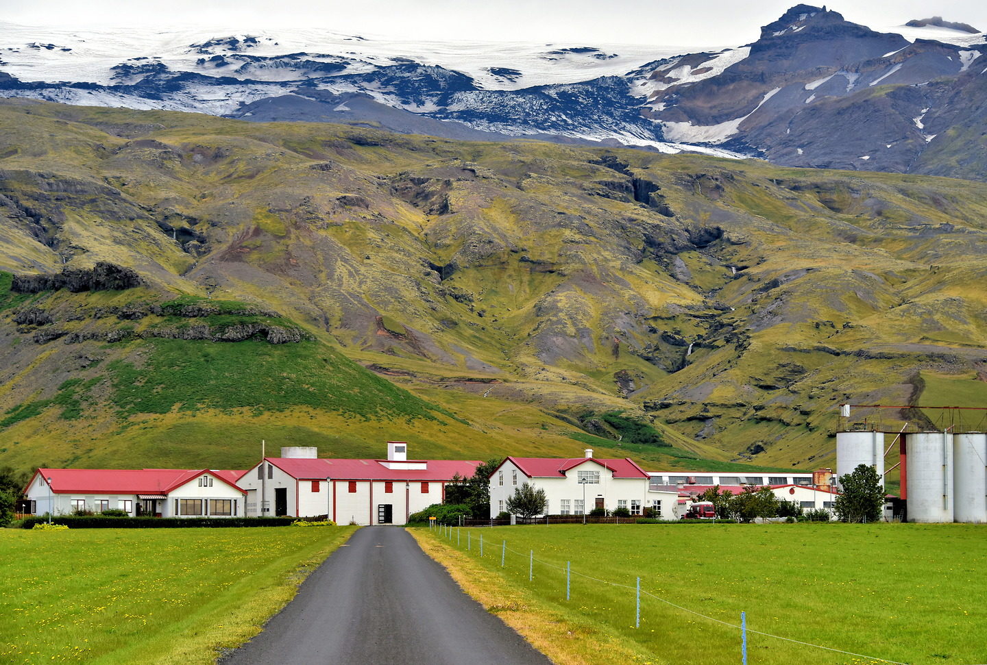
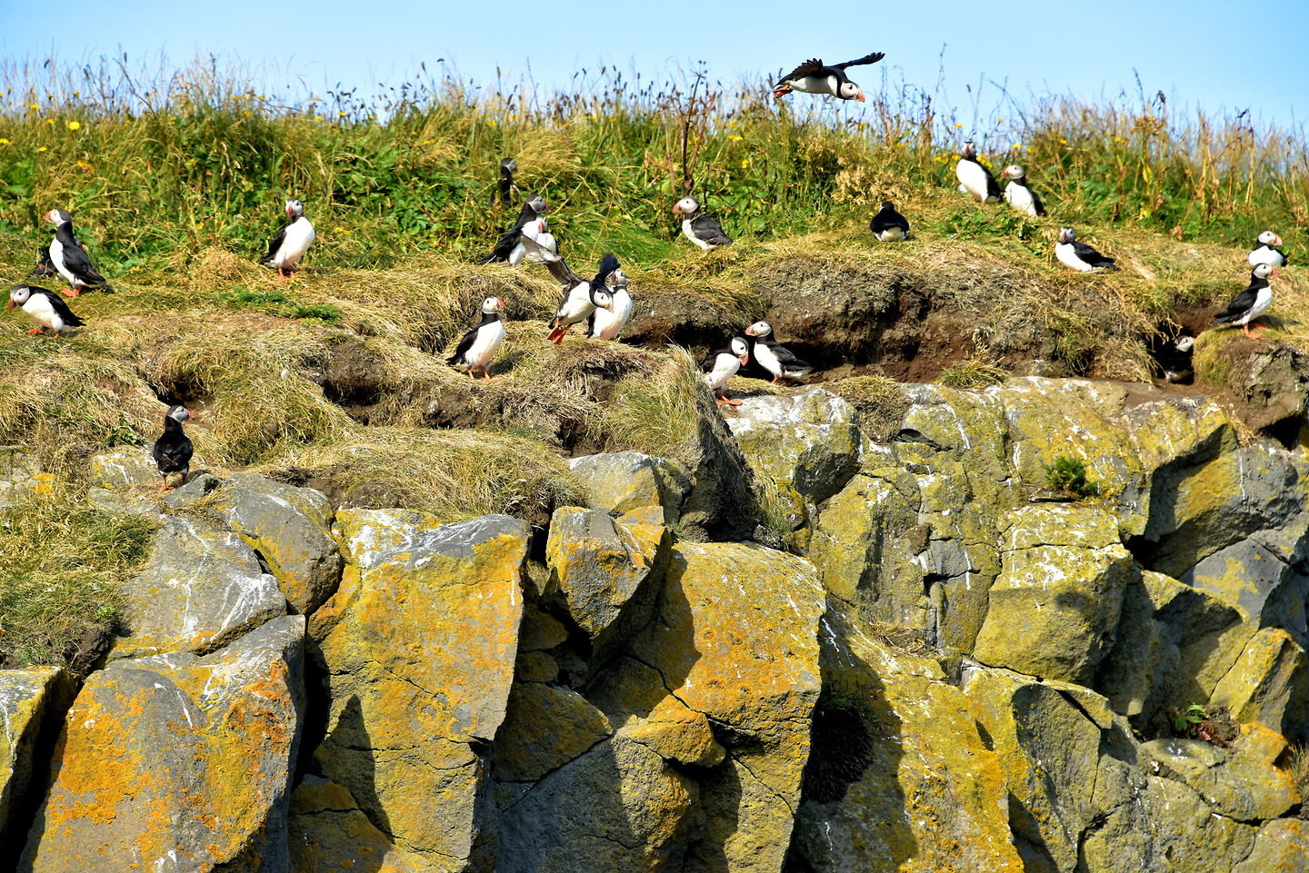
Iceland’s most scenic drive is in the South Region from Seljalandsfoss to Jökulsárlón. Along 157 miles on Route 1 are enough incredible displays of nature to create a lifetime of memories. You will be dazzled by every spectacular waterfall, glacier, mountain, shoreline, sea spire and iceberg you encounter.

Share this

1 Seljalandsfoss in South Iceland

Seljalandsfoss is one of Iceland’s most popular waterfalls. It is invigorating to watch the Seljalandsá River from the Eyjafjallajökull glacier rush over the ledge and plunge 197 feet. The resulting spray causes rainbows to dance in the sunlight. Most exciting is the chance to explore a narrow trail behind the foss. You will feel the water’s power and hear its roar. You will also get wet. So, wear rain gear, good hiking shoes and your biggest smile.

Þjóðvegur & Þórsmerkurvegur, Iceland

2 Three Waterfalls near Seljalandsfoss in South Iceland

After enjoying Seljalandsfoss, do not be in a hurry to leave. The surrounding meadow is lush and green thanks to the constant mist coming from the waterfall. Sitting next to the gentle stream is a perfect place for a picnic lunch. Then walk west along the path to see three more waterfalls. The two visible here are (right to left) Fosstúnsfoss and Myllufoss.

Þjóðvegur & Þórsmerkurvegur, Iceland

3 Fosstúnsfoss near Seljalandsfoss in South Iceland

Adjacent to Seljalandsfoss is Fosstúnsfoss. This cascade waterfall seems to disappear into the ground. Most people on the pathway walk right by where the stream exits and never see how it forms this bubbling creek.

Þjóðvegur & Þórsmerkurvegur, Iceland

4 Myllufoss near Seljalandsfoss in South Iceland

Myllufoss is a ribbon waterfall that splits into streams as it cascades down the rock face. Mill Falls is named after a fulling operation from the 1820s. This was a step in making wool clothes. In a fulling mill, the cloth was hammered or pressed using a waterwheel before being cleaned and stretched.

Þjóðvegur & Þórsmerkurvegur, Iceland

5 Gljúfurárfoss near Seljalandsfoss in South Iceland

You might miss the fourth waterfall at Seljalandsfoss because it is mostly hidden by this cliff in the foreground called Franskanef (French Nose). For a better look, climb up the ledge or walk a bit further to the flowing Gljúfurá River and then into a narrow mountain slit. This ledge waterfall is Gljúfrabúi meaning Dweller of the Gorge. The dramatic display of water from Gljúfurárfoss drops 131 feet.

Þjóðvegur & Þórsmerkurvegur, Iceland

6 2010 Eruption of Eyjafjallajökull in South Iceland

The Þorvaldseyri family has farmed at the base of glacier-covered Eyjafjallajökull since 1906. In early 2010, about 3,000 earthquakes and crustal displacement here preceded a major eruption of the stratovolcano on April 14. People were evacuated as steaming meltwater flooded the area. A six-mile ash cloud diverted airplane traffic across northwest Europe for almost a week. If you would like to learn more about this catastrophic event and its aftermath, then stop by the Þorvaldseyri Volcano Visitor Center across Route 1.

Þorvaldseyri, 861 Hvolsvöllur, Iceland

7 Icelandic Cattle in South Iceland

Norsemen brought cattle when they began settling in Iceland at the end of the 9th century. Almost all of the country’s cows share Norse heritage because it has been illegal to import them since 1870. The current population of dairy cows is about 75,000 of which 25,000 to 30,000 produce milk. These docile creatures with engaging brown eyes are seen grazing in fields during the summer months.

Þjóðvegur & Þorvaldseyri, Iceland

8 Rútshellir Cave in South Iceland

As you drive along Route 1 in South Iceland, keep watchful for interesting turf buildings. This one is built with field stones into the base of a massive boulder that fell from the Eyjafjöll mountain centuries ago. Inside of Rútshellir are two man-made caves. The larger of the two – about 65 feet long – was used to store hay. The caves’ appeal is enhanced by legends of the murder of Rútur, the evil original owner. Some people claim he was a menacing elf. Not far away are similar buildings called Drangurinn in Drangshlíð. Folklore suggests these cowsheds were the home of a man who married an elf woman. Apparently, the elves helped cows give birth here at night.

Rutshellir Caves Island, Drangshlíð 2, Iceland

9 Observing Powerful Skógafoss in South Iceland

One of Iceland’s most spectacular sites is Skógafoss. This powerful display (classified as a ledge and cataract waterfall) is 49 feet wide and plunges 197 feet. You can get very close to feel the incredible energy of the Skógá River as it cascades over the cliff that once loomed above the ocean; the coastline has since receded three miles away. Then climb about 500 steps to the elevated observation platform. This assent is also the start of Fimmvörðuháls, a popular 14 mile hiking trail winding between the Eyjafjallajokull and Myrdalsjokull glaciers.

Skógafoss, Skogar, 861 South Iceland

10 Rainbow and Legend at Skógafoss in South Iceland

Skógafoss is constantly shrouded in swirling clouds of mist. On sunny days, you are guaranteed to see an arching rainbow and often a double. If you have always wanted to discover a pot of gold at the end of a rainbow, then Skógafoss is the place to look. According to folklore, an early settler named Þrasi Þórólfsson buried treasure here circa 900 AD. One man found it during the 17th century. However, when he tried to extract it, the handle came off in his hand and the chest disappeared. The legendary ring is on display at nearby Skógar Museum.

Skógafoss, Skogar, 861 South Iceland

11 Turf Houses at Skógar Museum in South Iceland

Sharing a road with Skógafoss off of Route 1 is the Skógar Museum. It began in 1949 when Þórður Tómasson decided to protect Iceland’s cultural heritage. He curated the folk museum for 64 years. During those decades, the collection grew to 15,000 artifacts. They are exhibited in three main buildings plus six historical ones such as this row of turf houses. One of them was a storehouse built by the founder’s great-grandfather in 1840. While visiting Skógasafn, you will learn how Icelanders have lived through the ages dating back to the Norse settlers.

Skogasafn 1, Skogar, 861 South Iceland

12 Sólheimajökull Glacier in South Iceland

Sólheimajökull is a grand glacier. It one of three outlets of the Mýrdalsjökull Glacier covering 230 square miles of southern Iceland. Beneath its massive surface is Katla. This volcano has erupted violently twenty times since the early 10th century, the last in 1918. Currently, it is covered by up to 2,300 feet of ice. When it explodes, all that ice quickly melts causing outburst floods called jökulhlaup. The resulting outwash plains and the stone-covered path of the glacier’s retreat are obvious as you walk towards the Sólheimajökull Glacier.

Sólheimajökulsvegur, Iceland

13 Sólheimajökull Glacier Terminus in South Iceland

The terminus of Sólheimajökull Glacier has countless facets ranging in color from sparking blue to black. The dark streaks are evidence of volcanic eruptions while the ice sheet moved from the accumulation zone to the ablation zone where it ends at this toe or snout. To get a sense of how massive this glacier is, notice the people on the surface. Several companies offer guided tours of Sólheimajökull because the walking is fairly moderate.

Sólheimajökulsvegur, Iceland

14 Crashed Plane on Sólheimasandur Beach in South Iceland

This airplane hull appears to be a casualty of war. The tail is missing and so are parts of the wings. The fuselage is riddled with holes as if pierced by an anti-aircraft gun. The real story is this U. S. Navy plane made a crash landing on Sólheimasandur Beach in 1973 after running out of fuel. The crew survived. The abandoned DC-3 has attracted tourists ever since. Take a good look because this is all there is to see. To reach it, you need to walk across barren, windswept black sand for about 2.5 to 3 miles one way. Frankly, unless you really want to stretch your legs, save your energy for more attractive sites along the southern coast.

Þjóðvegur & Sólheimajökulsvegur, Iceland

15 Reynisfjara Beach at Dyrhólaey in South Iceland

Most people reach Dyrhólaey Nature Reserve by turning off Route 1 near the town of Vík onto 218. After a short drive, the road splits. One direction heads to the Dyrhólaey Lighthouse on the High Island (Háey). The other ends at a parking lot at the eastern edge of the reserve named Lágey or Low Island. This headland provides views of two marvelous black sand beaches. Facing west at the end of Kirkjufjara Beach is Dyrhólaey, the cliff with arches. On the other side is this view of Reynisfjara Beach with Arnardrangur (Eagle Rock) in the foreground and the impressive Reynisfjara sea spires in the distance.

Þjóðvegur & Dyrhólavegur, Iceland

16 Puffins on Cliff at Dyrhólaey in South Iceland

The grassy cliffs at the Dyrhólaey Nature Reserve provide perfect habitat for Atlantic puffins during their breeding season running from mid-April through August. An adjacent walking path allows tourists to get surprisingly close to this colony. You can observe as they dart in and out of their burrows, socialize along the ledges and use them for frequent takeoffs and landings. Other birdlife includes the common eider (a large sea duck) and the northern fulmar, a seabird resembling a gull.

Þjóðvegur & Dyrhólavegur, Iceland

17 Puffins Flying at Dyrhólaey in South Iceland

At the Dyrhólaey Nature Reserve, it is spectacular watching flocks of flying puffins with Myrdalsjökull – Iceland’s fourth largest glacier – in the background. These common puffins are only about eight inches tall yet they are incredibly fast. They can reach air speeds of 48 to 55 mph. To achieve this, an Atlantic puffin must flap their wings up to 400 times a minute.

Þjóðvegur & Dyrhólavegur, Iceland

18 Dyrhólaey Promontory at Dyrhólaey in South Iceland

The visual highlight of Dyrhólaey Nature Reserve is its namesake promontory. This 380 foot cliff fingering into the Atlantic Ocean has three arches. A huge vessel can sail through the largest opening shown here. This impressive formation was born from volcanic activity over 100 thousand years ago and then carved by relentless pounding waves. The word Dyrhólaey means “hill island with door hole.”

Þjóðvegur & Dyrhólavegur, Iceland

19 Sea Stacks at Dyrhólaey in South Iceland

There are six rock formations encircling the Dyrhólaey cliff. Háidrangur on the left is the tallest at 187 feet. Its names means sheer stack. Adjacent to it but not shown in the photo is Lundadrangur. In the distance is Mávadrangur (Seagull Monolith) and in the foreground is Söðulsker. The one seen at the tip of the headland is called Litlidrangur or Little Monolith.

Þjóðvegur & Dyrhólavegur, Iceland

20 Puffin Enjoying View at Dyrhólaey in South Iceland

The seascapes at Dyrhólaey Nature Reserve are so incredible that even the puffins take time from their busy schedule of breeding and fishing to savor the view. If you are planning to visit during the peak summer tourism season, be aware access is restricted in early May and limited until mid-June.

Þjóðvegur & Dyrhólavegur, Iceland

21 Top Rated Reynisfjara Beach in South Iceland

From the moment you exit your car and head towards Reynisfjara Beach, you immediately understand why National Geographic ranked it among the top ten, non-tropical beaches in the world. The Garðar cliff with its chiseled columns is a stunning backdrop to the black sand, twin monoliths plus the rolling North Atlantic Ocean.

Reynishverfisvegur, Iceland

22 Hexagonal Basalt Columns at Reynisfjara in South Iceland

The basalt columns at Reynisfjara Beach are an impressive artwork of nature. Most of the hexagon-shaped columns are parallel, straight and symmetrical. Although their reach exceeds 200 feet, they have natural platforms at intermittent levels. Tourists delight in climbing to these seats while having their photo taken and then enjoying an elevated perspective of the seascape. This uncharacteristic, fan-like display is above the Hálsanefshellir sea cave. They resemble pipe organs above a church entrance.

Reynishverfisvegur, Iceland

23 Sea Stacks at Reynisfjara in South Iceland

Black lava pebbles crunch beneath your feet as you stroll along Reynisfjara Beach to admire the pair of sea stacks. These are called Reynisdrangar. The tallest needle towers 217 feet. According to folklore, they are petrified trolls who turned to stone when caught beaching a boat at sunrise. Other stories tell of a monster living in the cave. You will only notice colonies of seabirds. The rolling surf might seem romantic and calm. Just do not venture too close and remain vigilant. They can suddenly become “sneaker waves.” These are violent surges of water capable of sweeping unsuspecting people into the frigid sea.

Reynishverfisvegur, Iceland

24 Reynir Church near Vík in South Iceland

Vík í Mýrdal is a small community of less than three hundred people. Their parishioners are served by two, almost identical churches: one in the village and this one named Reyniskirkja. Similar to so many places in Iceland, Reynir Church has a legend. The story goes that a stranger – perhaps a troll – appeared to help a farmer build a wooden church yet demanded his child in exchange unless he could correctly guess his name. When the farmer learned it in a dream, he confronted the stranger, called him Finnur and the man vanished.

Reyniskirkja, Vík í Mýrdal, Iceland

25 Elevated View of Fjaðrárgljúfur in South Iceland

Fjaðrárgljúfur is a 1.25 mile serpentine canyon. The gorge was formed about 9,000 years ago as a glacier melted from the Geirlandshraun Mountain during the last Ice Age. Most visitors opt to take an easy trail winding along the upper edge. The views are spectacular. Only the daring venture onto this vertigo-inducing ledge.

Fjaðrárgljúfur, Kirkjubaejarklaustur, Iceland

26 Walking Inside Canyon at Fjaðrárgljúfur in South Iceland

The best way to fully appreciate the 328 foot height of the winding cliffs at Fjaðrárgljúfur is to walk along the narrow canyon floor. The Fjaðrá River is typically shallow and calm. This allows you to wade across it to reach dry patches of palagonite volcanic stone and glacier sentiment. If you hike far enough, you will encounter a pleasant waterfall.

Fjaðrárgljúfur, Kirkjubaejarklaustur, Iceland

27 Foss á Siðu in South Iceland

Foss á Siðu is not Iceland’s most spectacular waterfall. However, it is fun to watch as the water sourced from the unseen Þórutjörn Lake tumbles over a 99 foot cliff and down a natural staircase. The waterfall is part of a property farmed for more than 1,100 years. And of course, because this is Iceland, there is an interesting story behind it. Apparently the land has been haunted by a ghost since the 16th century. But this spirit does not sound spooky. It is a dog named Móri.

Foss a Sidu, Þjóðvegur, Iceland

28 Hiking Trails at Skaftafell in South Iceland

Skaftafell is a paradise for hikers and nature lovers. Starting at the information center are nine trailheads. These paths range in distance from under a mile to 17.7 miles. One of the most popular leads to Svartifoss (Black Waterfall) cascading 65 feet over basalt columns. The other is this 2.2 mile, round trip to Skaftafell Glacier (Skaftafellsjökull) next to the snow-capped Hafrafell Mountain. Formally the Skaftafell National Park, Skaftafell became part of the Vatnajökull National Park in 2008. This reserve covers over 8,700 square miles or about 14% of Iceland’s landmass. Included within its boundaries is the entire namesake glacier.

Skaftafellsvegur, Iceland

29 Skaftrafell Glacier at Skaftafell in South Iceland

Approaching an Icelandic glacier is a surreal experience. The ribbon of ice always appears massive from the road. As you start walking towards it, you are further awed by its size. Skaftafellsjökull is one of the best in Iceland for tourists to experience. Skaftrafell Glacier is located close to Route 1. The hiking trail is easy to traverse and just over a mile long. You will be mesmerized by the waving patterns of whites, blacks and blues. Guided tours are available to let you walk on the surface and explore its fascinating crevasses.

Skaftafellsvegur, Iceland

30 Kvíárjökull Glacier in South Iceland

While driving on Route 1 from Skaftafell to Fjallsárlón, you will marvel at several glacier fingers squeezing between V-shaped mountain ridges as they slowly reach their ablation zone and begin to melt and calve icebergs. Kvíárjökull glacier is a scenic example. Besides being beautiful, they share three things in common. First, they are outlets of the massive Vatnajökull, a glacier covering 8% of Iceland. Two, they are capped by Hvannadalshnúkur, the country’s tallest summit at just under 7,000 feet. Finally, their ice covers Öræfajökull, the largest Icelandic active volcano. The giant stratovolcano has been dormant since the early 18th century but has explosive potential.

Kvíárjökull, Iceland

31 Fjallsárlón Lagoon and Fjallsjökull Terminus in South Iceland

Fjallsárlón is a lagoon formed by the melting waters of the Fjallsjökull terminus. It is easy to walk along the stone-filled moraine for a close look at the floating icebergs. Although this glacier is impressive, it is only a small outlet of its parent Vatnajökull, Europe’s largest glacier by volume. This glacier lake is not as popular as Jökulsárlón, its neighbor about six miles away. So you can explore Fjallsárlón in relative solitude. Then, rather than driving, consider taking the Breiðármörk Trail for a 9.5 mile challenging hike to Jökulsárlón.

Fjallsárlón, Iceland, 785 Öræfi, Iceland

32 Introduction to Jökulsárlón in South Iceland

No Icelandic vacation is complete without visiting Jökulsárlón. The lagoon formed in the early 1930s as the melting of the Breiðamerkurjökull glacier began to accelerate. The lake has grown to almost ten square miles and is the country’s deepest at about 800 feet. More important than measurements is Jökulsárlón’s magical beauty. Sparkling icebergs in unique shapes and colors are suspended in aquamarine water. These 1,000 year old ice shards are a blend of whites with blue crystals resembling jewels. The black stripes are ash bearing witness to a millennium of volcanic activity.

Jökulsárlón, Iceland

33 Amphibious Boat Ride at Jökulsárlón in South Iceland

Two types of tours are available to experience the thrill of Jökulsárlón. Most tourists opt for an amphibious boat. Passengers embark onto a flat deck surrounded by bench seats. Then the vehicle drives into the lagoon and floats among the icebergs for about 40 minutes. Adventurous people sign up for a Zodiac tour. These are lightweight and fast inflatable boats. They skim across the water and travel further into the glacier lake until reaching the terminus. It is thrilling to watch calving icebergs as they break free from the glacier, splash into the water, twist and turn and sparkle brightly.

Jökulsárlón, Iceland

34 Movies Featuring Jökulsárlón in South Iceland

Jökulsárlón is a darling among cinematographers. The location has been featured in two James Bond films: “A View to Kill” and “Die Another Day.” The lagoon simulates Siberia in “Lara Croft:Tomb Raider” plus has been in scenes for “Game of Thrones.” And Justin Bieber took a swim here in his 2015 music video “I’ll Show You.” There is no doubt you will be similarly inspired to take countless photos of this incredible glacier lake within Vatnajökull National Park.

Jökulsárlón, Iceland

35 Iceberg Rush Towards Ocean at Jökulsárlón in South Iceland

A noteworthy feature of Jökulsárlón is the serenity. The surface is calm while the icebergs are motionless in their natural beauty. Suddenly, everything changes. The water begins churning and rushing, sucking large ice chucks into the rapids. They race and ricochet for about a mile until entering into the ocean. The best way to view this spectacular flow is from a suspension bridge along Route 1.

Jökulsárlón, Iceland

36 Diamond Beach at Jökulsárlón in South Iceland

Encircling the southern end of Jökulsárlón is an elevated section of sand and rock. As you can see in the left corner of this photo, this is a perfect place to savor the dreamy spectacle of Glacier’s River Lagoon from shore. If you have time, treat yourself to Breiðamerkursandur. This is where the ice flow meets the North Atlantic. Locals call it Diamond Beach because of the dazzling ice crystals dancing in the surf and washing up on the black stone coastline. To find it, walk along the Jokulsar River starting at the bridge.

Jökulsárlón, Iceland

37 Mýrdalsjökull Glacier in South Iceland

At the conclusion of your Icelandic road trip, you will be convinced the country’s landscape inspired the creation of these superlatives: awe-inspiring, breathtaking, incredibly beautiful and absolutely stunning. By itself, this view of Mýrdalsjökull Glacier is worth more than 10,000 words.

Þjóðvegur & Reynishverfisvegur, Iceland
TOP