Snæfellsnes Peninsula, Iceland

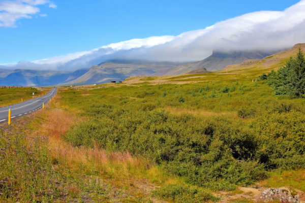
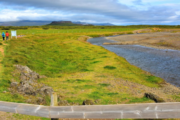
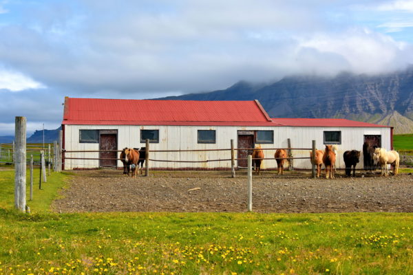
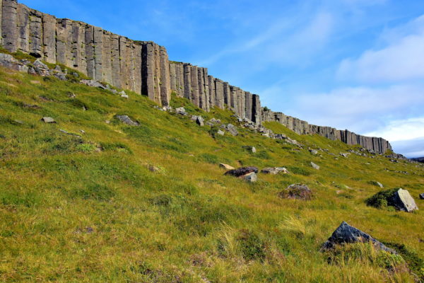
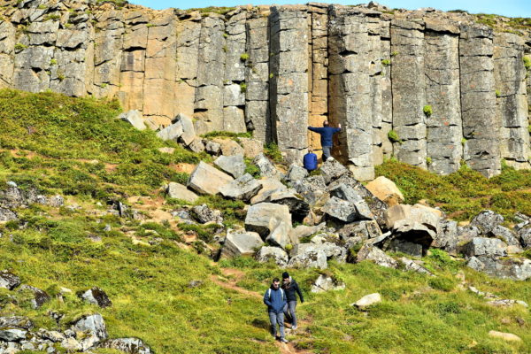
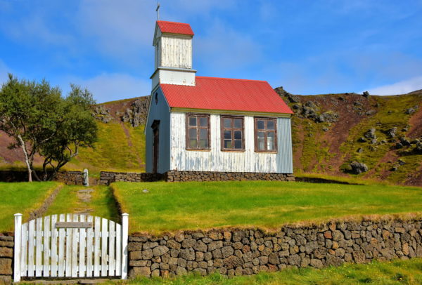
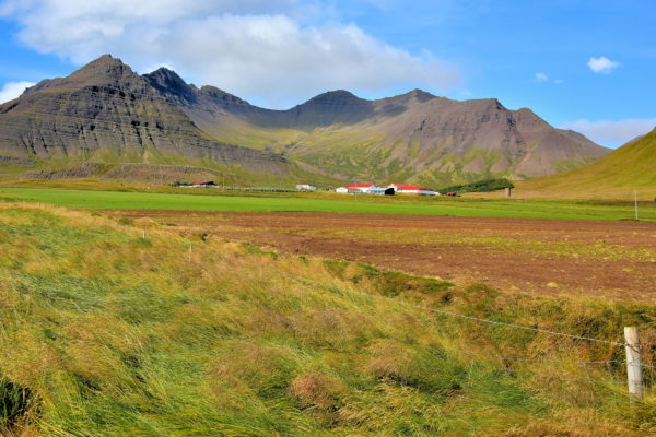
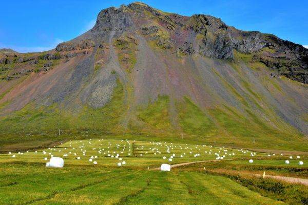
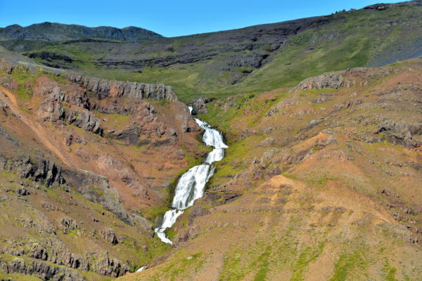
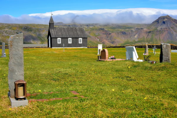
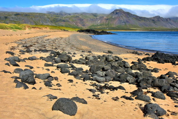
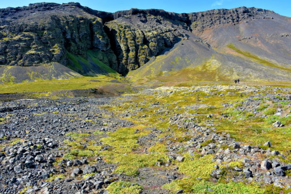
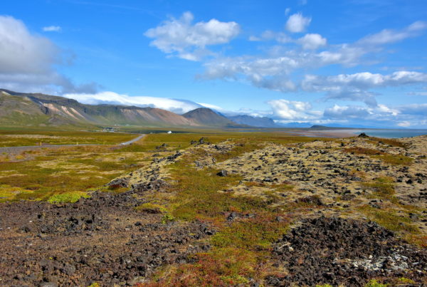
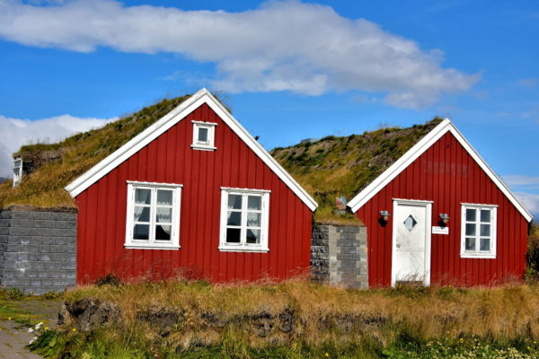
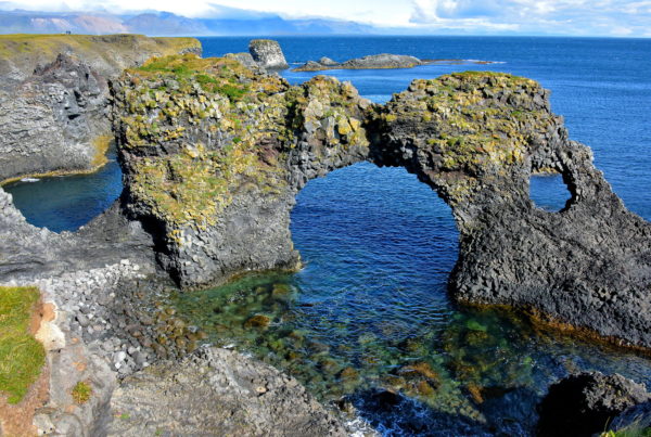
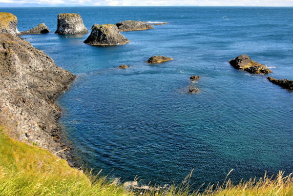
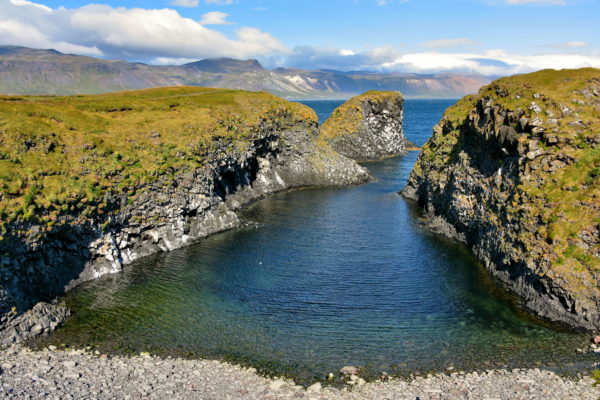
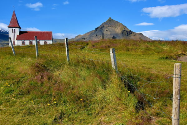
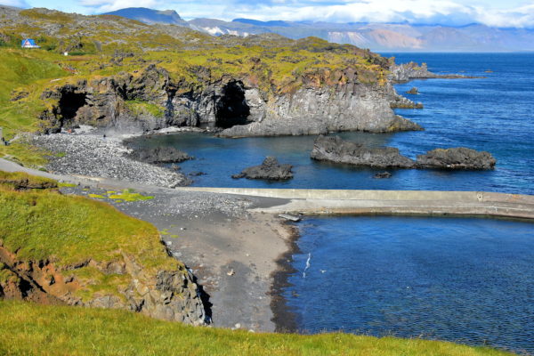
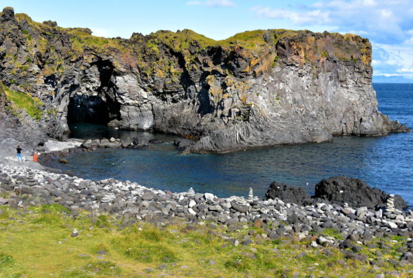
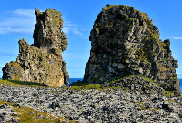
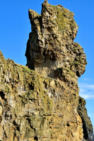
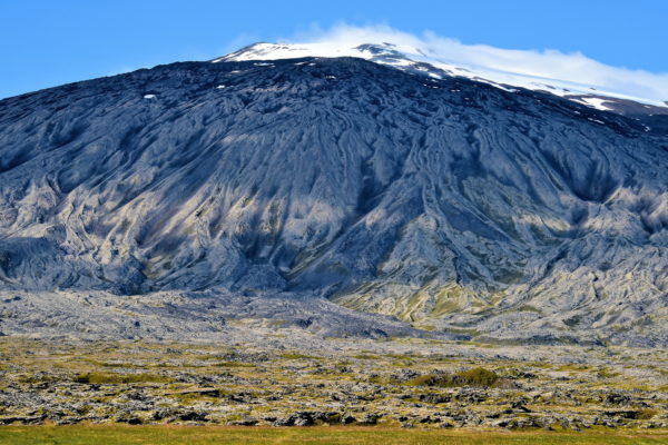
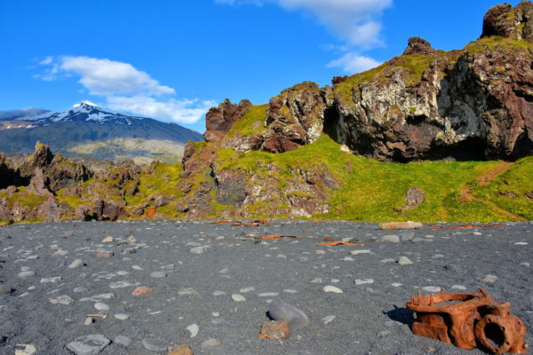
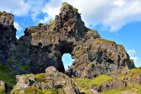
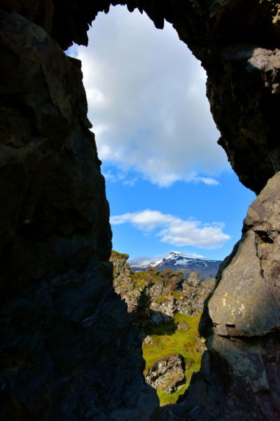
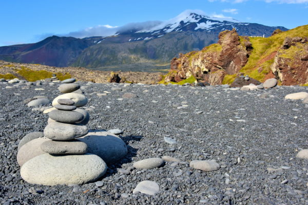
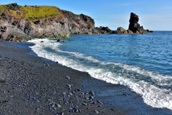
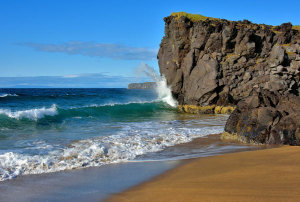
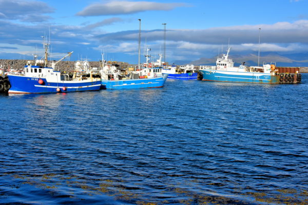
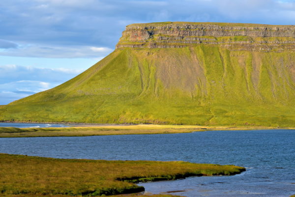
Encircling Snæfellsnes Peninsula along Iceland’s west coast is a picturesque drive. The 56 mile long cape is shaped by a backbone of mountains culminating with Snæfellsjökull, a stunning glacier-capped stratovolcano. Along the way are lava fields, quaint farms, stunning coastlines and fascinating geological scenery.

Share this
Drive Around Snæfellsnes Peninsula, Iceland - Encircle Photos

Drive Around Snæfellsnes Peninsula, Iceland

It is easy to drive around Snæfellsnes Peninsula while enjoying the incredible scenery. The ring from Eldborg in the south to Stykkishólmur in the north is about 120 miles following primarily Highway 54. Yes, this can be done in a day from Reykjavík. However, that round trip is 300 miles. This distance may not let you make frequent stops to see the major highlights.

Enlarge/Slideshow
Eldborg Crater on Snæfellsnes Peninsula, Iceland - Encircle Photos

1 Eldborg Crater on Snæfellsnes Peninsula, Iceland

This couple is headed towards the Eldborg Crater seen rising almost 200 feet on the horizon. The 656 foot diameter of this oval volcanic cone was formed during an eruption over 5,000 years ago. The walking path traverses two miles across an ancient lava field. Eldborg Crater is located off of Road 54 (sign reads Snorrastaðír) at the start your ring drive around Snæfellsnes Peninsula.

Eldborg Crater, Iceland
Enlarge/Slideshow See On Map Directions
Accommodation Options on Snæfellsnes Peninsula, Iceland - Encircle Photos

2 Accommodation Options on Snæfellsnes Peninsula, Iceland

Iceland only has two cities. The rest of the communities are towns or villages. So do not expect to find many fancy hotels during your Iceland travels. Most tourists prefer camper vans, campgrounds, guesthouses, hostels or spending nights on working farms. These horses are the welcoming committee at the Snorrastaðir Farm, part of a consortium of farmers who started the Icelandic Farm Holidays Association in 1980.

Snorrastadir Farm Holidays, Snorrastöðum, Borgarnes, Iceland
Enlarge/Slideshow See On Map Directions
Gerðuberg Basalt Columns Wall on Snæfellsnes Peninsula, Iceland - Encircle Photos

3 Gerðuberg Basalt Columns Wall on Snæfellsnes Peninsula, Iceland

As you turn off Road 54 and drive less than a mile towards Gerðuberg Cliffs, you begin to see this impressive wall stretching for 1,640 feet. You will assume it is manmade. The origin of these basalt columns is volcanic. They were formed as lava cooled irregularly from top to bottom, causing fractures in the rock as it contracted. When the columns form a straight row (similar to a colonnade), the result is called columnar jointing.

Gerðuberg Cliffs, Iceland
Enlarge/Slideshow See On Map Directions
People Admiring Gerðuberg Basalt Columns on Snæfellsnes Peninsula, Iceland - Encircle Photos

4 People Admiring Gerðuberg Basalt Columns on Snæfellsnes Peninsula, Iceland

The best way to fully appreciate the Gerðuberg basalt columns is to get close to them. The hexagon-shaped columns range in height from 40 to 46 feet and average about five feet wide. There is a path at the bottom of the cliff so you can walk along and admire this work of nature from the Tertiary period (2.6 to 66 million years ago).

Gerðuberg Cliffs, Iceland
Enlarge/Slideshow See On Map Directions
Ytri-Rauðamelur on Snæfellsnes Peninsula, Iceland - Encircle Photos

5 Ytri-Rauðamelur on Snæfellsnes Peninsula, Iceland

Down the dirt road from Gerðuberg is a small country chapel perched behind a white picket fence and lava rock wall. Ytri-Rauðamelur is so small it can only accommodate half dozen benches for worshipers.

Eglise Gerðuberg, Iceland
Enlarge/Slideshow See On Map Directions
Réttarskarð Farm on Snæfellsnes Peninsula, Iceland - Encircle Photos

6 Réttarskarð Farm on Snæfellsnes Peninsula, Iceland

The landscape along the southern border of Snæfellsnes Peninsula is characterized by plains at the base of mountains. Some of the landscape is lava fields while other sections host modest farmhouses. The Réttarskarð Farm is a picturesque example. In the background is Rauðamelsfjall. The high lava ridge reaches an elevation of 1,463 feet.

[64.846204, -22.380048]
Enlarge/Slideshow See On Map Directions
Bales of Wrapped Hay on Snæfellsnes Peninsula, Iceland - Encircle Photos

7 Bales of Wrapped Hay on Snæfellsnes Peninsula, Iceland

It is common to see giant marshmallows dotting Iceland’s countryside like these at the Böðvarsholt farm. By wrapping hay in plastic, the bales can be preserved for up to three years. Farmers typically use white because it deflects the sunshine. Only 1% of Iceland’s land is good for cultivation. The largest harvest – up to 99% – is hay. The fodder crop is used to feed the country’s sheep, cattle and horses. In the background is Kambshaus. The mountain reaches an elevation of 2,470 feet.

Bodvarsholt, 356 Snaefellsbaer, Iceland
Enlarge/Slideshow See On Map Directions
Kálfárfossar Waterfall near Búðir on Snæfellsnes Peninsula, Iceland - Encircle Photos

8 Kálfárfossar Waterfall near Búðir on Snæfellsnes Peninsula, Iceland

As you approach the village of Búðir, you will see a pair of cascade waterfalls called Kálfárfossar. This foss is the larger of the two. They are formed as the Kálfá River splits into two streams before tumbling down the cliff. They are the impressive backdrop to the Kálfárvellir Farm. Nearby is the Bjarnarfoss waterfall sourced by the Mælifell Mountain.

[64.843864, -23.356543]
Enlarge/Slideshow See On Map Directions
Church and Cemetery at Búðir on Snæfellsnes Peninsula, Iceland - Encircle Photos

9 Church and Cemetery at Búðir on Snæfellsnes Peninsula, Iceland

After the first church was built in 1703 in the hamlet of Búðir, it served a handful of locals until being abandoned in 1816. Then Steinunn Sveinsdóttir was determined to reestablish the parish. After repeated rejections by the Church of Iceland, she took her appeal to Frederick VII, the King of Denmark, who granted her permission. Construction of Búðakirkja – a historical reproduction of the original – was finished in 1848. Next to this black wooden church and cemetery is Hotel Búðir, a lovely place for a gourmet meal and overnight stay.

Útnesvegur & Búðavegur, Iceland
Enlarge/Slideshow See On Map Directions
Búðavík Bay at Búðir on Snæfellsnes Peninsula, Iceland - Encircle Photos

10 Búðavík Bay at Búðir on Snæfellsnes Peninsula, Iceland

Búðir is encircled by the Búðahraun lava field where several trails begin. The easiest path is to Búðavík Bay where you can stroll among lava rocks scattered across Iceland’ largest, shell-sand beach. A few steps forward is Búðaós, originally called Hraunhöfn meaning Lava Harbour. This is an estuary of the Hraunhafnará River where merchant ships once docked. In the background is Mælifell, a rhyolite mountain with an elevation of 1,857 feet. Ambitious hikers may also want to explore the adjoining Búðahraun Nature Reserve.

Útnesvegur & Búðavegur, Iceland
Enlarge/Slideshow See On Map Directions
Rauðfeldsgjá Mountain Fissure on Snæfellsnes Peninsula, Iceland - Encircle Photos

11 Rauðfeldsgjá Mountain Fissure on Snæfellsnes Peninsula, Iceland

These people are walking across a lava field towards the base of Mount Botnsfjall. The round, shaded area in the middle is the Rauðfeldsgjá fissure. This narrow crack is a portal to a hidden gorge with a stream and high, moss-covered walls leading up to a natural skylight. The ravine is named after two brothers who were killed here 1,200 years ago by Bárður Snæfellsás, a half-man half-troll.

Rauðfeldsgjá Ravine, Iceland
Enlarge/Slideshow See On Map Directions
Lava Field on Snæfellsnes Peninsula, Iceland - Encircle Photos

12 Lava Field on Snæfellsnes Peninsula, Iceland

Much of Iceland’s landscape is old lava fields resulting from eruptions that have spewed a third of the earth’s molten rock during the last 500 years. The country also holds the record for the world’s largest lava flow in 1783. 30 volcanoes are still active. This disproportionate activity is due to the country’s position along the Mid-Atlantic Ridge. The tectonic plates have been moving over a volcanic hot spot for 25 million years.

[64.787305, -23.643225]
Enlarge/Slideshow See On Map Directions
Turf Houses at Arnarstapi on Snæfellsnes Peninsula, Iceland - Encircle Photos

13 Turf Houses at Arnarstapi on Snæfellsnes Peninsula, Iceland

These twin turf houses are among the handful of buildings at Arnarstapi. During the 15th and 16th centuries, this village (sometimes called Strapi) was a thriving port for fishing and merchant ships. Today, the modest harbor is used for small pleasure crafts. The town’s focus is on tourists who come to marvel as its chiseled coastline.

Arnarstapavegur, Arnarstapi, Iceland
Enlarge/Slideshow See On Map Directions
Viking Ship at Arnarstapi on Snæfellsnes Peninsula, Iceland - Encircle Photos

14 Viking Ship at Arnarstapi on Snæfellsnes Peninsula, Iceland

This Viking ship at Arnarstapi is a recreational and not a historical reproduction. The original Norse vessels were similar wooden boats built in a clinker style (overlapping planks). These longships navigated the rivers and coastal waters of Scandinavia. In contrast, the wider and sturdier merchant ships called knarr were designed for sailing in open seas. They transported Iceland’s earliest settlers and traders.

Arnarstapavegur, Arnarstapi, Iceland
Enlarge/Slideshow See On Map Directions
Bárður Snæfellsás Statue at Arnarstapi on Snæfellsnes Peninsula, Iceland - Encircle Photos

15 Bárður Snæfellsás Statue at Arnarstapi on Snæfellsnes Peninsula, Iceland

Although this looks like a decorative pile of rocks, the Bárður Snæfellsás statue by artist Ragnar Kjartansso commemorates the story of a medieval Arnarstapi resident. Bárður was a half-man, half-troll who lived here after fleeing Norway. After a severe family argument, he exiled himself to the Snæfellsnes Glacier. For centuries, the locals believed he was their protector and called him the Guardian Spirit of Snæfell.

Bárðar Saga Snæfellsáss Statue, Arnarstapavegur, Arnarstapi, Iceland
Enlarge/Slideshow See On Map Directions
Gatklettur Arch Rock at Arnarstapi on Snæfellsnes Peninsula, Iceland - Encircle Photos

16 Gatklettur Arch Rock at Arnarstapi on Snæfellsnes Peninsula, Iceland

As you walk toward the coastline of Arnarstapi, the stunning beauty of Gatklettur is revealed. You will be awestruck. Arch Rock features a stone bridge over a circular opening created by the sea. The azure waters of northern Faxa Bay can be calm and transparent or have violent, crashing waves.

Gatklettur, Arnarstapavegur, Arnarstapi, Iceland
Enlarge/Slideshow See On Map Directions
Nature Reserve at Arnarstapi on Snæfellsnes Peninsula, Iceland - Encircle Photos

17 Nature Reserve at Arnarstapi on Snæfellsnes Peninsula, Iceland

The Arnarstapi shoreline is surrounded by the Hellnahraun lava field. Both were formed by an eruption 3,900 years ago. In 1979, these 143 acres were declared a nature reserve. The area is prime habitat for colonies of seabirds. The most common are kittiwakes. They glue their nests to the side of the cliffs and in gorges. Birdwatches will also recognize great black-backed gulls and Artic terns.

Arnarstapavegur, Arnarstapi, Iceland
Enlarge/Slideshow See On Map Directions
Pumpa Ravine at Arnarstapi on Snæfellsnes Peninsula, Iceland - Encircle Photos

18 Pumpa Ravine at Arnarstapi on Snæfellsnes Peninsula, Iceland

Another gorgeous, geological design at Arnarstapi is Pumpa. The ravine forms a nearly perfect, triangular inlet. Other coastal formations have names such as Músargjá, Miðdjá and Eystrigjá. If you have time, continue walking along the 1.5 mile coastal path until you reach the neighboring village of Hellnar.

Arnarstapavegur, Arnarstapi, Iceland
Enlarge/Slideshow See On Map Directions
Church and Mt. Stapafell at Hellnar on Snæfellsnes Peninsula, Iceland - Encircle Photos

19 Church and Mt. Stapafell at Hellnar on Snæfellsnes Peninsula, Iceland

Hellnar was founded in the mid-16th century. The village’s population peaked in the early 18th century when 150 to 200 people – primarily fishermen and farmers – lived here. Their first church was built in 1833 and then replaced with this one in 1945. In the background is Mt. Stapafell. The pyramid-shaped, volcanic mountain has an elevation of 1,725 feet. According to folklore, it is home to reclusive elves.

Hellnar Church, Iceland
Enlarge/Slideshow See On Map Directions
Valasnös at Hellnar on Snæfellsnes Peninsula, Iceland - Encircle Photos

20 Valasnös at Hellnar on Snæfellsnes Peninsula, Iceland

As you park your car at Grouholl Hill, you won’t see its impressive coastline. After a short walk, you will be rewarded with this view of Valasnös. Between this dramatic basalt rock formation and the concrete pier is a cove of clear blue water dotted with islets. If you want to savor this view, then find an outdoor seat at the Fjöruhúsið Café and order some home-made bread with a bowl of fish soap.

Hellnar View Point, 5730, Iceland
Enlarge/Slideshow See On Map Directions
Baðstofa Cave at Hellnar on Snæfellsnes Peninsula, Iceland - Encircle Photos

21 Baðstofa Cave at Hellnar on Snæfellsnes Peninsula, Iceland

Hellnar’s shore is composed of black and white polished rocks. Walking over them is a bit tricky. The challenge is worth it for a closer look at the large cave in the center of Valasnös. Baðstofa is famous for displaying changing colors as the sun and sea reflect off its walls.

Hellnar View Point, 5730, Iceland
Enlarge/Slideshow See On Map Directions
Rock Towers at Lóndrangar on Snæfellsnes Peninsula, Iceland - Encircle Photos

22 Rock Towers at Lóndrangar on Snæfellsnes Peninsula, Iceland

Standing guard majestically along the steep cliffs of Faxaflói Bay are these rock towers at Lóndrangar. The tallest is 246 feet. The one on the right is 200 feet. These former volcanic plugs have been carved by the elements for thousands of years. Surrounding them is a barren lava field covered with sparse moss. You can observe them from a parking lot or, for a closer look, take a half-mile trail starting at the Malarrif Lighthouse.

Lóndrangar, Iceland
Enlarge/Slideshow See On Map Directions
First People atop Lóndrangar on Snæfellsnes Peninsula, Iceland - Encircle Photos

23 First People atop Lóndrangar on Snæfellsnes Peninsula, Iceland

The Book of Settlement, also called Landnámabók, is a medieval document describing Norse life in Iceland during the 9th and 10th centuries. Within its pages is the story of when Laugarbrekku-Einar observed a troll sitting on top of this tallest basalt pillar at Lóndrangar. From this angle, it does look like a horse. The next person to reach the summit was climber Ásgrímur Böðvarsson in 1735.

Lóndrangar, Iceland
Enlarge/Slideshow See On Map Directions
Snæfellsjökull and Glacier on Snæfellsnes Peninsula, Iceland - Encircle Photos

24 Snæfellsjökull and Glacier on Snæfellsnes Peninsula, Iceland

Snæfellsjökull National Park along the western tip of Snæfellsnes Peninsula was established in 2001. The namesake for the 66 square mile park is this glacier-capped mountain. Snæfellsjökull last erupted in 200 AD. Geologists estimate the stratovolcano is 700,000 years old. Its 4,744 foot summit has only been snowless once in 2012. This magnificent mountain became famous as the subterranean portal in Jules Verne’s 1864 novel “Journey to the Center of the Earth.”

[64.767335, -23.870355]
Enlarge/Slideshow See On Map Directions
Nautastígur Path Shipwreck at Djúpalónssandur on Snæfellsnes Peninsula, Iceland - Encircle Photos

25 Nautastígur Path Shipwreck at Djúpalónssandur on Snæfellsnes Peninsula, Iceland

At the southwestern end of Snæfellsnes Peninsula is Djúpalónssandur. Turn off Útnesvegur (574) at Road 572 marked Djúpalón. From the parking lot, follow Nautastígur Path (Path of the Bull) for about 330 yards to reach the beach. Along the way, you will notice chucks of rusted metal. These are the remnants of the British trawler Epine GY7. 14 seamen drowned when the ship sunk on March 13, 1948. As parts of the wreck washed ashore, it was decided to leave them as a memorial.

Djúpalónssandur Beach, Iceland
Enlarge/Slideshow See On Map Directions
Geological Window at Djúpalónssandur on Snæfellsnes Peninsula, Iceland - Encircle Photos

26 Geological Window at Djúpalónssandur on Snæfellsnes Peninsula, Iceland

This pointed cliff at Djúpalónssandur has a curious hole in the center. Tourists are immediately attracted to the opening even though they just walked past it on the other side. It is irresistible to peak through this geological window. Djúpalónssandur was once a thriving fishing village with over 400 residents. Now, the area is deserted except for exploring tourists.

Djúpalónssandur Beach, Iceland
Enlarge/Slideshow See On Map Directions
Snæfellsjökull Framed by Cliff at Djúpalónssandur on Snæfellsnes Peninsula, Iceland - Encircle Photos

27 Snæfellsjökull Framed by Cliff at Djúpalónssandur on Snæfellsnes Peninsula, Iceland

If you do walk up to the perforated cliff, make sure you have your camera ready. On a clear day, the surrounding rock perfectly frames the glacier summit of Snæfellsjökull (Snowy Mountain).

Djúpalónssandur Beach, Iceland
Enlarge/Slideshow See On Map Directions
Lifting Stones at Djúpalónssandur on Snæfellsnes Peninsula, Iceland - Encircle Photos

28 Lifting Stones at Djúpalónssandur on Snæfellsnes Peninsula, Iceland

White polished rocks are scattered everywhere at Djúpalónssandur. Tourists consider them perfect for stacking into cairns. Historically, captains of fishing boats used them to screen a sailor’s strength. The stones were graded from Fullsterkur (weighing 340 pounds) to Amlóði (at 50 pounds). In order to qualify as an oarsman, a recruit had to be able to lift the 119 pound Hálfdrættingur (Half Carrier) onto a platform.

Djúpalónssandur Beach, Iceland
Enlarge/Slideshow See On Map Directions
Elves’ Church at Djúpalónssandur on Snæfellsnes Peninsula, Iceland - Encircle Photos

29 Elves’ Church at Djúpalónssandur on Snæfellsnes Peninsula, Iceland

Two types of mysterious beings live in Iceland: hidden people (hulufólk) and elves (álfar). Some Icelanders can explain the characteristics of each while others do not try to differentiate. But if you think these are just subjects of folklore, then think again. Over half of Iceland’s population believe they exist. This is Söngklettur at Djúpalónssandu. Singing Rock is considered to be a church for the elves.

Djúpalónssandur Beach, Iceland
Enlarge/Slideshow See On Map Directions
Black Lava Pearl Beach at Djúpalónssandur on Snæfellsnes Peninsula, Iceland - Encircle Photos

30 Black Lava Pearl Beach at Djúpalónssandur on Snæfellsnes Peninsula, Iceland

Djúpalónssandur’s beach is filled with black lava stones. They have been highly polished by Atlantic Ocean waves since the last eruption of Snæfellsjökull in 200 AD. Locals call them Pearls of Djúpalón. The cliff on the left is Djúpalons-Klettur. The basalt column on the horizon is named Kerling. According to folklore, this is the remains of a troll woman who turned to stone when caught in the sunrise.

Djúpalónssandur Beach, Iceland
Enlarge/Slideshow See On Map Directions
Svörtuloft Cliff on Snæfellsnes Peninsula, Iceland - Encircle Photos

31 Svörtuloft Cliff on Snæfellsnes Peninsula, Iceland

As you approach the northwest coast of Snæfellsnes Peninsula, watch for a turn marked Öndverðarnesvegur Number 579. The paved road will guide you along this scenic coastline. The rugged beauty of Svörtuloft Cliff stretches for about 2.5 miles. Other points of interest nearby are Skarðsvík Beach, Vatnsborg crater, Saxhólsbjarg stone-arch promontory plus the orange Skálasnagi Lighthouse (also called Svortuloft).

Skarðsvík Beach, Iceland
Enlarge/Slideshow See On Map Directions
Skarðsvík Beach on Snæfellsnes Peninsula, Iceland - Encircle Photos

32 Skarðsvík Beach on Snæfellsnes Peninsula, Iceland

Most of Iceland’s shoreline is defined by old lava fields, rocks or black sand. So it is delightful to find this beach at the westernmost point of Snæfellsnes Peninsula. At low tide, the sand at Skarðsvík is firm with a golden hue. Watching the waves pounding against the rugged crag is mesmerizing. You will also be intrigued when reading an information board describing how a Viking grave was unearthed here in 1962.

Skarðsvík Beach, Iceland
Enlarge/Slideshow See On Map Directions
Rif Harbour on Snæfellsnes Peninsula, Iceland - Encircle Photos

33 Rif Harbour on Snæfellsnes Peninsula, Iceland

Nestled along the northern coast of Snæfellsnes Peninsula are two ports for commercial vessels. Hellissandur was the dominate harbor during the 18th century. The Maritime Museum tells many of their stories. Then fishermen began mooring their trawlers here at Rif. Nature lovers enjoy seeing seals along the beach and one of Iceland’s largest colonies of Artic terns. These two villages are part of a larger community named Snaefellsbaer.

Norðurgarður, Rif, Iceland
Enlarge/Slideshow See On Map Directions
Eyrarfjall along Álftafjörður on Snæfellsnes Peninsula, Iceland - Encircle Photos

34 Eyrarfjall along Álftafjörður on Snæfellsnes Peninsula, Iceland

Although Iceland has 14 to 18 hours of sunlight a day during August, this was not enough time to see and savor all of Snæfellsnes. Eyrarfjall was the last gorgeous landscape I enjoyed along Route 54 before heading south on 55 towards Eldborg to finish the scenic ring around the peninsula. This grand headland shapes the eastern shore of a fjord named Álftafjörður.

[64.988184, -22.617459]
Enlarge/Slideshow See On Map Directions
TOP