Saint Croix is encircled by the Caribbean Sea and is the largest of the three United States Virgin Islands. This travel guide describes all the places to go and things to do around the island whether you are visiting for a day or a week.
Saint Croix is encircled by the Caribbean Sea and is the largest of the three United States Virgin Islands. This travel guide describes all the places to go and things to do around the island whether you are visiting for a day or a week.
You are arriving in beautiful Saint Croix. At 82 square miles (22.7 miles long and eight miles wide), the Big Island is the largest of the three comprising the United States Virgin Islands. The archipelago is located in the northern section of the Leeward Islands encircle by the Caribbean Sea. This travel guide begins in Frederiksted. Then, enjoy a driving tour around the island. If you rent a car, be aware the driving and your steering wheel are both on the left. Along the way, you will see plenty of historic sites, coastlines, beaches, Christiansted, the easternmost point of the U.S. and a rum distillery before returning here. Prefer to be lazy instead? Then spend your day in the sunshine at Fort Frederik Beach on the left.
Frederiksted Pier, Frederiksted, St Croix 00840, USVI Enlarge/Slideshow See On Map Directions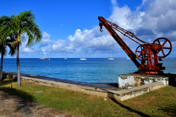
Your cruise ship will berth at the 1,526 foot Frederiksted Pier. Most disembarking passengers scurry off to join an excursion, hire a taxi or find a guide to start exploring the island. But not so fast! This pier is a mecca for underwater aficionados. Snorkeling is ideal here. You will see seahorses, batfish and frogfish swimming among the coral at 25 to 50 feet. You might also spot moray eels and octopus. If you prefer scuba diving, then discover several ship wrecks embedded in a colorful reef a short distance away. Or take the plunge off the pier! The water is fine with an average temperature of 80°F.
Frederiksted Pier, Frederiksted, St Croix 00840, USVI Enlarge/Slideshow See On Map Directions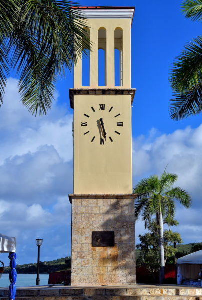
Frederiksted is the second largest town in Saint Croix with a population of about 1,000. The Historic District begins at the end of Frederiksted Pier. Along the boardwalk is the Eliza James-McBean Clock Tower. Frederiksted is named after Frederick V of Denmark and Norway. In 1754, the king assumed control of the Danish West Indies consisting of Saint Thomas, Saint John and Saint Croix. After the three islands were purchased by the United States in 1917, they became the U.S. Virgin Islands.
Clock Tower, Frederiksted, St Croix 00840, USVI Enlarge/Slideshow See On Map Directions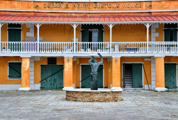
In front of the 18th century Oscar E. Henry Customs House is the Freedom Fountain. In the center is a statue of John “Moses” Gottlieb, also called General Buddhoe. On July 2 and 3, 1848, he led a massive rebellion on this spot. By blowing in a conch shell, he attracted as many as 8,000 slaves. They demanded their freedom. Fearing a bloody riot, Governor-General Peter von Scholten agreed to abolish slavery. This fountain was erected on the 150th anniversary of the emancipation proclamation.
Oscar E. Henry Customs House, Frederiksted, St Croix 00840, USVI Enlarge/Slideshow See On Map Directions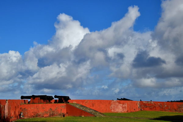
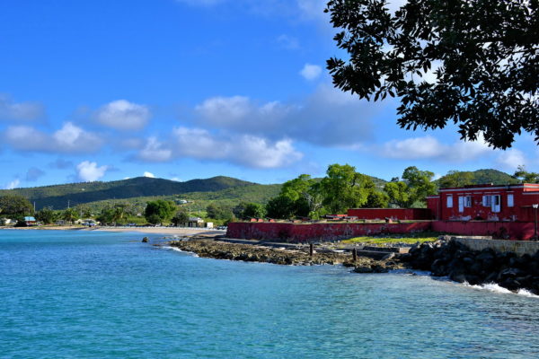
In 1733, the Danish West Indies Company purchased Saint Croix from France. After King Frederick secured full control in 1754, the Danes began constructing a trapezoidal defense to protect the deep-water port. Fort Frederik was finished in 1760. This battery of cannons still points toward the harbor. The Danish fortress never encountered a battle. However, Frederiksfort still holds an important role in the history of Saint Croix. In 1848, the emancipation proclamation was read here. In 1917, a ceremony marked the transfer of Saint Croix to the United States. Fort Frederik is now a fascinating museum.
Fort Frederik, Frederiksted, St Croix 00840, USVI Enlarge/Slideshow See On Map Directions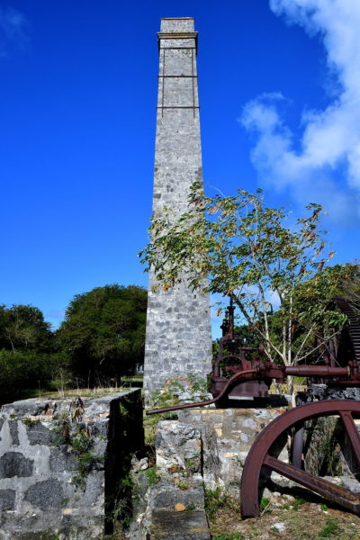
In 1742, there were about 240 plantations on Saint Croix. About half grew cotton and the rest were devoted to sugarcane. By 1803, over 26,000 slaves planted, cultivated and processed sugarcane. Then slavery was abolished in 1848 while sugarcane prices plummeted. Soon, the economy of Saint Croix was destroyed and the plantations were abandoned. You can walk among the shadows of this era at the Estate Whim Living Museum. There are several buildings on the 12 acre property dating back to the 1760s. Included are these ruins of the sugar mill and chimney.
52 Estate Whim, Frederiksted, St Croix 00840, USVI Enlarge/Slideshow See On Map Directions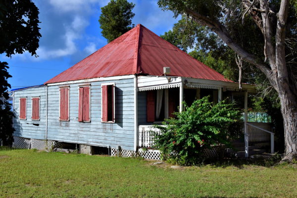
Among the historic structures at the Estate Whim are the Great House (former owner’s residence), the domestic quarters, cookhouse, slave residences, a bathhouse, a windmill and sugar factory. Of particular interest is My Granny House. A sign explains that Granny and Papa raised ten children in these cramped quarters, along with Cousin Leon.
52 Estate Whim, Frederiksted, St Croix 00840, USVI Enlarge/Slideshow See On Map Directions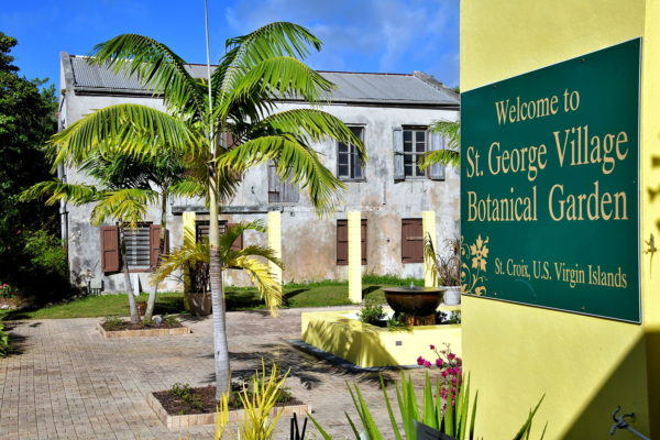
St. George Village Botanical Gardens are as gorgeous as they are historical. The 16 acres was an Amerindian settlement in 100 A.D. The Saladoid people lived here for 900 years. Beginning in 1750, this became a Danish sugarcane plantation. Estate St. George thrived until the mid-19th century then struggled as a cattle ranch until it was abandoned. In 1972, the land was donated to the St. Croix Garden Club. Today, St. George Village Botanical Gardens will delight you with over 1,000 species of plants and more than 6,000 trees. They are all growing amongst old plantation buildings.
127 Estate St. George, Frederiksted, St Croix 00840, USVI Enlarge/Slideshow See On Map Directions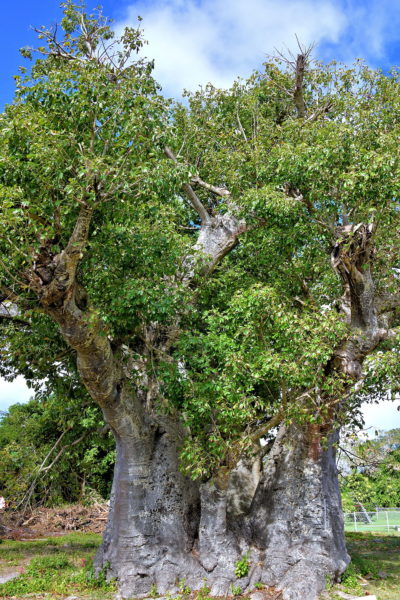
Estimates suggest the seeds for this baobab tree arrived from Africa and were planted over 250 years ago. The upside-down tree (also the tree of life) can reach a height of almost 100 feet with a truck girth of 50 feet. Most amazing is the tree’s ability to retain more than 30,000 gallons of water. Locals call this marvel Guinea Almond. This is the oldest baobab tree in the Virgin Islands. However, it is still relatively young because baobab trees can live over 2,000 years. There was a gruesome moment in this tree’s history. In 1878, a dozen women involved in the Fireburn riot where burned alive at the Grove Place baobab.
Highway 76 & Hwy 705, Frederiksted, St Croix 00840, USVI Enlarge/Slideshow See On Map Directions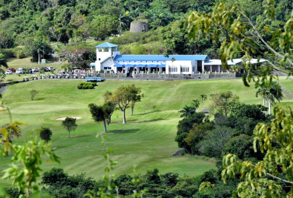
Golfers may be upset to learn there are only three courses on the island. The top choice is usually the Carambola Golf and Country Club. The 18-hole, par 72 course was designed by Robert Trent Jones. GOLF magazine and Gold Digest have rated Carambola as one of the best in the Caribbean. Another 18-hole option is the Buccaneer Golf Course. For less serious players, consider the 9-hole Reef Golf Course.
72 Estate River, Kingshill, St Croix 00850, USVI Enlarge/Slideshow See On Map Directions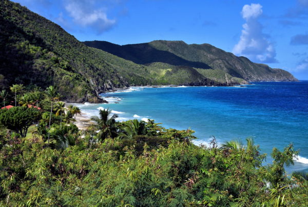
As you continue motoring along River Road (Highway 69), you will soon encounter The Beast. This is a dreaded hill among triathlon runners. The rapid ascent climbs for nearly 300 feet followed by an immediate downward slope with a grade of 27%. But from inside your car, this peak is your introduction to the North Shore. You are about to enjoy one of the most scenic drives in the Caribbean. Your first glimpse of picturesque perfection is Davis Bay. This cove is embraced by etched mounts covered by a lush rainforest. The 1,000 feet of Davis Beach is always highly rated. However, you will have to share your sandbox with the guests of the Carambola Beach Resort.
Davis Beach, Estate Davis Bay, St Croix 00850, USVI Enlarge/Slideshow See On Map Directions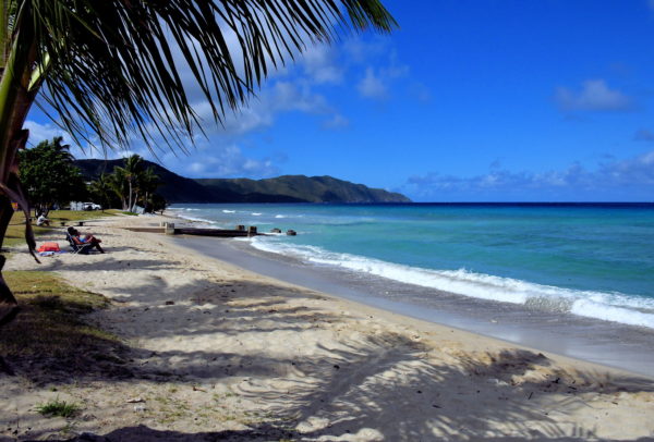
Describe your perfect beach. Plenty of soft white sand. Gentle warm surf. Unlimited views of the Caribbean Sea. Swaying palm trees. Amenities including food, bars, restrooms, water toy rentals, easy access and parking. You just described Cane Bay Beach. This is one of the best beaches in the Virgin Islands and other Caribbean islands.
Cane Bay Rd & Plantation Rd, Christiansted, St Croix 00820, USVI Enlarge/Slideshow See On Map Directions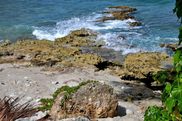
To the trained eye of an experienced scuba diver, these rocks along Cane Bay promise an exciting underwater adventure. They are not disappointed. Below the surface is a premier diving destination. It is affectionately called The Wall. The coral begins about 75 yards off shore in 10 feet of water. Then the depth drops to 30 feet, 80 feet, 200 feet and 600 feet. From there, the underwater cliff plunges over 13,000 feet. This is the world’s deepest drop off! You will be awestruck by the coral and marine life awaiting you. There is a dive center at Cane Bay Beach. They can provide the equipment and guides you need for an unforgettable experience.
Cane Bay Rd & Reflection Bay Rd, Christiansted, St Croix 00820, USVI Enlarge/Slideshow See On Map Directions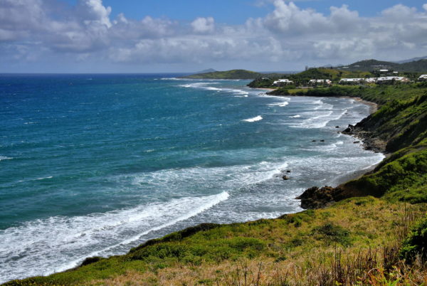
Continue following the North Shore Road headed east. Each twist and turn reveals another stunning seascape. Watch as relentless waves turn into white foam before battering the rugged shoreline. Exit the car often so you can feel the spraying mist in your face. Notice the scattered houses perched on hills and clustered near the coast. Scan the horizon for a potential sighting of passing humpback whales. On a clear day, you might see the sibling islands of Saint Thomas and Saint John.
Rustoptwist Point, N. Shore Rd, Christiansted, St Croix 00820, USVI Enlarge/Slideshow See On Map Directions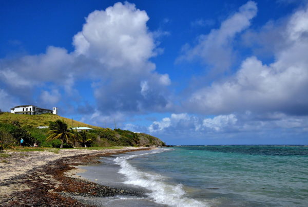
On November 14, 1493, Christopher Columbus moored his ships near the mouth of the Salt River. He called the island Santa Cruz meaning Holy Cross. He dispatched two dozen men to explore their discovery. Soon after they set foot on this beach, they were attacked by a tribe of Kalinago, also known as Island Caribs. The landing party made a hasty retreat (one later died of his wounds). In disgust, Columbus called this point Cabo de la Flecha (Cape of the Arrow). This was the first battle among Europeans and any Indigenous people of the New World. It was also the only time Christopher Columbus’ crew set foot on what would become United States soil. In the upper left corner is the Salt River Bay Visitor Station.
Columbus Landing Site, Christiansted, St Croix 00820, USVI Enlarge/Slideshow See On Map Directions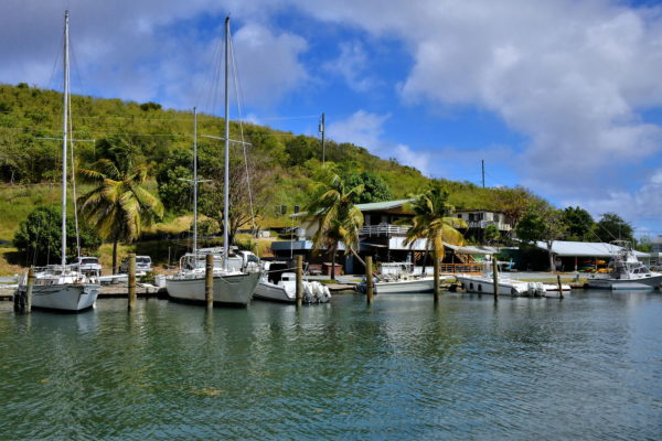
These watercrafts are docked at the Salt River Marina, a sheltered inlet of Sugar Bay. This is the center of the Salt River Bay National Historic Park. The 1,000 acre ecological preserve contains waterways, sculpted coves, a large mangrove forest, coral reefs, a submarine canyon, a bioluminescent bay and archeological sites tracing thousands of years of human history.
Salt River Marina, N Shore Rd, Christiansted, St Croix 00820, USVI Enlarge/Slideshow See On Map Directions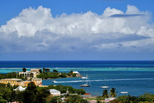
The Danish West India Company was chartered in 1671. The trading company proceeded to purchase and colonize Saint Thomas (1668), Saint John (1718) and then Saint Croix (1733). Soon after securing this island from France, Governor Frederik Moth began planning a new city. He initially called it Bassin. The settlement was renamed after Christian VI, the king of Denmark and Norway from 1730 until 1746. Christiansted became the capital of the Danish West Indies from 1754 until 1871. You are now viewing where these historic events occurred. The ochre-colored building in the lower left is Fort Christiansvaern. This Danish defense is the oldest structure on Saint Croix.
Christiansted Bypass Overlook, Christiansted, St Croix 00820, USVI Enlarge/Slideshow See On Map Directions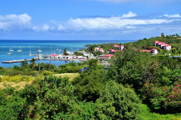
An adjacent view from the Christiansted Bypass Overlook shows Gallows Bay. The gruesome name stems from the placement of gallows along the shoreline during the 18th century. Today, this neighborhood just east of Christiansted’s historic district offers retailers, schools and harbors catering to locals. At the end of the center dock is the U.S. Customs and Protection Office. From here, you can catch the QE IV Ferry to Saint Thomas. Christiansted is the largest city on Saint Croix with a population of about 3,000 Crucians.
Christiansted Bypass Overlook, Christiansted, St Croix 00820, USVI Enlarge/Slideshow See On Map Directions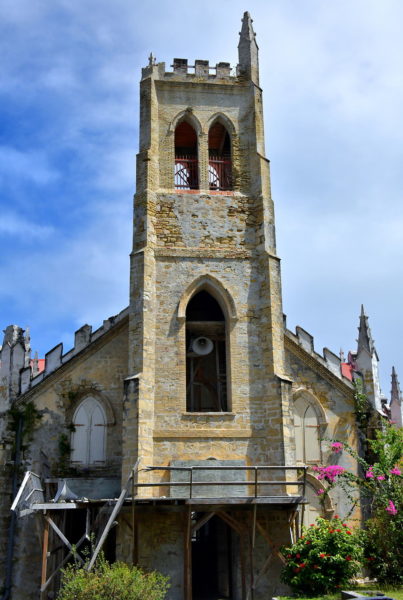
As you drive into Christiansted, you are bound to see St. John’s Anglican Church. The Gothic Revival, stone façade topped with a prominent bell tower is hard to miss. This Church of England was established in 1760. This makes St. John’s the oldest Anglican parish in the U.S. Virgin Islands. The first church was built in 1772. After it was destroyed by fire, this replacement was erected in 1868.
17b Strand St, Christiansted, St Croix 00820, USVI Enlarge/Slideshow See On Map Directions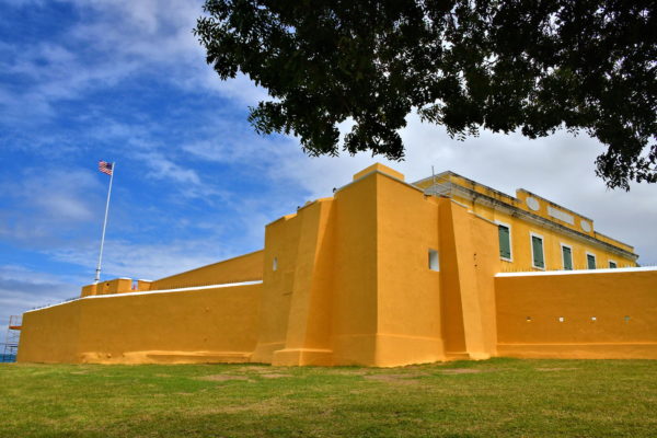
The Danes built Fort Christiansvaern from 1738 through 1749. Their goal was to protect the harbor and their fledgling settlement against potential attacks from the British, French, privateers and slaves. The cannons never fired a shot in battle. Fort Christiansvaern (Christian’s Defense) remains unchanged from colonial times except for an expansion from 1835 to 1841. After 1878, the fort was repurposed several times as a courthouse, prison and police headquarters. Today, it is a popular tourist attraction.
Hospital & Company Streets, Christiansted, St Croix 00820, USVI Enlarge/Slideshow See On Map Directions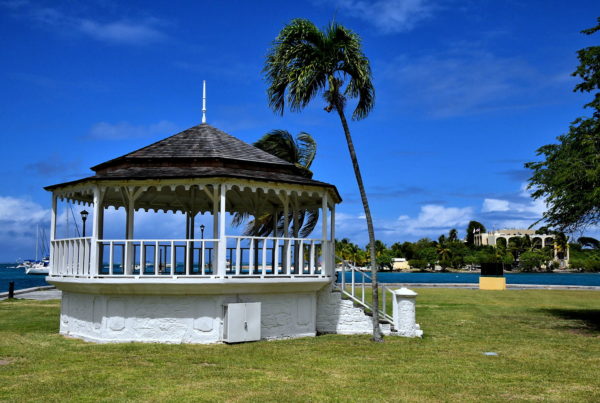
There are six historic buildings within the 27 acre Christiansted National Historic Site. They date from 1749 through 1856. Highlights managed by the U.S. National Park Service include Fort Christiansvaern (1749), the Guinea Company Warehouse (1749), the Steeple Building (1753), the Customs House (1830) and the Scale House (1856). In the center is a green space named D. Hamilton Jackson Park. David Hamilton Jackson (1884 – 1946) was a leading activist leader for civil rights, press freedom, unionization and U.S. citizenship. This concert gazebo at the park has a placid view of Protestant Cay across a narrow channel in Christiansted Harbor.
1 Company St, Christiansted, St Croix 00820, USVI Enlarge/Slideshow See On Map Directions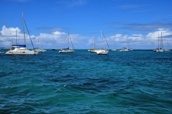
The northern edge of Christiansted is defined by Christiansted Harbor. There is no surprise why the Danes selected this location for their mid-18th century settlement. The first reason is the natural beauty of this kidney-shaped cove. More important, the reef about two miles from shore reduces waves while promised to be treacherous for invading ships. The entrance is tricky even for today’s sailors. Despite this, the harbor hosts excellent anchorages and marinas for residents, vacationers and day trippers.
Hospital & King Streets, Christiansted, St Croix 00820, USVI Enlarge/Slideshow See On Map Directions
A relic of the sugarcane era on Saint Croix is this windmill along the harbor waterfront. It is positioned in front of a townhouse built for a Danish doctor in 1756. About 200 years later, the windmill pumped water into the swimming pool of the Comanche Hotel and was their honeymoon suite. Today, it is occupied by a bar and distillery tasting room.
40A Strand St, Christiansted, St Croix 00820, USVI Enlarge/Slideshow See On Map Directions
Every visitor to Christiansted spends time on the boardwalk facing the harbor. Have a seat on one of the benches. Survey the anchored boats bobbing in the azure water. Smell the unique air of the Caribbean. Feel the topical warmth on your face. People watch. The experience is divine! When you start getting antsy, consider a sightseeing boat charter. Maybe talk to a captain about a half or full-day fishing trip. If you are lucky, you might catch a marlin or sailfish worth bragging about. Or arrange for a sunset sail. This is Saint Croix at its best.
Christiansted Boardwalk, Christiansted, St Croix 00820, USVI Enlarge/Slideshow See On Map Directions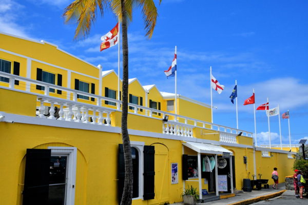
After a relaxing time along the boardwalk, let’s give your wallet a spin. There are several tempting cafes, restaurants and bars encircling you. Sample them for breakfast, lunch, dinner and cocktails. Try your luck in Caravelle Hotel’s casino shown here. Go on a shopping spree. The boutique stores are clustered along King Street and fan out in the alleys. Of course there are the standard souvenir stores. But chances are excellent you will find something locally made – jewelry, crafts, paintings, clothing, Cruzan rum – that will make a perfect memento of your trip.
44A Queen Cross St, Christiansted, St Croix 00820, USVI Enlarge/Slideshow See On Map Directions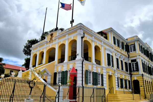
During the Danish control of Saint Croix, the Government House was home for the governor of the Danish West Indies plus municipal offices. In 1871, after the capital moved from Christiansted to Charlotte Amalie in Saint Thomas, this historic building served the island administrator. That role ended in March of 1917 when the Danes sold Saint Thomas, Saint John and Saint Croix to the United States, forming the U.S. Virgin Islands. The Government House was created by merging two mansions along King Street with a connecting gallery. The Schopen Wing (shown here) was constructed in 1747. The Sobotker Wing was finished fifty years later. After an extensive renovation, the Government House was filled with period furnishings. The National Historic Site is now home to the governor of the U.S. Virgin Islands and his family.
1105 King St, Christiansted, St Croix 00820, USVI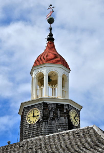
The Danes built this Lutheran church in 1753. The original name was the Lutheran Church of the Sabaoth. Until 1831, this was the place of worship for the officers and soldiers at Fort Christiansvaern plus the local government officials and staff of the Danish West Indies. The name was later officially changed to the Church of our Lord God of Sabato. But everyone calls it the Steeple Building because of the clock tower and wooden cupula topped with a red roof, a weather vane and the Danish flag. The Steeple Building is part of the Christiansted National Historic Site.
1 Company St, Christiansted, St Croix 00820, USVI Enlarge/Slideshow See On Map Directions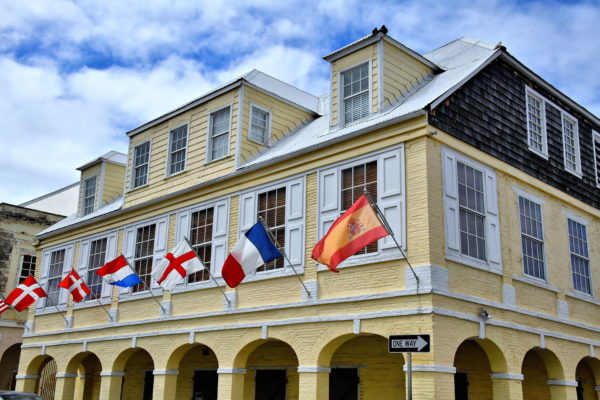
When Christiansted was founded in 1733, Governor Frederik Moth divided the land emanating from the harbor into grids. The main streets became Strandgade (Strand Street), Kongensgade (King Street), Compagniets Gade (Company Street) and Dronningens Gade (Queen Street). Warehouses sprang up along the waterfront. Behind them, wealthy plantation owners, merchants and traders constructed their homes with bricks to provide protection from hurricanes. They were typically two stories. The first level often had an arched loggia. Take time to walk along the streets of Christiansted and admire some of this colonial-style architecture.
52 King Street, Christiansted, St Croix 00820, USVI Enlarge/Slideshow See On Map Directions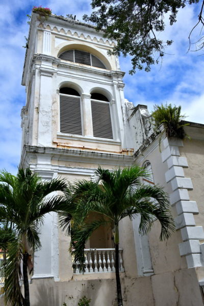
Beginning in 1753, the Danish Lutherans began worshiping in their newly consecrated Lutheran Church of the Sabaoth (now the Steeple Building) near the fort. After hurricanes in 1825 and 1827 damaged the building, services were temporarily moved to St. John’s Anglican Church (shown earlier in this guide). But a closer and more permanent solution was desired. So, in 1831, the congregation purchased the Dutch Reformed Church. It was built in 1740, qualifying as the oldest church on the island. They renovated the church for three years while adding the bell tower. Next, the interior fixtures from the Steeple Building were moved in. The new name became the Lord God of Sabaoth Lutheran Church.
45 King St, Christiansted, St Croix 00820, USVI Enlarge/Slideshow See On Map Directions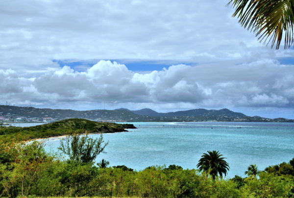
After visiting Christiansted, it is time to resume your driving tour of Saint Croix. Your first stop is a few miles away: The Buccaneer. This property includes an 18-hole golf course, tennis courts, pools, spa and all the extras you would expect at a premier resort. Best of all is their 340 acres of oceanfront. These are primarily used by guests. However, all beaches in Saint Croix can be used by the public. You will immediately notice this view of Beauregard Bay from the hotel. Nestled at the base is the Grotto Beach. Standard issue here is sand, surf and sun yet few amenities. But the relative seclusion also means fewer people.
5007 Estate, Christiansted, St Croix 00824, USVI Enlarge/Slideshow See On Map Directions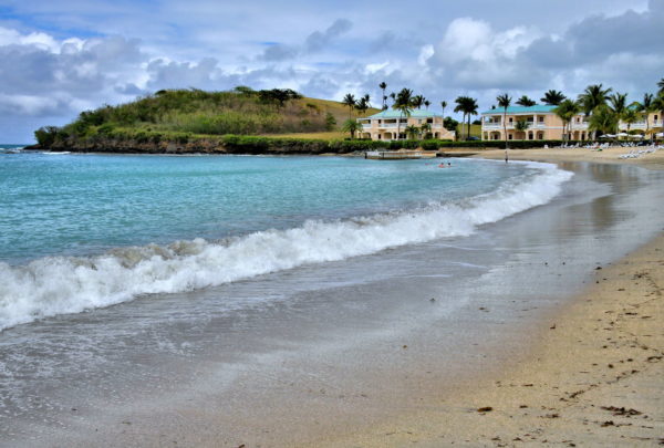
More directly in front of the Buccaneer Beach & Golf Resort is Mermaid Beach. Here you will find everything you need. The crescent-shaped beach is meticulously maintained. The surf tends to gently roil into Martel Bay. The swaying palm trees provide plenty of shade. There is a restaurant and bar within barefoot distance. Plus, renting chairs and water toys is easy. The only downside is true of any five-star-rated beach: the sand can get busy.
5007 Estate, Christiansted, St Croix 00824, USVI Enlarge/Slideshow See On Map Directions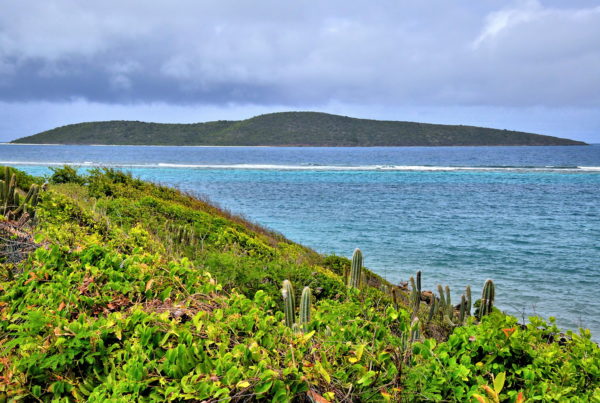
You have reached Yellowcliff Bay in the settlement of Cotton Valley. Park your car along East End Road and admire this display of nature. On the horizon about two miles away is Buck Island. This uninhabited islet has the wonderful Turtle Beach – among the best in the Virgin Islands – and hiking trails. But what really distinguishes Buck Island is below the water: the 4,554 acre elkhorn-coral barrier reef. This marine garden is inhabited by over 250 species of fish and sea creatures. Buck Island is an Underwater National Monument, one of only two in the United States.
24 Cotton Valley Shores, Cotton Valley, St Croix 00820, USVI Enlarge/Slideshow See On Map Directions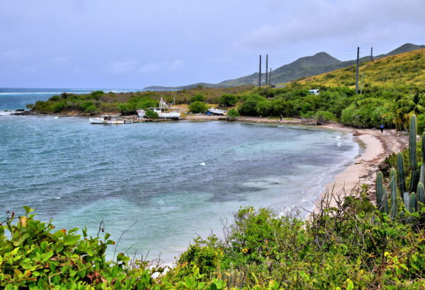
Powell Bay is one of several small coves and beaches you will discover while traveling in the East End of Saint Croix. Perhaps you have noticed the increasingly dry conditions with sparse vegetation. Cactus are now growing along the shoreline. When you reach the terminus of the East End Road, the landscape seems desert-like. Compare this to the lush rainforest on the opposite side of the island. These differences in ecosystems are partially caused by the trade winds blowing across the island. Another factor is the difference in rainfall. The Northwest has about 50 inches of rain a year. The East End receives significantly less.
Tague Point, East End Rd, Cotton Valley, St Croix 00820, USVI Enlarge/Slideshow See On Map Directions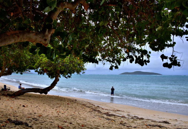
Cramer Park is a haven for Crucians, especially on weekends. People arrive early to claim their spot on the long, sandy beach. Families favor the sheltered picnic tables for barbecues and social gatherings. Kids spend the day playing in the white sand and splashing in the balmy water. Teenagers and young adults come to hang out and suntan while playing loud music. Campers pitch their tent here for days. In short, this last major beach in the East End is very active. Don’t come to Cramer’s Park Beach if you plan to nap in the sun.
Cramer Park Beach, Knight, St Croix 00820, USVI Enlarge/Slideshow See On Map Directions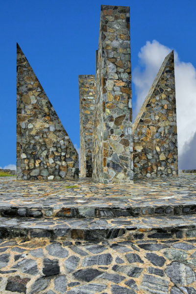
Have you ever wondered where the easternmost point is of the United States? This stone sundial at Point Udall marks the spot. The name honors Stewart Udall, the U.S. Secretary of the Interior from 1961 – 1969. He was a strong advocate for a cleaner earth. This Millennium Monument was unveiled in time for the first sunrise on the United States on January 1, 2000. If you are a hiker, do not be in a hurry to leave. The trailhead for the Jack and Isaac Bay Preserve is nearby. This nature lover’s dream consists of over 300 acres of incredible scenery. The beaches are also a major nesting area for green and hawksbill turtles.
Point Udall, East End Rd, East End, St Croix 00820, USVI Enlarge/Slideshow See On Map Directions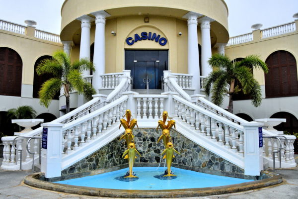
Saint Croix only has two casinos. You already tried your luck in Christiansted. As you begin returning to Frederiksted along the south side of the island, you have a second chance to go home a winner. The Divi Carina Bay Casino was the first in the U.S. Virgin Islands. Waiting for you are plenty of slots, live gaming tables and competitive poker games. This casino is part of the Divi Carina Bay Beach Resort. Everything is included for one price at this all-inclusive facility, except of course your gambling.
5025 Turner Hole Rd, Christiansted, St Croix 00820, USVI Enlarge/Slideshow See On Map Directions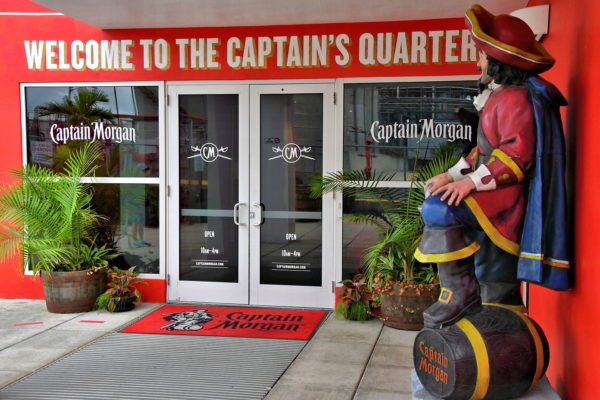
When you say Saint Croix to a rum connoisseur, they immediately think of Cruzan Rum. The distillery was founded in 1760. The island’s newest distillery was opened in 2010 by Diageo, a huge London-based alcohol company. Most rum drinkers know their brand: Captain Morgan. Open these doors at the Captain’s Quarters, enjoy the displays and movie at the visitors’ center, take the 40 minute distillery tour and end your experience at the tasting bar.
Melvin H. Evans Hwy & Colon St, Christiansted, St Croix 00820, USVS Enlarge/Slideshow See On Map Directions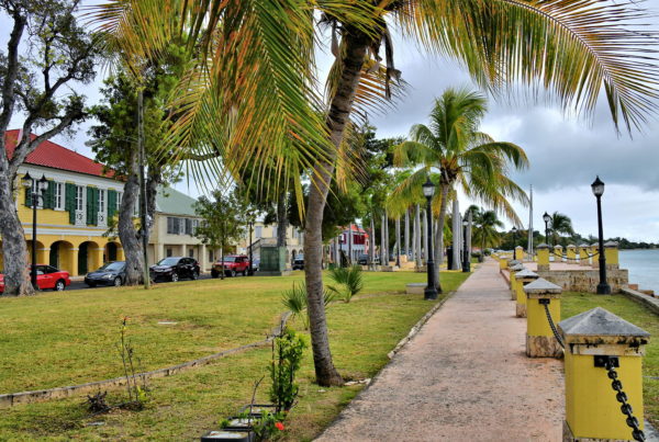
Your day encircling Saint Croix ends where you started – Frederiksted Pier. If there is time before your cruise ship leaves, spend it walking parallel to Strand Street. This waterfront promenade is lovely. Waves lap along one side of you. Palm trees line the path. And colorful, Victorian Era buildings face the Caribbean Sea. This is a perfect way to recall all the fun you had while visiting Saint Croix.
10 Strand St, Frederiksted, St Croix 00840, USVI Enlarge/Slideshow See On Map Directions