Ketchikan, Alaska

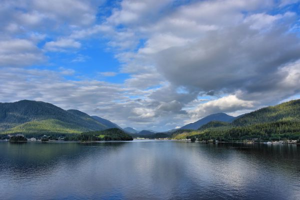
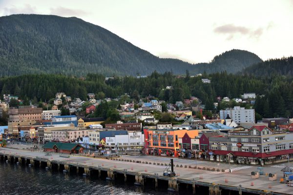
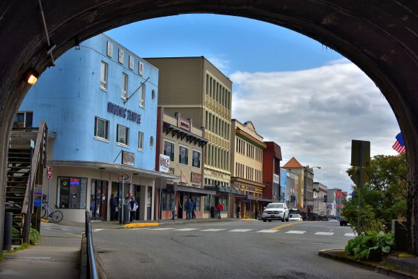
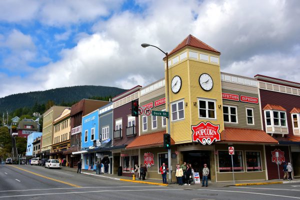
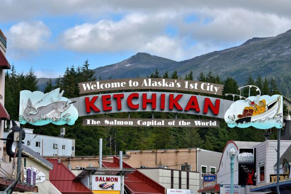
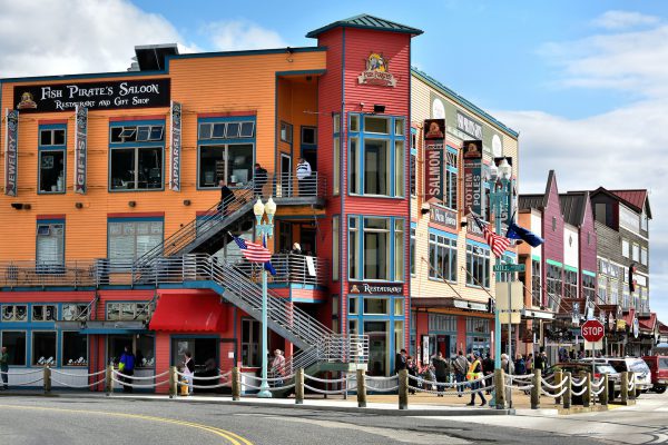
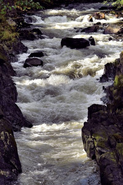
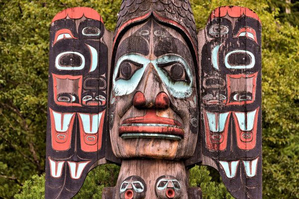
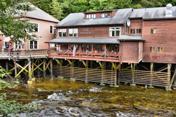
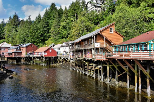
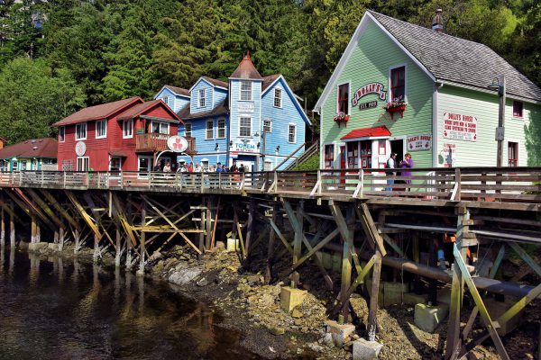
Ketchikan, which is Alaska’s most southern city, is on Revillagigedo Island plus it’s surrounded by water and the Tongass National Forest. It features the world’s largest collection of totem poles, an annual salmon run, remnants of the Gold Rush’s red light district and is the gateway to over two million acres of pristine scenery.

Share this
Floatplane Taking Off at Sunrise in Ketchikan, Alaska - Encircle Photos

1 Floatplane Taking Off at Sunrise in Ketchikan, Alaska

No roads lead to Ketchikan, Alaska …literally. The only ways in and out are by boat, ferry, commercial plane or a floatplane like this one taking off at sunrise. Most of these seaplanes are used for air tours over the Tongrass National Forest and for transporting fishermen and campers to ideal locations. Local residents also use these single prop taxis as the fastest means to get to neighboring islands.

1245 Tongass Ave Ketchikan, AK 99901
Enlarge/Slideshow See On Map Directions
Water Transportation to Ketchikan, Alaska - Encircle Photos

Water Transportation to Ketchikan, Alaska

Although Ketchikan is Alaska’s most southern city, reaching it by water is a considerable journey. Most tourists arrive by cruise ship so a day or two at sea before arriving is part of the fun. There is also a ferry available that is part of the Alaska Marine Highway System’s Inside Passage Route. A trip to British Columbia takes six hours. Add another 36 hours if your destination is the state of Washington.

Enlarge/Slideshow
Downtown View of Ketchikan, Alaska - Encircle Photos

2 Downtown View of Ketchikan, Alaska

As you can see from this elevated view of downtown Ketchikan, it is a walkable town of less than 4.5 miles and it is surrounded by the Tongrass National Forest. From May through September, most tourists arrive by cruise ships which dock along Front Street. Then before or after they take a nature excursion, the visitors explore these downtown shops. The retailers include jewelry stores, small art galleries and native heritage boutiques.

30 Front St, Ketchikan, AK 99901
Enlarge/Slideshow See On Map Directions
Tunnel into Downtown Ketchikan, Alaska - Encircle Photos

3 Tunnel into Downtown Ketchikan, Alaska

This tunnel leads from Water Street in Newtown into Front Street which is the harbor facing road of downtown Ketchikan, Alaska. On the left is a Masonic Temple. The Freemasonry Hall originated in France during the 18th century.

Front St & Grant St, Ketchikan, AK 99901
Enlarge/Slideshow See On Map Directions
Yukon Heath’s Popcorn Emporium in Ketchikan, Alaska - Encircle Photos

4 Yukon Heath’s Popcorn Emporium in Ketchikan, Alaska

If you arrive in Ketchikan, Alaska, on a cruise ship and feel calorie deficient then make stop at Yukon Heath’s Popcorn Emporium in this yellow building on the corners of Dock and Front Streets. They feature “23 flavors of gourmet popcorn, fudge and taffy.” Heck, you will gain weight from the wonderful aromas as you walk by this chain.

Dock St & Front St, Ketchikan, AK 99901
Enlarge/Slideshow See On Map Directions
Welcome to Ketchikan Sign in Ketchikan, Alaska - Encircle Photos

5 Welcome to Ketchikan Sign in Ketchikan, Alaska

Arched over Mission Street is this welcome sign that declares Ketchikan is the “Salmon Capital of the World.” Five types of salmon swim around this town of about 8,000 people located on Revillagigedo Island. Its other nickname is the “Rain Capital of Alaska” because their moderate climate averages over 150 inches of rain a year.

Mission St & Front St, Ketchikan, AK 99901
Enlarge/Slideshow See On Map Directions
Colorful Stores on Front Street in Ketchikan, Alaska - Encircle Photos

6 Colorful Stores on Front Street in Ketchikan, Alaska

These colorful stores, restaurants and bars along Front Street between Mill Street and Spruce Mill Way are designed to capture the short-time tourists’ dollars. The real charm of Ketchikan, however, is several blocks back from the harbor particularly in the Creek Street and Stedman-Thomas National Historic District.

76 Front St, Ketchikan, AK 99901
Enlarge/Slideshow See On Map Directions
St. John’s Episcopal Church in Ketchikan, Alaska - Encircle Photos

7 St. John’s Episcopal Church in Ketchikan, Alaska

When St. John’s Episcopal Church was built in 1904 it stood on the edge of the harbor. Although this stark white, simple building has not moved from its original position on Mission Street, it is now a couple of blocks from the water’s edge in Ketchikan, Alaska.

503 Mission St, Ketchikan, AK 99901
Enlarge/Slideshow See On Map Directions
Rushing Ketchikan Creek in Ketchikan, Alaska - Encircle Photos

8 Rushing Ketchikan Creek in Ketchikan, Alaska

Ketchikan, Alaska, is believed to be named after the salmon-filled Ketchikan Creek that flows for six miles before gushing through the historic part of town. It is derived from the language of the indigenous Tlingit people who are a tribe of hunter-gathers that have populated Alaska for over 10,000 years ago. They call this city Kichxáan and the creek Kitschkhin.

652 Park Ave, Ketchikan, AK 99901
Enlarge/Slideshow See On Map Directions
Fog Woman Totem Pole Detail in Ketchikan, Alaska - Encircle Photos

9 Fog Woman Totem Pole Detail in Ketchikan, Alaska

There are several parks in and around Ketchikan that claim to collectively display the world’s largest collection of totem poles. These ornate carvings – some which date back to the 19th century – are the work of three local tribes: the Tlingit, Haida and Tsimshian. This detail from the 55 foot Chief Johnson totem pole is of “Fog Woman.” She is responsible for the summer salmon runs when they return to local streams to spawn. The original pole was created by Israel Shotridge in 1901.

105 Stedman St, Ketchikan, AK 99901
Enlarge/Slideshow See On Map Directions
Salmon Lookout Point in Ketchikan, Alaska - Encircle Photos

10 Salmon Lookout Point in Ketchikan, Alaska

The west entrance to Creek Street is reached by crossing a small footbridge and then taking a turn along the boardwalk. This intersection, next to the Creek Street Grill and below the Fraternal Order of Eagles, is the perfect spot to watch the salmon swimming in the shallow waters of the Ketchikan Creek during the summer and early autumn.

716 Totem Way, Ketchikan, AK 99901
Enlarge/Slideshow See On Map Directions
Creek Street in Ketchikan, Alaska - Encircle Photos

11 Creek Street in Ketchikan, Alaska

Perched over the Ketchikan Creek are wooden buildings suspended by lattice and salt-covered pilings. Along this boardwalk are small shops that cater to tourists and offer great views of the salmon-filled stream below. When it was part of the red light district in the early 20th century, an escape route called “Married Man’s Trail” led up the hill to the Cape Fox Lodge which is visible at the top of this photo. The hotel is now accessible by a funicular.

203 Stedman St Ketchikan, AK 99901
Enlarge/Slideshow See On Map Directions
Dolly’s House Brothel in Ketchikan, Alaska - Encircle Photos

12 Dolly’s House Brothel in Ketchikan, Alaska

The green building at No. 24 Creek Street is Dolly’s House, a famous brothel in the former red light district of Ketchikan, Alaska. It was founded in 1919 during the Gold Rush by Dolly Arthur whose real name was Thelma Copeland. The museum’s motto is “Where Both Men and Salmon Came Upstream to Spawn.” The practice of prostitution was outlawed by the Anti-Crib laws in the 1950’s but it was a good run while it lasted.

24 Creek St, Ketchikan, AK 99901
Enlarge/Slideshow See On Map Directions
TOP