Fiordland, New Zealand South Island

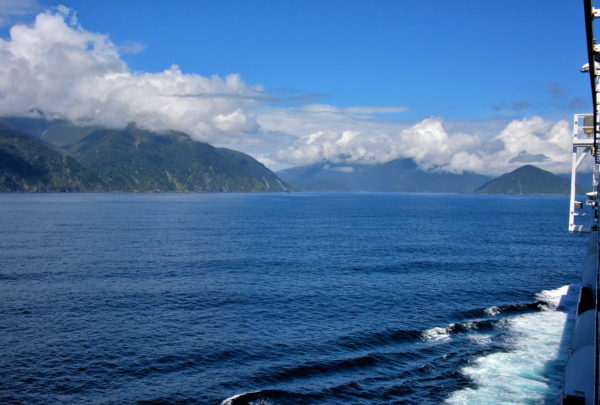
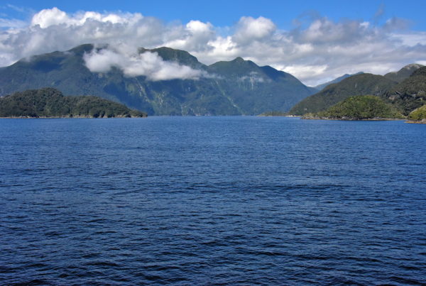
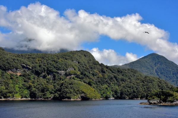
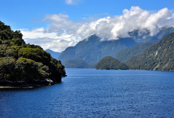
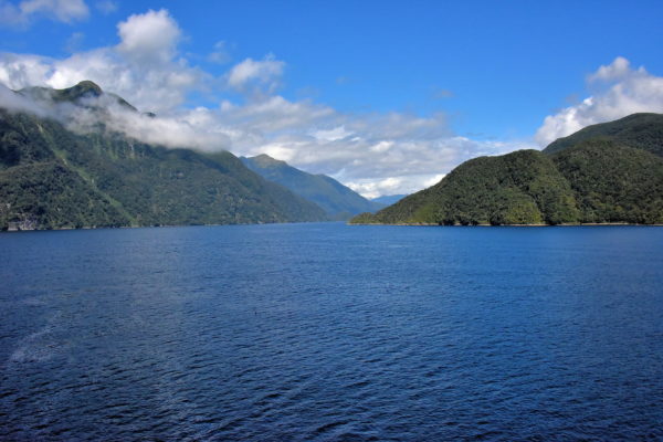
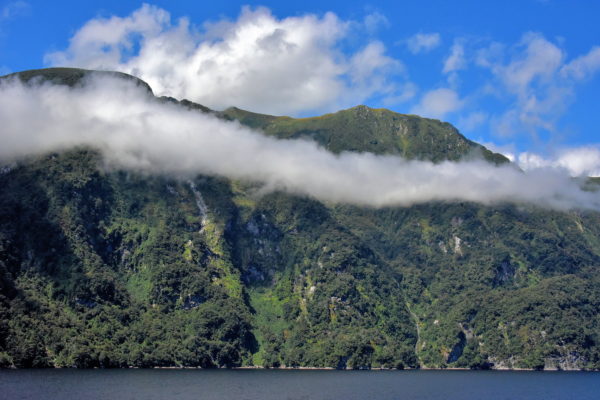
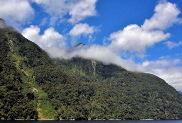
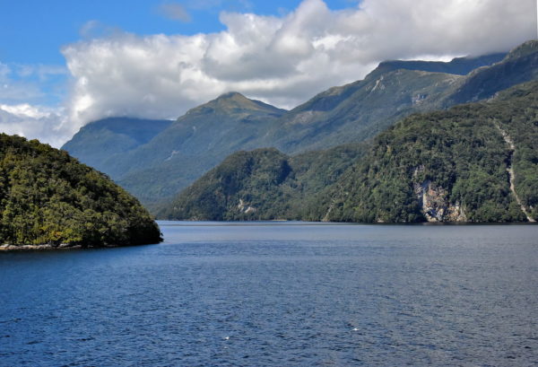
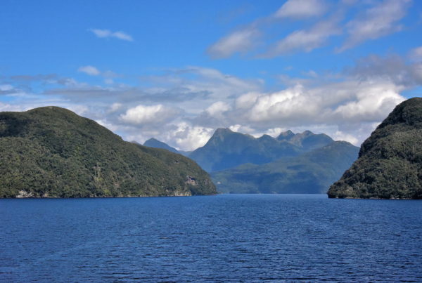
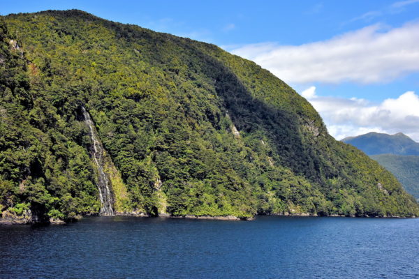
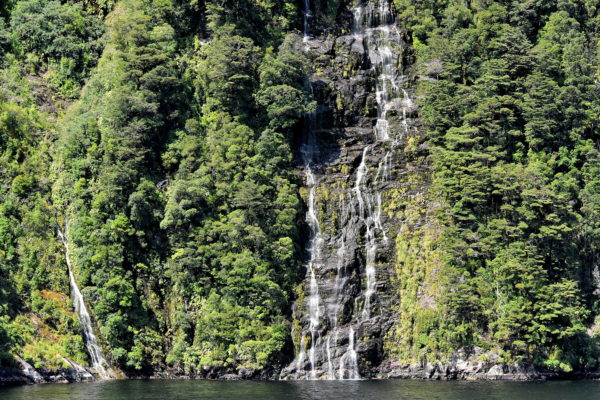
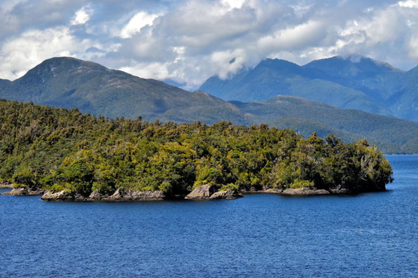
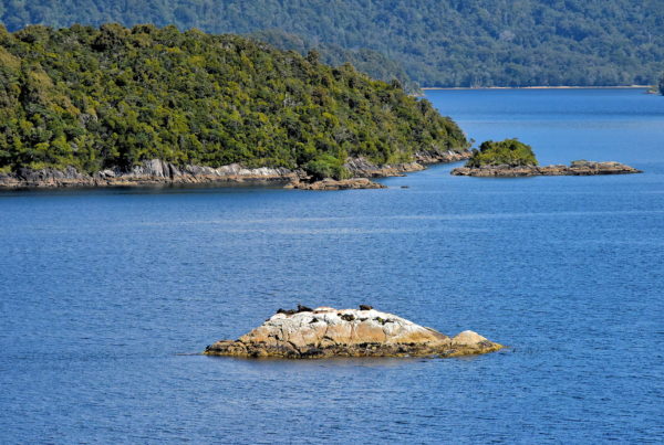
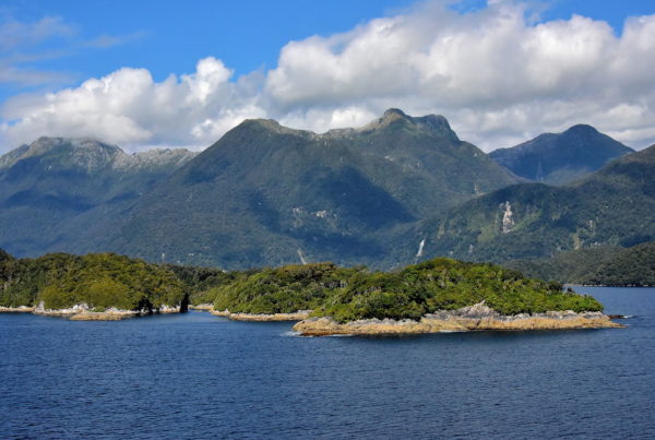
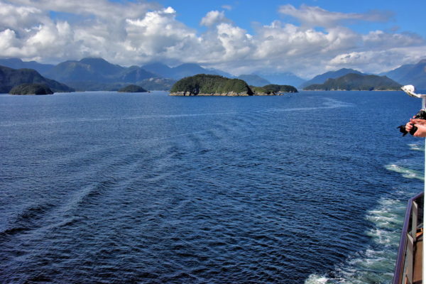
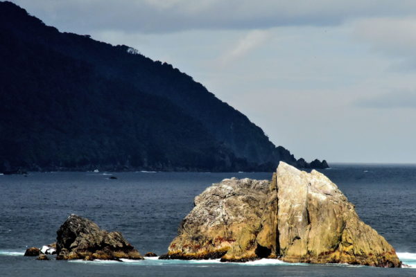
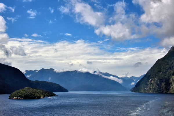
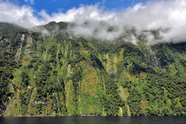
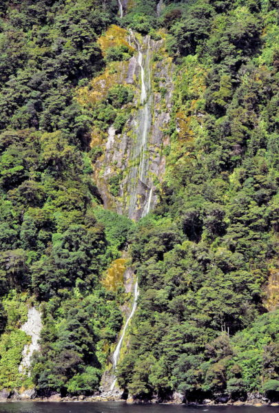
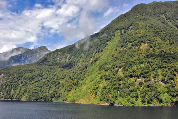
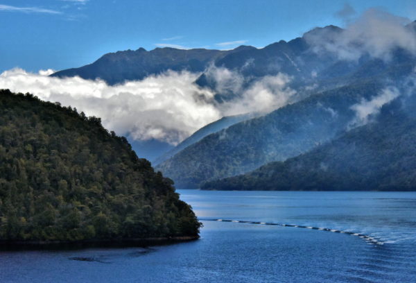
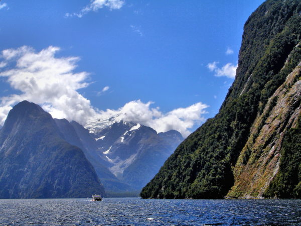
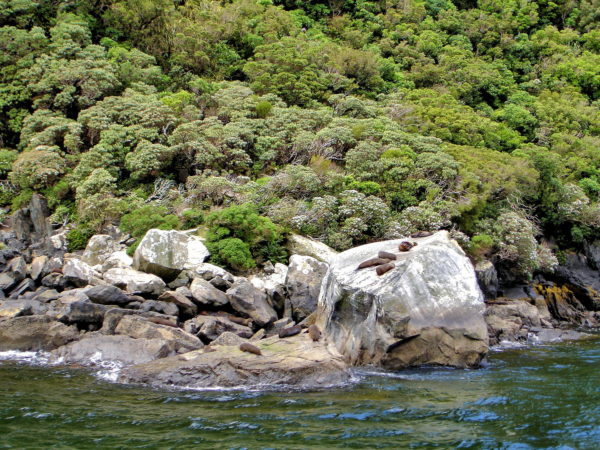
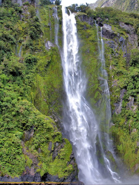
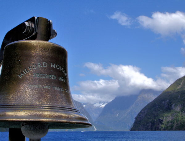
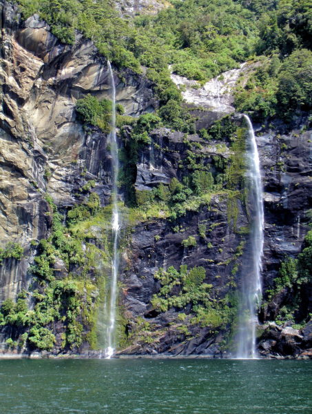
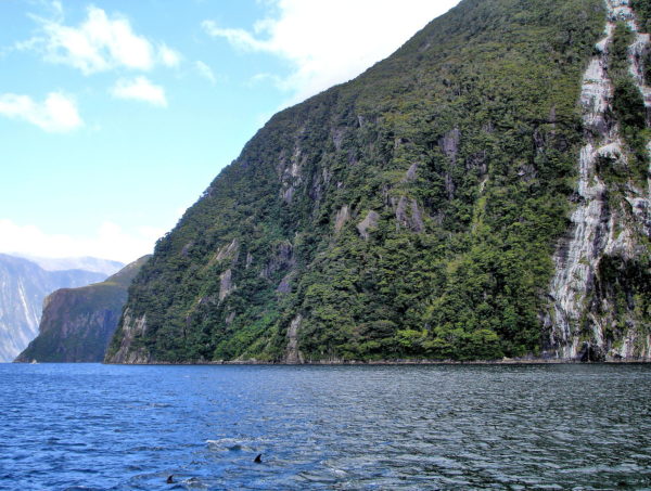
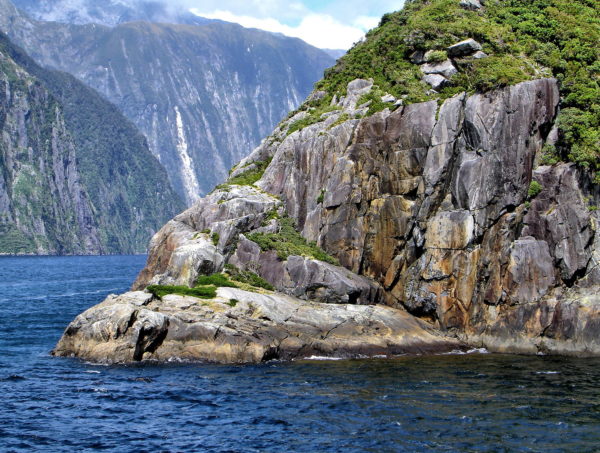
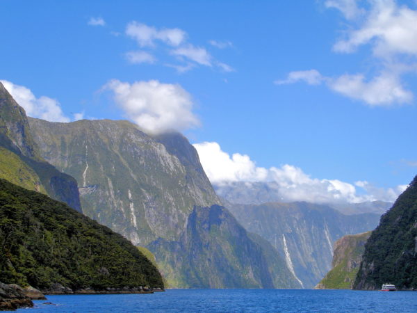
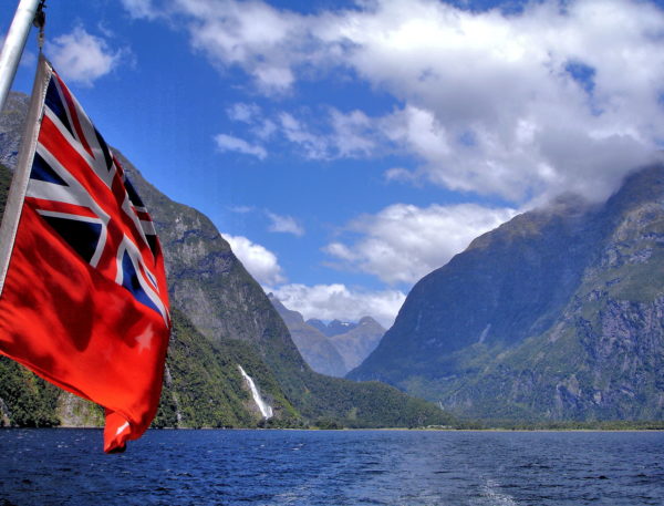
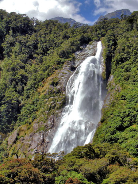
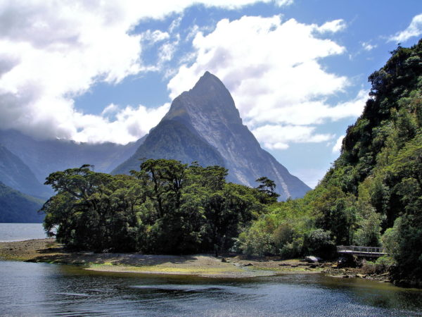
Fiordland along the southwestern coast of New Zealand consists of 14 scenic fjords including Milford Sound, one of the world’s top destinations. The glacier-carved valleys squeezed among towering mountains will amaze you. Climb aboard a sightseeing cruise to marvel at six magical sounds.

Share this
Approaching Breaksea Sound, Introduction to Fiordland, New Zealand - Encircle Photos

1 Approaching Breaksea Sound, Introduction to Fiordland, New Zealand

Fiordland is 134 miles of stunning coastline between the Tasman Sea and Fiordland National Park along the southwest corner of New Zealand’s South Island. Reachable only by air or boat, this World Heritage Site features 14 glacier-carved fjords, countless islands and uninhabited scenic beauty. Your picturesque journey begins as your ship approaches Breaksea Sound and then travels 21 miles before exiting at Dusky Sound.

Breaksea Sound, Southland 9691, New Zealand
Enlarge/Slideshow See On Map Directions
Breaksea Island in Breaksea Sound at Fiordland, New Zealand - Encircle Photos

2 Breaksea Island in Breaksea Sound at Fiordland, New Zealand

Guarding the entrance of Breaksea Sound is this cragged, one-square-mile islet with an elevation of 3,766 feet. Breaksea Island is home to a colony of Fiordland crested penguins. This endemic species was considered endangered and bordered on extinction. Then aggressive conservation efforts helped eradicate pests – especially Norway rats – on the island. The distinguished-looking penguin stands two feet tall. The flightless birds have pronounced, yellow eyebrows flaring toward the back of their heads. Also watch for a pod of playful bottlenose dolphins. They love greeting visitors by swimming along your boat.

Breaksea Sound, Southland 9691, New Zealand
Enlarge/Slideshow See On Map Directions
Entering Breaksea Sound at Fiordland, New Zealand - Encircle Photos

3 Entering Breaksea Sound at Fiordland, New Zealand

After your ship sails between Breaksea Island and Rocky Point, you approach Gilbert Island (on the right) and Entry Island (on the left) as you enter Breaksea Sound. The cloud-shrouded mountains are part of the Southern Alps. This 310 mile range is the backbone of the South Island’s west coast. The summit is over 12,000 feet. The peaks get smaller as they traverse south through Fiordland. The tallest along Breaksea Sound is Mount Kellard at 3,940 feet. Those in the background are 3,200 to 3,600 feet.

Breaksea Sound, Southland 9691, New Zealand
Enlarge/Slideshow See On Map Directions
Sailboat at Stevens Cove in Breaksea Sound at Fiordland, New Zealand - Encircle Photos

4 Sailboat at Stevens Cove in Breaksea Sound at Fiordland, New Zealand

Several coves dot the shorelines at the mouth of Breaksea Sound. Those with names are Disappointment, Occasional, Sunday and, shown here, Stevens Cove along Resolution Island. Better inlets for anchorage are further into Breaksea Sound. One is Beach Harbor protected by Harbour Islands. Across the channel are three coves with the uncreative names of First, Second and Third. These are idyllic places for pleasure boats. Mooring is limited to 48 hours. Historically, the coves also offer safe harbor from notorious winds that can howl along the coastline reaching speeds up to 80 mph with tumultuous seas.

Breaksea Sound, Southland 9691, New Zealand
Enlarge/Slideshow See On Map Directions
Farther into Breaksea Sound at Fiordland, New Zealand - Encircle Photos

5 Farther into Breaksea Sound at Fiordland, New Zealand

The waterway forks just beyond Entry Island. Breaksea Sound travels northeast past Harbour Islands (on the right) and extends for 19 miles into the Vancouver Arm and the Broughton Arm. Its total coverage of 19 square miles qualifies Breaksea Sound as the third largest of the 14 fjords in Fiordland. Instead of exploring this area, your ship will travel south through the Acheron Passage.

Breaksea Sound, Southland 9691, New Zealand
Enlarge/Slideshow See On Map Directions
Naming of Acheron Passage at Fiordland, New Zealand - Encircle Photos

6 Naming of Acheron Passage at Fiordland, New Zealand

Connecting Breaksea Sound and Dusky Sound is Acheron Passage. The entrance is equally grand and serene. The channel’s naming rights were a bit choppier. Explorer Captain James Cook called this waterway North Entrance to Dusky Bay. Yet his third lieutenant Richard Pickersgill named it Resolution Passage after their ship, the HMS Resolution. Neither name was lasting. The honors went to John Stokes in 1851 while he was captain of the HM Acheron. The 100 man crew of this 150 foot surveying ship charted the west coast of New Zealand from 1848 to 1855.

Acheron Passage, Southland 9691, New Zealand
Enlarge/Slideshow See On Map Directions
Resolution Island along Acheron Passage at Fiordland, New Zealand - Encircle Photos

7 Resolution Island along Acheron Passage at Fiordland, New Zealand

While sailing out of Breaksea Sound, along Acheron Passage and into Dusky Sound, the landmass on the starboard (right) side of the ship is Resolution Island. Encompassing 80 square miles, it is Fiordland’s largest island. Its namesake was the HMS Resolution. The Royal Navy cargo vessel arrived here in 1773 captained by British explorer James Cook. In 1891, Resolution Island became New Zealand’s initial reserve for preserving indigenous flora and fauna. The first curator was Richard Henry. His tireless mission for 17 years on Resolution Island was to reverse damage done by the Māori and Europeans, irradiate non-native predators and save endemic plants and animals from extinction. Henry remained a staunch naturalist for another 21 years until his death in 1929.

Acheron Passage, Southland 9691, New Zealand
Enlarge/Slideshow See On Map Directions
Forested Cliffs along Acheron Passage at Fiordland, New Zealand - Encircle Photos

8 Forested Cliffs along Acheron Passage at Fiordland, New Zealand

The tall cliffs encircling the Fiordland waterways are blanketed with thick vegetation. The temperate rainforest ecoregion is a perfect habitat for nothofagus beech trees, indigenous to the Southern Hemisphere. Some of them are over 800 years old. Beneath this thick mass of silver, southern and mountain beech is a carpet of ferns and mosses clinging to the thin topsoil on the rocky edges. Notice the green, younger vegetation with the waterfall in the middle. This is evidence a glacier once retreated along this path. The gray patch in the center is an exposed moraine.

Acheron Passage, Southland 9691, New Zealand
Enlarge/Slideshow See On Map Directions
Fjord Verses Sound at Fiordland, New Zealand - Encircle Photos

9 Fjord Verses Sound at Fiordland, New Zealand

During your short journey through Breaksea Sound and Acheron Passage, you have seen a sound, passage and arm. What’s the difference? Nothing. All of these U-shaped seawater valleys were carved by glaciers over 100,000 years ago. This technically qualifies them as fjords and not sounds which are sunken river inlets. And New Zealanders prefer the word fiord versus the Norwegian spelling of fjord. Confused? So were Captain Cook and his men so blame them for the misnomers.

Acheron Passage, Southland 9691, New Zealand
Enlarge/Slideshow See On Map Directions
Wet Jacket Arm in Acheron Passage at Fiordland, New Zealand - Encircle Photos

10 Wet Jacket Arm in Acheron Passage at Fiordland, New Zealand

If you study a map of Fiordland, you will notice numerous narrow and long fingers of water protruding inland. They are typically called an arm despite qualifying as sounds. This is the entrance to Wet Jacket Arm. This six mile long, 5,000 acre marine reserve branches eastwardly from Acheron Passage. It was humorously named by Captain Cook’s crew after enduring days of torrential rain. The Ngāi Tahu (Māori tribe) calls it Moana Uta. At the end of Wet Jacket Arm is Herrick Creek, famous for being the last recorded sighting of a moose in 1995. Moose were imported from Saskatchewan Canada in 1900 and again in 1910. Several were shot by hunters through 1952. Since then, they have been as elusive as Big Foot with only an occasional sighting, antler, dropping or hair sample.

Acheron Passage, Southland 9691, New Zealand
Enlarge/Slideshow See On Map Directions
Māori Legend of Fiordland, New Zealand - Encircle Photos

11 Māori Legend of Fiordland, New Zealand

According to Māori legend, Tu-te-raki-whanoa was a deity who formed Fiordland by carving the coastline with his mighty ax. His masterful seascape was complete at Milford Sound. It is claimed Resolution Island adjacent to Acheron Passage shown here is actually one of the great god’s footprints. Livid over the beautiful seascape, the revengeful goddess of death, Te-Hine-nui-to-po, released sandflies to prevent habitation. The Māori name for these nasty insects is Te namu meaning “little devils.” The curse worked. Fiordland is virtually free of human population except for visiting tourists. And the female blackflies are waiting for them. These blood-thirsty critters cause swelling plus itching and can ruin the enjoyment of the most picturesque scenery.

Acheron Passage, Southland 9691, New Zealand
Enlarge/Slideshow See On Map Directions
Waterfall along Acheron Passage at Fiordland, New Zealand - Encircle Photos

12 Waterfall along Acheron Passage at Fiordland, New Zealand

Waterfalls are plentiful along Acheron Passage, especially south of Wet Jacket Arms. They are sourced by two mountains on the port side of your ship: Mount Forster (3,700 feet) and Mount Hodges (3419 feet). There are at least a hundred more falls in nearby Dusky Sound. These cascades are especially bountiful after a heavy rainfall. And there is no shortage of precipitation around here. Typically, it rains up to 300 inches during about 200 days a year. The tallest waterfall within Fiordland is Sutherland Falls near Milford Sound with an amazing, three-level drop of 1,900 feet.

Acheron Passage, Southland 9691, New Zealand
Enlarge/Slideshow See On Map Directions
Long Island in Dusky Sound at Fiordland, New Zealand - Encircle Photos

13 Long Island in Dusky Sound at Fiordland, New Zealand

You will know when you exit Acheron Passage because you can no longer travel south: Long Island is there to greet you. This islet is 7.5 miles long. If you head east toward the upper end of the sound, you will soon discover Cooper Island. At 6.9 square miles in size, Cooper is the third largest island in Fiordland. More likely your ship will sail west through Bowen Channel and into the spectacular panorama of Dusky Sound. Across the 1.2 mile wide Long Island is Cook Channel, named after the famous Captain James Cook.

Dusky Sound, Southland 9691, New Zealand
Enlarge/Slideshow See On Map Directions
Fur Seals Sunning in Dusky Sound at Fiordland, New Zealand - Encircle Photos

14 Fur Seals Sunning in Dusky Sound at Fiordland, New Zealand

West of Long Island into Dusky Sound is pockmarked with islets. They are a haven for New Zealand fur seals. This species related to sea lions were almost hunted to extinction by the Polynesians for food and then by the Europeans starting in 1792. By the early 19th century, the marine mammal was almost wiped out. Fortunately, the fur seal population has rebounded. Since 1978, kekeno (Māori name) have been safeguarded by the Marine Mammals Protection Act. Other frequent visitors to these waters are bottlenose dolphins plus southern right and humpback whales.

Dusky Sound, Southland 9691, New Zealand
Enlarge/Slideshow See On Map Directions
Dusky Sound Description at Fiordland, New Zealand - Encircle Photos

15 Dusky Sound Description at Fiordland, New Zealand

Dusky Sound is enormous and beautiful. The fjord offers 25 miles of gorgeous scenery and the mouth is five miles wide. Its isolation toward the southern end of Fiordland has created a haven for endemic wildlife and lush vegetation. These are Two Sisters Islands. They are among the 700 islets accenting your cruise through Breaksea Sound, Acheron Passage, Wet Jacket Arm and Dusky Sound. The mountains piercing the clouds peak at 3,744 feet.

Dusky Sound, Southland 9691, New Zealand
Enlarge/Slideshow See On Map Directions
Captain Cook’s Exploration of Dusky Sound at Fiordland, New Zealand - Encircle Photos

16 Captain Cook’s Exploration of Dusky Sound at Fiordland, New Zealand

Until the late 18th century, people believed the unexplored land in the Southern Hemisphere must match the northern continents they knew. James Cook, a captain in the Royal Navy, was commissioned to test this theory called Terra Australis. During his first expedition (1768 – 1771) aboard the HMS Endeavour while circumnavigating New Zealand, he discovered these waters on March 14, 1770 and named them Dusky Bay. His ship the HMS Resolution returned during his second voyage (1772 – 1775) and moored at Pickersgill Harbor just south of Dusky Sound for six weeks in 1773. His detailed mapping provided the names of all the features you see here. From left to right, they are: Five Fingers Peninsula (part of Resolution Island) and the islets called Petrel, Anchor, Seal, Many, Normans and Indian Islands.

Dusky Sound, Southland 9691, New Zealand
Enlarge/Slideshow See On Map Directions
Leaving Dusky Sound at Fiordland, New Zealand - Encircle Photos

17 Leaving Dusky Sound at Fiordland, New Zealand

Don’t despair as your ship sails out of Dusky Sound. Your exploration of New Zealand’s geological crown jewels has just begun. You are headed north to discover the most famous of Fiordland’s 14 sounds. These endless vistas are part of Fiordland National Park. Created in 1952, the country’s largest park has nearly three million acres of unsurpassed beauty.

Dusky Sound, Southland 9691, New Zealand
Enlarge/Slideshow See On Map Directions
Hares Ears Entry to Doubtful Sound at Fiordland, New Zealand - Encircle Photos

18 Hares Ears Entry to Doubtful Sound at Fiordland, New Zealand

Hares Ears marks the picturesque entrance to Doubtful Sound. The waterway stretches inland 25 miles, measures 33 square miles and reaches a depth of 1,381 feet. This makes it Fiordland’s deepest, second largest and second most popular fjord. It is ironic this islet is named after the brown hare. The lepus europaeus is distributed throughout New Zealand yet is absent in Fiordland. Before they arrived with the Europeans in the mid-19th century – along with hitchhiking rats – New Zealand was devoid of mammals. Because these varmints had no predators, they quickly flourished into pests. To control them, the British introduced stoats (a type of weasel) and cats in to the wild. They in turn wiped out many species of native flightless birds. Conservation efforts are still underway to eradicate these invasive species and save endangered endemic fauna.

Doubtful Sound, Southland 9691, New Zealand
Enlarge/Slideshow See On Map Directions
Doubtful, the Sound of Silence at Fiordland, New Zealand - Encircle Photos

19 Doubtful, the Sound of Silence at Fiordland, New Zealand

Superlatives fail to describe the majesty of Doubtful Sound as it appears over your ship’s bow. Let’s introduce you to some of the scenery. On the left are the Shelter Islands. The point is Jamieson Head, part of Bauza Island. Its namesake was Felipe Bauzá y Cañas, the cartographer (map drawer) aboard a five-year Spanish expedition in the late 19th century. As you travel slowly for less than a mile along the Patea Passage, you are awed by the swirling clouds above the 4,432 foot Behind Peaks. Marvel how the blue sky shares its color with the sea. The Māori call this fjord Patea meaning “place of silence.” This is why Doubtful is commonly referred to as the Sound of Silence.

Doubtful Sound, Southland 9691, New Zealand
Enlarge/Slideshow See On Map Directions
Unique Water in Doubtful Sound at Fiordland, New Zealand - Encircle Photos

20 Unique Water in Doubtful Sound at Fiordland, New Zealand

Visitors to Fiordland are mesmerized by the enormous lush cliffs – etched with waterfalls – and the mountain peaks defining the U-shaped valleys. Sure, tourists love being on the water. Yet they do not study it unless hoping to see some of the 70 bottlenose dolphins resident in Doubtful Sound. People assume this is saltwater because it connects with the Tasman Sea. Surprisingly, the ecosystem is a mix of aquatic and marine. As far as 30 feet below the surface is freshwater. The low salinity is caused by the region’s extensive rainfall. The water color is a murky brown because of plant tannins draining from the forest. Below 30 feet is dense, dark saltwater that is not conducive to much life.

Doubtful Sound, Southland 9691, New Zealand
Enlarge/Slideshow See On Map Directions
Waterfalls in Doubtful Sound at Fiordland, New Zealand - Encircle Photos

21 Waterfalls in Doubtful Sound at Fiordland, New Zealand

If you are an aficionado of waterfalls, you will not be disappointed while touring Doubtful Sound. The 100 to 200 inches of annual rainfall produces cascades down every cliff. The deeper you travel into the fjord, the more dramatic the show of nature. Just follow Malaspina Reach toward the sound’s terminus at Deep Cove. Along this route are all of Doubtful’s named waterfalls. The granddaddy is Browne Falls across from Fergusson Islands. Estimates of its height vary but the consensus is 2,700 feet. This qualifies as New Zealand’s tallest waterfall.

Doubtful Sound, Southland 9691, New Zealand
Enlarge/Slideshow See On Map Directions
Secretary Island in Doubtful Sound at Fiordland, New Zealand - Encircle Photos

22 Secretary Island in Doubtful Sound at Fiordland, New Zealand

If your ship’s itinerary includes multiple fjords, then you will probably not travel farther into Doubtful Sound or one of its branching arms. Instead, you will sail around the tip of Secretary Island. This wedge-shaped 31 acres has the tallest mountain off the New Zealand mainland. Mount Grono peaks at 3,924 feet. The summit’s namesake was Welsh sea captain John Grono. He moored his ship in a nearby bay several times in the early 19th century while collecting thousands of seal pelts during each expedition. You are now sailing through the short Pendulo Reach before connecting with Thompson Sound.

Doubtful Sound, Southland 9691, New Zealand
Enlarge/Slideshow See On Map Directions
Looming Storm in Thompson Sound at Fiordland, New Zealand - Encircle Photos

23 Looming Storm in Thompson Sound at Fiordland, New Zealand

Thompson Sound flows by terraces of forested rock reaching peaks over 4,000 feet. The glacier-carved channel becomes enchantingly beautiful as clouds drift down before obliterating the sun. The green seascape turns gray then black. The temperature drops. A few drops of rain hit your face. Soon a torrential downpour. Enjoy the experience. You are being baptized in the always changing weather of Fiordland.

Thompson Sound, Southland 9691, New Zealand
Enlarge/Slideshow See On Map Directions
Introduction to Milford Sound at Fiordland, New Zealand - Encircle Photos

24 Introduction to Milford Sound at Fiordland, New Zealand

The masterpiece of Fiordland National Park – the country’s largest park – is Milford Sound. Piopiotahi (Māori name) is the northernmost of the fjords along the southwestern coast of New Zealand. This incredible 9.9 mile inlet of the Tasman Sea is defined by sheer summits like Mount Kimberley (The Lion) at 4,271 feet on the left, the snow-capped Mills Peak at 5,987 feet and the 3,966 foot Cascade Peak on the right. Savor the pristine scenery above water during a sightseeing cruise. Marvel at the waterfalls. Enjoy seeing dolphins, penguins, fur seals and whales in the water. And stop at Harrison Cove (center) to view marine life at 32 feet below the surface at the Milford Sound Underwater Observatory. You will soon understand why Milford Sound is rated among the top destinations not only in New Zealand but also the world.

Milford Sound, Southland 9691, New Zealand
Enlarge/Slideshow See On Map Directions
Seal Rock in Milford Sound at Fiordland, New Zealand - Encircle Photos

25 Seal Rock in Milford Sound at Fiordland, New Zealand

A visual treat is watching New Zealand fur seals basking in the sunshine on Seal Rock. Are they lazy? No. They rest at a haul out site like this after spending a week or more fishing in the ocean. Males average eight feet long and can top the scales at over 300 pounds. Females are considerably smaller. Despite their size, Antarctic fur seals are incredibly nimble in the water and land. You will enjoy watching them use their hind flippers to jockey for the best napping position. Kekeno (Māori name) were hunted to near extinction during the 19th century. After aggressive conservation, including total protection under the Marine Mammals Protection Act signed in 1978, their population has rebounded.

Milford Sound, Southland 9691, New Zealand
Enlarge/Slideshow See On Map Directions
Stirling Falls in Milford Sound at Fiordland, New Zealand - Encircle Photos

26 Stirling Falls in Milford Sound at Fiordland, New Zealand

With a drop of 508 feet, Stirling Falls is the second tallest in Milford Sound. Its namesake was Royal Navy Commodore Frederick Stirling. After captaining the HMS Clio, he was commander-in-chief of the Australia Squadron and then Pacific Station during the 1870s. Stirling Falls plunges over an elevated chasm – actual a glacier valley – nestled between two personified mountains. Directly to the south is The Lion at 4,272 feet. To the north is The Elephant at 4,948 feet. The Māori name for this magnificent falls is Wai Manu meaning “Cloud on the Water.”

Milford Sound, Southland 9691, New Zealand
Enlarge/Slideshow See On Map Directions
Sightseeing in Milford Sound at Fiordland, New Zealand - Encircle Photos

27 Sightseeing in Milford Sound at Fiordland, New Zealand

Despite its remote location along New Zealand’s southwest coast, nearly one million people annually visit Milford Sound. Nearly all tourists are thrilled during their sightseeing cruise. Options range from a scenic boat ride lasting less than an hour up to two hours. Also available are more extensive excursions including other sounds and overnight cruises. The Milford Monarch is a passenger ship launched in 1994 and operated by Real Journeys. Alternative companies are Cruise Milford and the oldest, Southern Discoveries. They can all arrange bus or air transportation to and away from Milford Sound.

Milford Sound, Southland 9691, New Zealand
Enlarge/Slideshow See On Map Directions
Four Sisters in Milford Sound at Fiordland, New Zealand - Encircle Photos

28 Four Sisters in Milford Sound at Fiordland, New Zealand

Milford Sound’s most famous falls are constantly on display. Yet their intensity of cascading water will vary depending on the season and weather. Following a torrential rain, the cliffs become a symphony of waterfalls. Such is the case with the Four Sisters. They are nearly identical ribbons of water tumbling in a parallel formation. Two of the siblings were missing on this day. But you can bet they returned soon. Milford Sound is one of the world’s wettest places with an average rainfall over 250 inches during 180 or more days.

Milford Sound, Southland 9691, New Zealand
Enlarge/Slideshow See On Map Directions
Bottlenose Dolphins in Milford Sound at Fiordland, New Zealand - Encircle Photos

29 Bottlenose Dolphins in Milford Sound at Fiordland, New Zealand

There is a pod of 60 resident bottlenose dolphins in Milford Sound. They love putting on a show for visitors. So keep your camera poised as their hooked dorsal fins approach. Soon you will be delighted by their acrobatic antics in the wake of your boat. Then they will race along the side in a leaping game of tag before disappearing. If you are lucky, you can watch them chase, herd and feed on a school of fish. Other marine life sharing Milford Sound are Fiordland crested penguins from July through November and an occasional group of southern right whales.

Milford Sound, Southland 9691, New Zealand
Enlarge/Slideshow See On Map Directions
Glacier Etched Rocks in Milford Sound at Fiordland, New Zealand - Encircle Photos

30 Glacier Etched Rocks in Milford Sound at Fiordland, New Zealand

It is easy to get mesmerized by the sheer cliffs encircling Milford Sound. But a close inspection of the rock reveals scars and polishing from the fjord’s formation. Milford Sound was created during 20 glacial periods dating back to the Ross Glaciation 2.5 million years ago. The incredible power of these glaciers moved an estimated 13.2 billion tons of rock while carving out the valley. The forces were the strongest near the terminus, resulting in a water depth of 1,312 feet. As the debris was pushed towards the Tasman Sea, the water depth is just over 80 feet. It took over 600 million years of tectonic shifts and erosion to create the magnificent mountain peaks.

Milford Sound, Southland 9691, New Zealand
Enlarge/Slideshow See On Map Directions
History of Milford Sound at Fiordland, New Zealand - Encircle Photos

31 History of Milford Sound at Fiordland, New Zealand

Milford Sound was used by generations of Māori for fishing. During the earliest European circumnavigation voyages, the fjord was unexplored because its narrow entrance was easy to miss. Plus the shallow water of 88 feet at the mouth seemed unpromising and potentially dangerous. In 1812, the ship Governor Bligh captained by seal hunter John Grono was the first to sail through the opening along the Tasman Sea. He called the discovery Milford Haven after his hometown in Wales. During the mid-19th century, it was renamed Milford Sound by John Lort Stokes during a surveying expedition aboard the HMS Acheron. This panorama facing the end of Milford Sound displays two of the tallest summits. Sheerdown Peak on the left has an elevation of 6,161 feet. Next to it is Odyssey Peak at 5,974 feet.

Milford Sound, Southland 9691, New Zealand
Enlarge/Slideshow See On Map Directions
New Zealand Flag in Milford Sound at Fiordland, New Zealand - Encircle Photos

32 New Zealand Flag in Milford Sound at Fiordland, New Zealand

Dutchman Abel Tasman discovered New Zealand in 1642. Yet the British were the first to circumnavigate and mapped it (Captain Cook beginning in 1769), settle it (James Busby first resident in 1833), purchase land (Treaty of Waitangi in 1840), create the Colony of New Zealand (1841) and form the self-governing Dominion of New Zealand (1907). In fact, the United Kingdom’s sovereign is still the head of state for the constitutional monarchy. No wonder New Zealand’s flag incorporates the Union Jack in the upper left corner (canton). The four stars are the Southern Cross. Also called the Crux, it represents a Southern Hemisphere constellation. The flag’s background color is normally royal blue. This Red Ensign is reserved for merchant vessels while at sea. In the background is Lady Bowen Falls.

Milford Sound, Southland 9691, New Zealand
Enlarge/Slideshow See On Map Directions
Lady Bowen Falls in Milford Sound at Fiordland, New Zealand - Encircle Photos

33 Lady Bowen Falls in Milford Sound at Fiordland, New Zealand

Bowen River is sourced at the 7,300 foot elevation of Mount Grave. It then flows six miles before gushing 531 feet over a cliff near the end of Milford Sound. Lady Elizabeth Bowen Falls is named for the wife of George Bowen. He was successively the governor of Queensland, New Zealand, Victoria, Mauritius (French Island in Indian Ocean) and finally Hong Kong from 1859 until 1887. The Maori name is Hine Te Awa meaning “girl on the river.” Bowen Falls is the tallest and most dramatic waterfall in Milford Sound.

Milford Sound, Southland 9691, New Zealand
Enlarge/Slideshow See On Map Directions
Mitre Peak in Milford Sound at Fiordland, New Zealand - Encircle Photos

34 Mitre Peak in Milford Sound at Fiordland, New Zealand

Milford Sound is encircled with enormous mountains. The most famous and photographed summit at 5,551 feet is not the tallest. What elevated this mount to iconic status are the five points resembling a bishop’s ceremonial headgear. The Māori name is Rahotu. The first person to call it Mitre Peak was Captain John Lort Stokes while aboard the HMS Acheron in 1851. This view is from shore next to Southern Discoveries, a sightseeing cruise company. In the foreground is part of the Freshwater Basin harbour. Nearby is the information centre and airport.

Milford Sound, Southland 9691, New Zealand
Enlarge/Slideshow See On Map Directions
Flying to Milford Sound at Fiordland, New Zealand - Encircle Photos

Flying to Milford Sound at Fiordland, New Zealand

Milford Sound is the only one of Fiordland’s sounds accessible by road. The drive from Queenstown is 179 miles (over four hours – longer with frequent photo stops) and 75 miles from Te Anau (about two hours). The scenery is gorgeous along the way but exhausting during a one-day round trip. Most people prefer to book a tour by bus or coach so they can enjoy the views and an occasional nap. Be forewarned: Milford Sound gets very busy midday when everyone arrives almost simultaneously. An exhilarating alternative is flying over the stunning Southern Alps either by plane or helicopter. The ride is expensive but the memory will last forever.

Enlarge/Slideshow
TOP