Corner Brook, NL, Canada

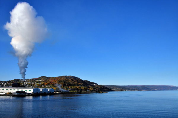
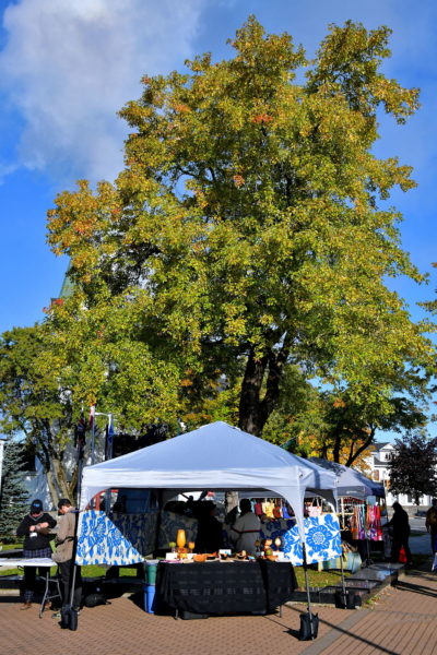
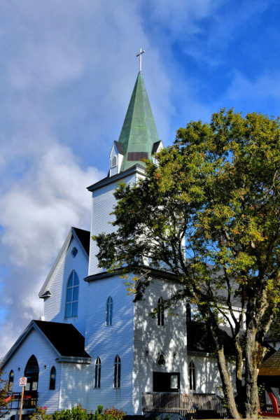
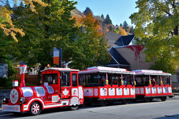
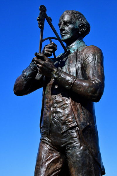
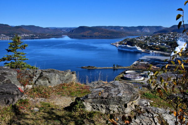
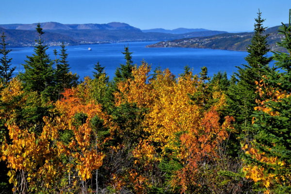
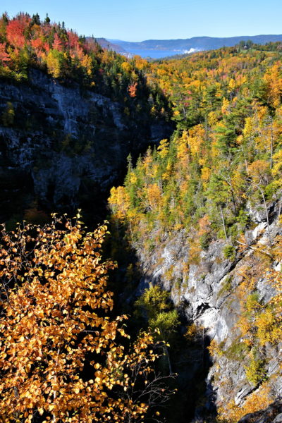
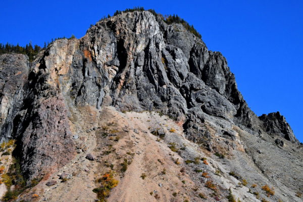
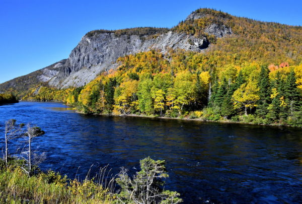
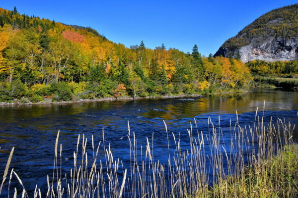
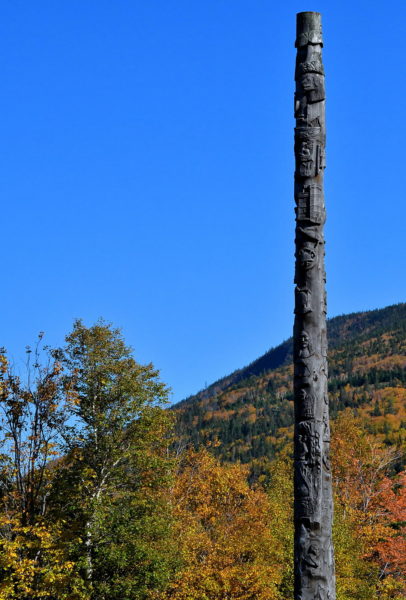
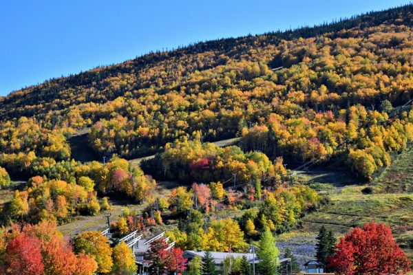
A joy of Atlantic Canada is Corner Brook. This small city in Western Newfoundland is big on scenery. Among the visual highlights are a long fjord named Humber Arm, magnificent mountain ridges, plenty of nature trails and a kaleidoscope of autumn colors. Come see what Captain James Cook discovered in 1767.

Share this
Approaching Corner Brook, Canada - Encircle Photos

1 Approaching Corner Brook, Canada

Corner Brook is home to 20,000 residents near the Bay of Islands on the west coast of Newfoundland in eastern Canada. If you are approaching on the Humber Arm aboard a cruise ship, do not judge the city by its smokestack. The paper mill has been a major employer since 1923 and a guardian of over 3.4 million acres of forest. Also, have modest expectations for downtown. Instead, equate Corner Brook with scenery … plenty of spectacular scenery. The apex is in autumn when the sun illuminates endless bouquets of colorful leaves.

710 Gearyville Rd, Corner Brook, NL A2H 1B5, Canada
Enlarge/Slideshow See On Map Directions
City Hall in Corner Brook, Canada - Encircle Photos

2 City Hall in Corner Brook, Canada

Whether you take the free shuttle bus from the cruise ship, or elect to make the 15 minute (non-scenic) walk into town, you will arrive at City Hall. These are the offices for the mayor and six members of the City Council. Also inside is the Rotary Arts Centre featuring a 90 seat theater and two art galleries. History buffs will enjoy visiting the free Corner Brook Museum & Archives on 2 West Street. Afterwards, it will not take you long to explore the rest of downtown. There are only a few shop and restaurants.

5 Park St, Corner Brook, NL A2H 6E1, Canada
Enlarge/Slideshow See On Map Directions
Crafts Market at Remembrance Square in Corner Brook, Canada - Encircle Photos

3 Crafts Market at Remembrance Square in Corner Brook, Canada

Outside of City Hall is Remembrance Square. The plaza is graced with two life-size sculptures of soldiers and a bronze caribou atop a granite war memorial. These are the works of local sculptor Morgan MacDonald. The square is the scene of Remembrance Day ceremonies every November 11, a statutory holiday in Newfoundland. On the days when a cruise ship is in port, local artisans raise tents to exhibit and market their crafts.

Remembrance Square, Main St, Corner Brook, NL A2H 6E1, Canada
Enlarge/Slideshow See On Map Directions
St. John the Evangelist Cathedral in Corner Brook, Canada - Encircle Photos

4 St. John the Evangelist Cathedral in Corner Brook, Canada

St. John the Evangelist Cathedral is a lovely, white clapboard church on Main Street. The interior is humble yet handsome with stained glass windows accenting the woodwork. This is the See for the Anglican Diocese of Western Newfoundland. Approximately 60% of the population of Newfoundland and Labrador are affiliated with the Protestant faith. Specifically, 26% are Anglican and worship with the Church of England.

25 Main St, Corner Brook, NL A2H 1C2, Canada
Enlarge/Slideshow See On Map Directions
Sightseeing Street Train in Corner Brook, Canada - Encircle Photos

5 Sightseeing Street Train in Corner Brook, Canada

In 2019, a new accommodation for tourists was introduced by the Corner Brook Port Authority. This open-air, two-compartment train can accommodate from 16 to 20 people. They are pulled by a truck resembling a steam engine locomotive. It only costs $2 CAD to hop aboard the Mill Whistler Road Train for a fun tour of downtown.

17 West St, Corner Brook, NL A2H 3M1, Canada
Enlarge/Slideshow See On Map Directions
Glynmill Inn in Corner Brook, Canada - Encircle Photos

6 Glynmill Inn in Corner Brook, Canada

In the early 1920s, the Armstrong-Whitworth Company from England was commissioned by the Newfoundland Power and Paper to build a mill in Corner Brook. To accommodate their senior managers and staff during the large project, they hired Halifax architect Andrew Cobb to design living quarters. This handsome, Tudor Revival guesthouse opened in 1924 with a long list of advanced features rarely seen at the time in Newfoundland. The property is now the highly-rated Glynmill Inn, operated by Steele Hotels. It is named after Sir Glyn West, the former chairman of Armstrong-Whitworth. The half-timber building is designated as a Registered Heritage Structure for its historical and architectural merits.

1B Cobb Ln, Corner Brook, NL A2H 2V3, Canada
Enlarge/Slideshow See On Map Directions
Viewing Platform on Glynmill Pond in Corner Brook, Canada - Encircle Photos

7 Viewing Platform on Glynmill Pond in Corner Brook, Canada

After admiring Glynmill Inn, it is a short stroll along Cobb Lane before reaching a staircase down to a wooden platform overlooking Glynmill Pond. Stop! Savor the spectrum of autumn foliage reflecting off the clear blue lake. Smell the evergreens. Hear the rustle of dry leaves. Watch a graceful swan swim by. This scenery is sensational! Linger as long as you want. Moments like this are a rare gift.

2-4 Cobb Ln, Corner Brook, NL A2H 2V3, Canada
Enlarge/Slideshow See On Map Directions
History of Glynmill Pond in Corner Brook, Canada - Encircle Photos

8 History of Glynmill Pond in Corner Brook, Canada

Glynmill Pond is a heart-shaped artificial lake. In the early 1920s, a dam was built (left in photo) to harness fresh water for the pulp and paper mill. In 2002, fish ladders were installed to allow Atlantic salmon to return and spawn. In addition, fry were released to increase the salmon population.

Glynmill Pond, Corner Brook, NL A2H 2V3, Canada
Enlarge/Slideshow See On Map Directions
Rushing Stream at Glynmill Pond in Corner Brook, Canada - Encircle Photos

9 Rushing Stream at Glynmill Pond in Corner Brook, Canada

This torrent of water is the Corner Brook Stream rushing into Glynmill Pond. These rapids are observed from a wooden footbridge connecting the east and west banks of the lake.

Glynmill Pond, Corner Brook, NL A2H 2V3, Canada
Enlarge/Slideshow See On Map Directions
Glynmill Pond, One of Four Trails in Corner Brook, Canada - Encircle Photos

10 Glynmill Pond, One of Four Trails in Corner Brook, Canada

Glynmill Pond Trail extends for about 1.25 miles. Two other recreational paths within the city are the Corner Brook Stream Trail and the Three Bear Mountain Trail. All three are well-groomed and designed as loops. They are easy walking. The most remote footpath is the Corner Brook Gorge Trail. The heavenly spot shown here is the east bank of Glynmill Pond. Continue walking for about a mile and you will return to City Hall. This guide suggests crossing back over the footbridge and going uphill heading south. If you are directional challenged, let the high-rise about a third of a mile away be your beacon.

Glynmill Pond, Corner Brook, NL A2H 2V3, Canada
Enlarge/Slideshow See On Map Directions
Sir Richards Squires Building in Corner Brook, Canada - Encircle Photos

11 Sir Richards Squires Building in Corner Brook, Canada

The Sir Richards Squires Building is the tallest in Corner Brook at 133 feet. The high-rise seems even taller because of its elevated position on Mount Bernard Avenue overlooking the city. Inside are a public library, government offices and the Newfoundland & Labrador Provincial and Supreme Courts. The namesake is Richard Squires. He was the prime minister of Newfoundland from 1919 to 1923 and again in 1928 to 1932.

84 Mt Bernard Ave, Corner Brook, NL A2H 5G2, Canada
Enlarge/Slideshow See On Map Directions
Vibrant Fall Colors Encircling Corner Brook, Canada - Encircle Photos

12 Vibrant Fall Colors Encircling Corner Brook, Canada

You are standing on the corner of O’Connell and University Drives. This busy intersection is unremarkable except for one thing: the 187 foot elevation provides an unobstructed view of the fall leaves descending toward city center. On a clear day, you can also see Irishtown-Summerside on the hillside across the Humber Arm from Corner Brook. The town has a population of about 1,500 people.

O’Connell Dr & University Dr, Corner Brook, NL A2H 6P9, Canada
Enlarge/Slideshow See On Map Directions
Arts and Culture Centre in Corner Brook, Canada - Encircle Photos

13 Arts and Culture Centre in Corner Brook, Canada

Corner Brook is thankful to have an excellent Arts and Culture Centre since 1968. The performing arts venue has a 400 seat theater with an active schedule of productions. There is also exhibition space for art plus an 82 foot public swimming pool. The ACC facility is one of six similar centers across the province of Newfoundland and Labrador. They are managed by the Department of Tourism, Culture, Industry and Innovation.

11 University Dr, Corner Brook, NL A2H 5G5, Canada
Enlarge/Slideshow See On Map Directions
Margaret Bowater Park in Corner Brook, Canada - Encircle Photos

14 Margaret Bowater Park in Corner Brook, Canada

Gorgeous! Absolutely gorgeous! Imagine crossing over this footbridge while watching the water churn among the rocks. The surrounding foliage is spectacular! This is Margaret Bowater Park, a recreational highlight of Corner Brook. It is the entry point to the Corner Brook Stream Trail and the Gorge Trail. Park features include a playground, picnic area, a splash pad, restrooms and a small canteen for snacks. In the summer, kids like swimming in the stream and parents like the watchful eyes of a lifeguard. Adjacent is the 18-hole Blomidon Golf & Country Club.

19 O'Connell Dr, Corner Brook, NL A2H 5M5, Canada
Enlarge/Slideshow See On Map Directions
Trails at Captain Cook Historic Site in Corner Brook, Canada - Encircle Photos

15 Trails at Captain Cook Historic Site in Corner Brook, Canada

A focal point for tourism is the Captain James Cook National Historic Site. What makes the park attractive is its position on Crow’s Hill. Also called Cook’s Lookout, this headland has an elevation of about 530 feet. You will admire panoramic scenery from the easy walking paths. Along the way are several informative plaques. They describe the accomplishments of Captain James Cook and his exploration of this area in 1767.

Cook Historic Site, Mayfair Ave, Corner Brook, NL A2H 6M7, Canada
Enlarge/Slideshow See On Map Directions
Monument at Captain Cook Historic Site in Corner Brook, Canada - Encircle Photos

16 Monument at Captain Cook Historic Site in Corner Brook, Canada

This bronze statue by Luben Boykov is a tribute to Captain James Cook. He is holding a quadrant. This was an essential tool for sea navigation and map surveying. James Cook demonstrated skills as a cartographer early in his career with the British Royal Navy. While aboard the HMS Pembroke in 1758 and 1759, Cook mapped portions of the Saint Lawrence River to aid British attacks of the French territory. After the Treaty of Paris ended the Seven Year’s War in 1763, Cook was assigned to survey Newfoundland. The maps he created during five seasons (1763 -1767) were so accurate they were used by ship captains into the 20th century. Captain Cook achieved historical fame by later surveying Australia, New Zealand and the Hawaiian Islands (which he named Sandwich Islands). Cook was killed in 1779 while attempting to kidnap Kalaniʻōpuʻu, the king of Hawai’i.

Cook Historic Site, Mayfair Ave, Corner Brook, NL A2H 6M7, Canada
Enlarge/Slideshow See On Map Directions
City Overlook from Captain Cook Historic Site in Corner Brook, Canada - Encircle Photos

17 City Overlook from Captain Cook Historic Site in Corner Brook, Canada

Captain Cook Historic Site provides a wonderful overlook of Corner Brook. The city is nestled at the end of the picturesque Humber Arm fjord. In the distant right is the mouth of the Humber River. This river once served as the major transport for logs destined for Corner Brook’s pulp and paper mill. Today, the mill with the billowing smokestack is operated by Kruger Inc. The Canadian company is a leader in manufacturing industrial and consumer paper products plus recycling. Also notice the cruise ship in port. It is one of about 15 ships that arrive during the summer and autumn months. Each year, about 20,000 passengers enjoy exploring the charms of Corner Brook.

Cook Historic Site, Mayfair Ave, Corner Brook, NL A2H 6M7, Canada
Enlarge/Slideshow See On Map Directions
Humber Arm from Captain Cook Historic Site in Corner Brook, Canada - Encircle Photos

18 Humber Arm from Captain Cook Historic Site in Corner Brook, Canada

This majestic vista framed by autumn foliage is Humber Arm. The fjord stretches about 22 miles into Western Newfoundland before reaching Corner Brook. It is one of three arms of the Bay of Islands which in turn is a large inlet of the Gulf of St. Lawrence. On the left is Blomidon Mountains. Locals call it Blow Me Down Mountains. The summit reaches 2,313 feet. This is a popular area for hikers and those hoping to spot moose and caribou.

Cook Historic Site, Mayfair Ave, Corner Brook, NL A2H 6M7, Canada
Enlarge/Slideshow See On Map Directions
Couple Hiking on Gorge Trail in Corner Brook, Canada - Encircle Photos

19 Couple Hiking on Gorge Trail in Corner Brook, Canada

The trails in central Corner Brook are beautiful. Yet, they can attract plenty of camera-toting tourists, especially on days when a cruise ship is in port. If you prefer to experience nature’s best in relative isolation, then have a cab drop you off at Crocker’s Road. This is the trailhead for the Corner Brook Gorge Trail. The forest path is rated moderate. The hike is no problem for those in good shape. You will treasure every step for about 2.5 miles until the trail ends at Margaret Bowater Park.

Crockers Rd & Confederation Dr, Corner Brook, NL A2H 7S8, Canada
Enlarge/Slideshow See On Map Directions
Autumn Foliage on Gorge Trail in Corner Brook, Canada - Encircle Photos

20 Autumn Foliage on Gorge Trail in Corner Brook, Canada

At the Crocker’s Road entrance, the Gorge Trail has an elevation of about 325 feet. Shortly after you begin, you arrive at the first of several wooden observation platforms. While climbing the few stairs, be prepared to be awed, especially at the peak of the autumn leaves. If you are lucky, you will see acres of vibrant colors leading to the port along the Humber Arm. From here, the trail gradually descends about 185 feet for the balance of your nature walk.

Crockers Rd & Confederation Dr, Corner Brook, NL A2H 7S8, Canada
Enlarge/Slideshow See On Map Directions
Gorge on Gorge Trail in Corner Brook, Canada - Encircle Photos

21 Gorge on Gorge Trail in Corner Brook, Canada

Less than a half mile into your hike on the Corner Brook Gorge Trail, you learn how it got its name. The gorge is about 200 feet deep. The cliff faces below the tree lines are so sheer they seem to swallow the light, even on a sunny day. Your eyes will adjust to detect ribbons of water flowing down to the abyss. You may also hear the water of the Corner Brook Stream churning below.

Crockers Rd & Confederation Dr, Corner Brook, NL A2H 7S8, Canada
Enlarge/Slideshow See On Map Directions
Steam Locomotive No. 593 in Corner Brook, Canada - Encircle Photos

22 Steam Locomotive No. 593 in Corner Brook, Canada

Newfoundland was sparsely populated by coastal fishing towns through the late 19th century. In 1880, a dream was born to build a railway. Limited service began in 1882. Eventually, over 906 miles of narrow-gauge track were laid. The main route stretched from St. John’s in the southeast, through the middle of the island and ending in Port aux Basques in the southwest. Although initially heralded as a success, the railway was plagued by financial problems. Passenger schedules ended in 1969. Freight service stopped in 1988. You can learn more history at the Railway Society of Newfoundland Historic Train Site. Among the exhibits are several old trains such as steam Locomotive No. 593. “Newfie Bullet” operated over 1.5 million miles from 1921 until 1939. She reached a top speed of 30 m.p.h.

Riverside Drive at Station Road, Corner Brook, NL A2H 1A1, Canada
Enlarge/Slideshow See On Map Directions
Old Man in the Mountain on Route 1 in Corner Brook, Canada - Encircle Photos

23 Old Man in the Mountain on Route 1 in Corner Brook, Canada

Few things spark curiosity followed by smirks of disbelief like folklore. Corner Brook has the Old Man in the Mountain tale. About two miles east on Route 1 is this barren cliff called Breakfast Head. The crag overlooks the Humber River and tiny Shellbird Island. Look closely at the base of the dark crescent near the top. You will see a ruddy face with dark eyes, a protruding nose, long beard and a gray pointed hat. Legend claims this was a marker for buried treasure. Some people suggest British pirate Peter Easton buried three chests near here in the early 17th century. Others argue this stone marker was created by the ruthless couple Eric and Maria Cobham in the mid-18th century. Rumors also persist about gold being secretly uncovered. You decide. What you can count on is nearby is the Man in the Mountain Trail. The 2.25 mile (one way) hike leads to a 750 foot lookout point over the Humber Valley.

Man in the Mountain Trail Head, Riverside Extension, Corner Brook, NL, Canada
Enlarge/Slideshow See On Map Directions
Scenic Drive on Route 1 in Corner Brook, Canada - Encircle Photos

24 Scenic Drive on Route 1 in Corner Brook, Canada

For a special scenic treat, make the 36 mile drive on Route 1 from Corner Brook to the small town of Deer Lake (population 5,300). This trip is less about the destination and all about the journey. You are initially parallel to the Lower Humber River, pass farmsteads and then ride alongside a deep body of fresh water called Deer Lake. Every mile behind the wheel in the Humber Valley reveals another spectacular view of the forested Long Range Mountains. James Cook named the Humber River in 1767 after the Humber estuary in the northeast coast of England.

NL-1, Corner Brook, NL A2H 2N2, Canada
Enlarge/Slideshow See On Map Directions
Route 1, Part of Transcontinental Highway in Corner Brook, Canada - Encircle Photos

25 Route 1, Part of Transcontinental Highway in Corner Brook, Canada

Route 1 is part of the Trans-Canada Highway. The TCH stretches 4,860 miles across ten provinces of Canada from the Pacific Coast to the Atlantic Ocean. On the island of Newfoundland, the road begins at Channel-Port aux Basques (southwest corner) and travels for 562 miles before ending at St. John’s (eastern tip). This capital city for the province of Newfoundland and Labrador claims to be Mile One for the transcontinental highway.

NL-1, Corner Brook, NL A2H 2N2, Canada
Enlarge/Slideshow See On Map Directions
Savor the Riverbanks on Route 1 in Corner Brook, Canada - Encircle Photos

26 Savor the Riverbanks on Route 1 in Corner Brook, Canada

Traffic whizzes along the four lanes of Route 1 near Corner Brook. Too bad! Most people are missing the chance to linger along the banks of the Lower Humber River. From mid-July through the end of September, bring your fly rod. This is when 20,000 to 30,000 Atlantic salmon make their run. These delicious fish range from 15 to 40 pounds. After the season ends, the leaves begin to change into a rainbow of colors.

NL-1, Corner Brook, NL A2H 2N2, Canada
Enlarge/Slideshow See On Map Directions
Newfoundland & Labrador Heritage Tree in Steady Brook, Canada - Encircle Photos

27 Newfoundland & Labrador Heritage Tree in Steady Brook, Canada

Five miles outside of Corner Brook is Steady Brook, a town of about 400 people. The first landmark you will encounter looks like a totem pole. This is the Newfoundland & Labrador Heritage Tree. In 1998, the 65 foot long, nine ton cedar tree was transported from Gold River, British Columbia to Steady Brook. That distance across Canada is nearly 4,400 miles. Two artists – Robin Howell and Michael Bonnell – drew 50 images representing the country’s easternmost province. Then, five carvers worked together to bring this tribute to life.

1 Marble Dr, Corner Brook, NL A2H 2N2, Canada
Enlarge/Slideshow See On Map Directions
Marble Mountain Resort in Steady Brook, Canada - Encircle Photos

28 Marble Mountain Resort in Steady Brook, Canada

Western Newfoundland gets lots of snow … over 150 inches per season! When you are that snowbound, you have two choices: either complain or enjoy it. The perfect place for the latter is the Marble Mountain Ski Resort in Steady Brook. There are 39 runs on 225 acres. This qualifies as the biggest alpine ski resort in Atlantic Canada. Equally spectacular is the foliage on Mount Musgrave in the autumn.

2 Marble Dr, Corner Brook, NL A2H 2N2, Canada
Enlarge/Slideshow See On Map Directions
TOP