Coachella Valley, California

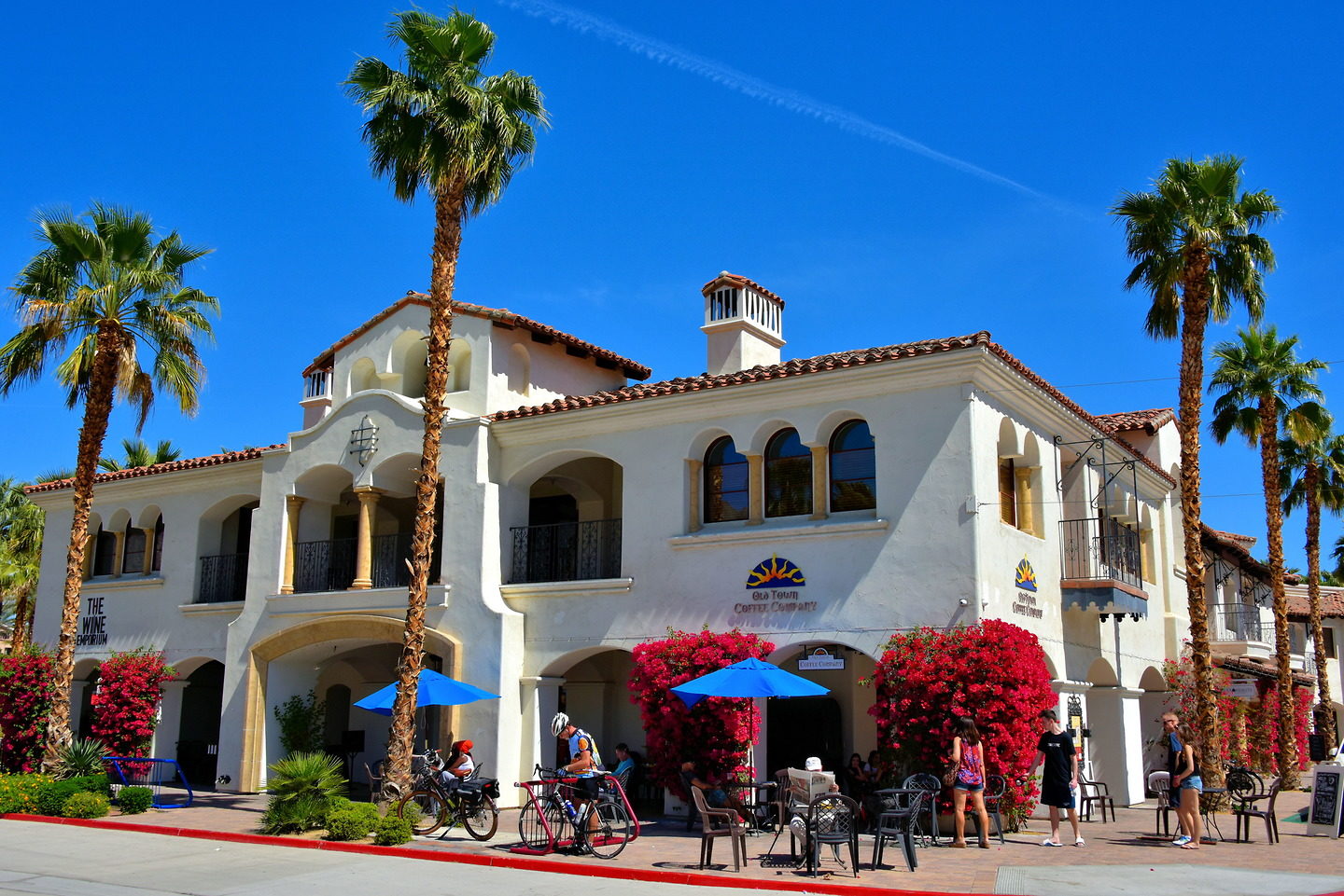
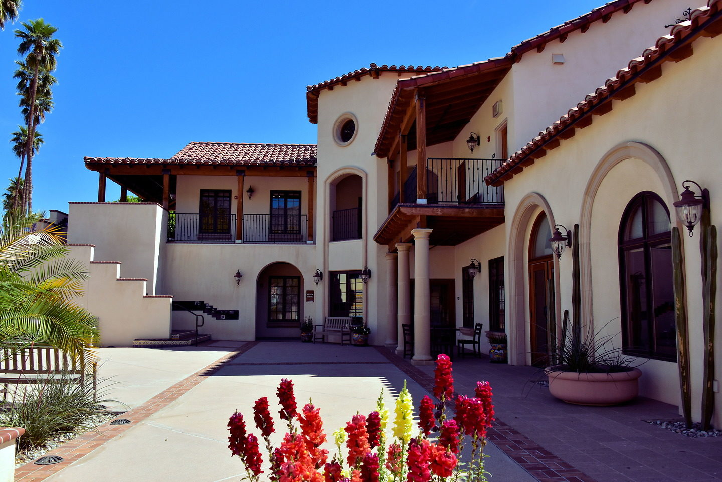
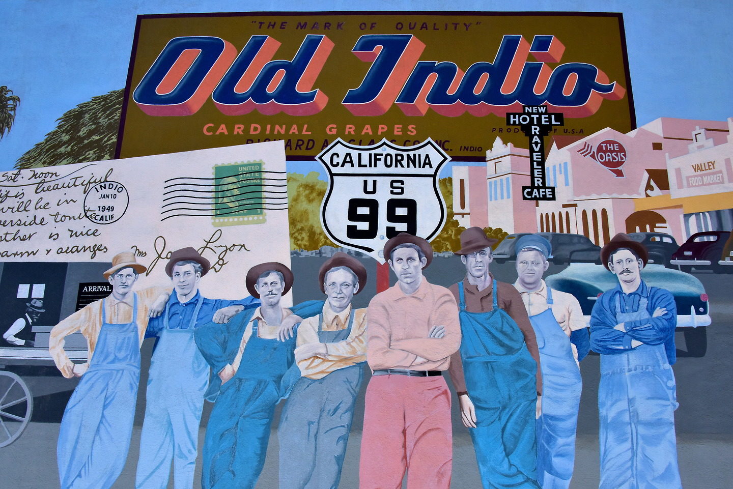
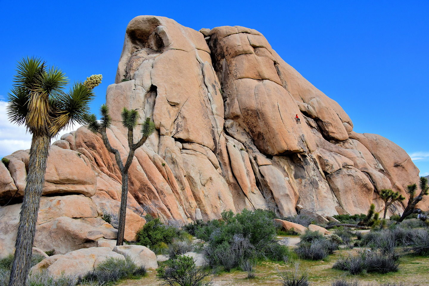
Palm Springs and Palm Desert are the best known cities in the 45 mile long Coachella Valley. But there are seven other communities in this part of Riverside Country. This travel guide shows highlights of two of them plus the picturesque Joshua Tree National Park.

Share this

1 San Jacinto Mountains in Coachella Valley, California

The San Jacinto Mountains define the western skyline of the northern communities in Coachella Valley. The mount’s namesake is Hyacinth of Caesarea (San Jacinto in Spanish). This 12 year old boy was martyred by the Romans for his faith in 108 AD. The range is part of “The Four Saints.” They are California mountains over 10,000 feet named after saints. At 10,834 feet, Mount San Jacinto is also the sixth tallest peak in the lower 48 states. Two other ranges defining the valley are the Santa Ross Mountains and the Little San Bernardino Mountains.

N Palm Canyon Dr, Palm Springs, CA 92262

2 Charming Old Town La Quinta, California

The Old Town of La Quinta is small – only a few blocks along Main Street – yet big on charm. The stores are housed in whitewashed buildings with Spanish features reminiscent of the Mediterranean. In the springtime, the structures are accented with blooming red bougainvillea. This sidewalk is one of several Patio Passageways. What a perfect place to sip coffee while reading a newspaper during your relaxing vacation.

78100 Main St, La Quinta, CA 92253

3 Origin of Name La Quinta, California

When you see the marquee for Old Town La Quinta, you figure this is where the town originated. It actually began a few blocks away when John Marshall became of the earliest settlers. In 1902, he homesteaded land he called Marshall’s Cove. Today, the property is the Tradition Golf Club. Some people believe Marshall was the first to call the area La Quinta meaning the “country house” or “hacienda.” Others speculate the name is the Spanish word for “fifth” because this was the fifth resting spot for travelers between Mexico and the San Gabriel Mission in San Bernardino, California.

78100 Main St #103, La Quinta, CA 92253

4 Wall Fountain in La Quinta, California

The planners of Old Town had attention to detail in creating a Spanish village ambiance. An example is this ornate ceramic wall fountain. Another is murals painted on colorful tiles. People also enjoy lounging on the Event Lawn and adjacent parks. These elements harmonize to create an enjoyable experience and a lasting memory.

78010 Main St, La Quinta, CA 92253

5 Features of Old Town La Quinta, California

Old Town La Quinta offers about 25 retailers including boutique shops, restaurants and galleries. Other favorite activities include a Sunday morning farmers market and an art walk. La Quinta is a short drive from Palm Desert. Visiting Old Town makes a perfect daytrip. Also consider a round of golf at one of the 25 nearby courses and having a steak at Arnold Palmer’s Restaurant.

78015 Main St #107, La Quinta, CA 92253

6 City Seal of La Quinta, California

The seal of the La Quinta was designed by Fred Rice and displays many of the city’s important elements. The setting sun speaks of its average high, year-round temperature of 89.5°F with over 348 days of sunshine. The borders are defined by the Santa Rosa Mountains in the west and the Coral Mountains in the south. The Gambel’s quail is the adopted bird readily seen in local parks. The “Gem of the Desert” was incorporated in 1982 and is home to about 38,000 residents.

77885 Avenida Montezuma La Quinta, CA 92253

7 La Quinta Museum in La Quinta, California

People interested in Coachella Valley history will enjoy walking through two floors of exhibits at La Quinta Museum. The story begins with a diorama of the Cahuilla Indians. Then it explains through vintage photographs the area’s early development and how it evolved into a popular resort community. Other major events are portrayed on a 32 foot mural by Andre Blanche. The museum is managed by the La Quinta Historical Society. It is housed in the former Palm Springs Land and Irrigation Company building. Constructed in 1935, this is the city’s oldest commercial structure.

77885 Avenida Montezuma La Quinta, CA 92253

8 Saint Francis of Assisi Church in La Quinta, California

The Coachella Valley has been the seasonal home of movie stars for decades. So it is not surprising this church was inspired by a film. In 1972, Franco Zeffirelli directed “Brother Sun, Sister Moon.” The movie is about Saint Francis of Assisi. A religious advisor on set was Reverend Peter Brennan. The two men recreated the movie version of the Italian, Romanesque church in La Quinta. In 1984, the first mass at Saint Francis of Assisi Church was attended by Frank Sinatra, Gregory Peck, Cary Grant and Roger Moore.

47225 Washington St, La Quinta, CA 92253

9 Coachella Valley Historical Museum in Indio, California

In 1926, Dr. J. C. Tyler built this combined house and dental office. The locals called it “Smiley Place.” In 1965, the Coachella Valley Historical Society was established. The Smiley-Tyler House has become the centerpiece for their two-acre Coachella Valley Historical Museum. You will enjoy learning about Indio’s past going back to the Cahilla People. An interesting story is how Dr. June McCarroll was the first person to paint a white line down the center of a highway in 1917. In 1924, she successfully lobbied the California DOT to make this marking a standard. World War II history buffs should also tour the nearby General Patton Memorial Museum.

82616 Miles Ave, Indio, CA 92201

10 Date Museum Water Tower in Indio, California

In an arid climate where the average yearly high is over 80°F, agriculture is challenging. Yet the Coachella Valley farmers, together with the U. S. Department of Agriculture, were innovative. They realized date palms had grown in similar environments in the Middle East since 6000 BC. In 1912, the Deglet Noor date was first harvested in California. This 60 foot, galvanized steel water tower was part of the M. H. Whitter Ranch Company, a date farm once located in nearby Coachella. Learn more at the Date History Museum and Gardens at the Coachella Valley Historical Museum.

82616 Miles Ave, Indio, CA 92201

11 Old Schoolhouse in Indio, California

This 1909 schoolhouse is typical of the buildings constructed in Indio by the Southern Pacific Railroad to educate the children of its workers. Its design resembles the railway’s 1876 depot. Grade schoolers attended class here until 1960. On its centennial anniversary, the school was moved to the Coachella Valley Historical Museum. The one-room landmark is the city’s oldest building.

82616 Miles Ave, Indio, CA 92201

12 Old Indio Mural in Indio, California

Downtown Indio is adorned with about a dozen fabulous murals since the Chamber of Commerce launched the Historic Mural Project in 1996. “Old Indio” is a beautiful example. Painted by Bijan Masoumpanah in 2014, this detail features workers of the Southern Pacific Railroad when the depot opened at Indian Wells (now Indio) in 1876. The town experienced addition growth when U. S. Route 99 – The Main Street of California – was constructed in the 1920s as part of its 1,600 mile connection between the Mexican and Canadian boarders.

Miles Avenue & Towne Street, Indio, CA 92201

13 Visitor Centers at Joshua Tree Park, California

Joshua Tree National Park has three entrances. If driving from Palm Springs, take Highway 62. You will first encounter this West Entrance at Joshua Tree Village. It is called the Joshua Tree Visitor Center. Some people proceed on the same road to the North Entrance. It is named the Oasis Visitor Center in the city of Twentynine Pines. Both lead through the Mojave Desert. From Indigo, take I-10 east for about 25 miles to the Cottonwood Visitor Center at the South Entrance. This is the Colorado Desert side of Joshua Tree. The park is open all year. However, the centers’ hours vary. Check with the National Park Service website for details.

6554 Park Blvd, Joshua Tree, CA 92252

14 Namesake Tree at Joshua Tree Park, California

The namesake for this national park is the Joshua tree. The largest of the yuccas can reach a height of 40 feet. It is indigenous only to the Mojave Desert. The spikey evergreen can live over 150 years. This odd-shaped yet picturesque member of the agave family has several names. The Cahuilla Indians called it hunuvat chiy’a or humwichawa. The scientific name is yucca brevifolia. In the mid-19th century, the Mormons observed the outstretched limbs resembled the Biblical Joshua leading the Israelites during the Exodus. They named it the Joshua tree.

64102 Park Blvd, Joshua Tree, CA 92252

15 Hiking Trails at Joshua Tree Park, California

There are over 20 popular hiking trails in Joshua Tree National Park. They range from wheelchair accessible to challenging. Three of the easiest are: Warren Peak (5.5 miles) near the West Entrance, the Hidden Valley Nature Trail (1 mile) and the Ryan Mountain Trail (3 miles). Other trailheads are frequently marked. The NPS website does a great job of describing the trials of JTNP.

64227 Park Blvd, Joshua Tree, CA 92252

16 Brief History of Joshua Tree Park, California

People have been enthralled with the Mojave Desert for over 5,000 years. The first to arrive after the Pleistocene era were hunters from the Pinto Culture. They were followed by three groups of Native Americans: Serrano, Chemehuevi and Cahuilla. The tribes referred to it as, “Oasis of Mara.” When Colonel Henry Washington surveyed the area in 1855, he called it “Twentynine Palms.” That name is still used by the town at the North Entrance. Next came cattlemen and a few cattle rustlers. Between 1894 and 1931, prospectors flooded the desert in search of gold and silver. During the 1920s and 1930s, archeologists gained an interest based on the work of Elizabeth Campbell. Their insistence on preservation led President Franklin D. Roosevelt to declare this a national monument in 1936. Finally, in 1994, it was given national park status. There are also a half dozen park landmarks listed as National Register of Historic Places.

64484 Park Blvd, Joshua Tree, CA 92252

17 Origin of Rock Formations at Joshua Tree Park, California

As you drive along Park Boulevard, you are impressed by the amazing rock formations. But how did these sculpted piles of boulders get here? Their origin is volcanic. Hot magma rose towards the surface. As it cooled, it cracked and crystalized into a material called monzogranite. It was further shaped by groundwater and then exposed through erosion.

64464 Park Blvd, Joshua Tree, CA 92252

18 Camping at Joshua Tree Park, California

There are about 500 campsites within nine campgrounds inside Joshua Tree National Park. That sounds like a lot. However, they fill up quickly during peak season (October through May) and are available only on a first-come, first-serve basis. A favorite is the Hidden Valley Campground where 45 sites are available. Campers are required to pay a small fee in addition to the cost of admission to the park. The maximum stay is two weeks. Expect it to get cold at night but the star gazing is spectacular.

Hidden Valley Campground Rd, Twentynine Palms, CA 92277

19 South Face of Intersection Rock at Joshua Tree Park, California

Since John Wolfe wrote a climber’s guidebook in 1970, Intersection Rock has become one of California’s most analyzed crags. Several tracks have been plotted by and for climbers on all four faces of Intersection Rock. The routes range in difficulty from 5.3 to 5.1b. If this popular spot is too crowded for you, there are approximately 8,000 other documented climbing routes in the park. A good book by Randy Vogel is “Classic Joshua Tree Routes and Bouldering.” There are several other climbers’ guidebooks available online.

Hidden Valley Campground Rd, Twentynine Palms, CA 92277

20 Rock Formation Names at Joshua Tree Park, California

Apparently, all of the rock formations within Joshua Tree National Park have names. Some also have aliases. Unless you have a detailed guidebook, it is impossible to accurately identify them throughout the nearly 800,000 square acre park. The exceptions are famous formations such as Intersection Rock directly behind this view. These two in Hidden Valley are: Chimney Rock on the right and The Blob on the left. Close by is The Old Woman.

Hidden Valley Campground Rd, Twentynine Palms, CA 92277

21 Keys View Panorama at Joshua Tree Park, California

A visual highlight of Joshua Tree National Park is Keys View. This overlook is perched at 5,185 feet on the Little San Bernardino Mountains. On a clear day, you can see over 30 miles of this southwest-facing panorama. In the background is the Coachella Valley. On the right is San Jacinto Peak, standing 10,831 feet above Palm Springs. On the left are the Santa Rosa Mountains and the city of Palm Desert. In the foreground are Indio Hills and the San Andreas Fault.

Keys View Rd Desert Hot Springs, CA 92241
TOP