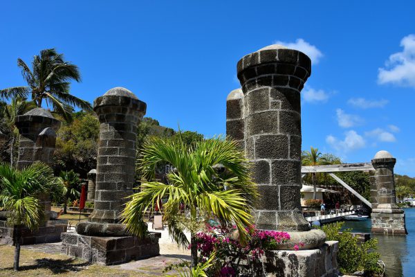
English Harbour began as a British garrison at the turn of the 18th century. For almost two hundred years, it evolved into an elaborate complex of buildings now called Nelson’s Dockyard. The fort was named after Horatio Nelson. The vice-admiral arrived in 1784 and later became its commander. When the Royal Navy base was abandoned in 1889, it fell into disrepair until an extensive restoration was finished in 1961. Nelson’s Dockyard is now a national park and a major tourist attraction. In 2016, this historic property was designated as a UNESCO World Heritage Site. These boat house pillars are among the most recognizable and photographed features.
The Admiral's Inn Dockyard Drive, English Harbour, Antigua and Barbuda Enlarge/Slideshow See On Map Directions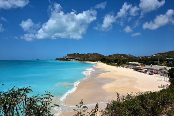
It would take you a full year to spend one day enjoying each of Antigua’s 365 beaches. If your vacation to this West Indies island is not that long, then consider adding Darkwood Beach to your short list of places to wear your bathing suit and sunglasses. One look is worth a thousand superlatives.
Darkwood Beach, Valley Rd, Antigua & Barbuda Enlarge/Slideshow See On Map Directions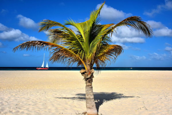
How many winter days have you daydreamed of this idyllic scene? Sitting next to a single palm on a gorgeous beach during a perfect warm day. No phones. No emails. No reality. Just the joy of watching a sailboat floating peacefully along the Caribbean. Perfection!
Manchebo Beach, J.E. Irausquin Boulevard # 55, Aruba Enlarge/Slideshow See On Map Directions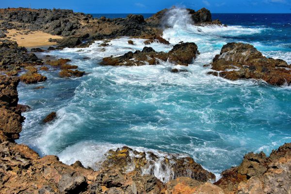
The western shore of Aruba is lined with sandy beaches and mega resorts while the northern coast is the direct opposite. It is barren, uninhabited and lined with reddish dust and volcanic rock. So why would you visit there? One reason is the windward side has huge waves relentlessly crashing into pools and cliffs. The result is a mesmerizing display of splashing, spraying and swirling water in gorgeous shades of blue and white. The perpetual motion is spectacular to watch!
Natural Bridge, Aruba Enlarge/Slideshow See On Map Directions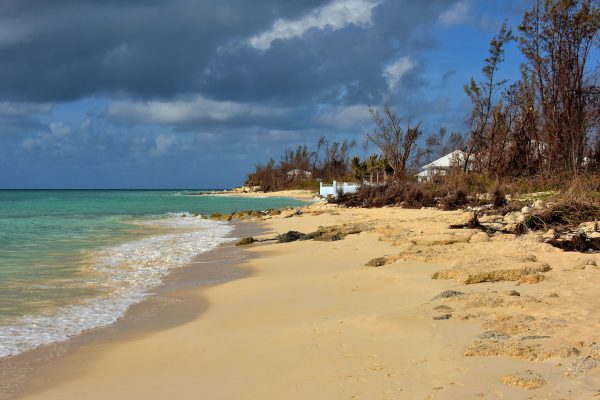
All of Grand Bahama’s best beach options are along the island’s southern shore. Some have restricted access, like this one in front of the Princess Isle gated community. Others have limited facilities. So many day trippers elect to purchase a day pass from a resort with full amenities such as equipment rentals, swimming pools, restaurants, etc. Popular choices are the Paradise Cove Beach Resort to the west of the port and the Grand Lucayan on Lucaya Beach across from the Port Lucaya Marketplace. Another option with fewer services is the Junkanoo Beach Club at Taino Beach. Shuttles are available from the cruise terminal.
Dundee Bay Dr Freeport, The Bahamas Enlarge/Slideshow See On Map Directions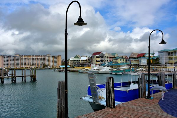
If you arrive to Freeport by boat, your first choice for docking is at the Port Lucaya Marina. This protective harbor has 150 slips to accommodate pleasure boats up to yachts for a day or the season. If the open sea sounds appealing but you don’t have a boat, you can charter a sightseeing cruise or hire a fishing captain to help you hook a wahoo or kingfish. If all you need is a breather from shopping at the adjacent Port Lucaya Marketplace, then smell the ocean air while strolling along the wooden boardwalk.
Port Lucaya Marketplace, Freeport, The Bahamas Enlarge/Slideshow See On Map Directions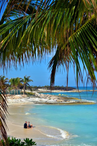
As you and your partner enjoy the idyllic setting of Great Stirrup Cay, you will notice the shoreline is lined with palm trees, the quintessential symbol of the tropics. Yet these Atlantic coconut palms are not indigenous to the Berry Islands. They were imported centuries ago for their value as food and rope plus during the 19th century for oil. Then NCL added more to the groves for sheer decoration.
Great Stirrup Cay, Bahamas Enlarge/Slideshow See On Map Directions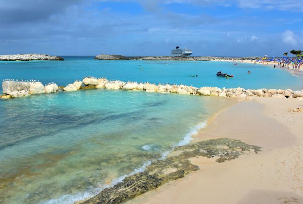
Great Stirrup Cay’s tropical climate is perfect for a day at the beach regardless of when you arrive. The average air temperature in the winter months is 77° Fahrenheit and above 80° during the rest of the year. Not surprising, the water temps are the same yet may feel warmer because of the shallow water formed by the breakwaters. Equally important is abundant sunshine. The island experiences overcast conditions less than five days a month.
Great Stirrup Cay, The Bahamas Enlarge/Slideshow See On Map Directions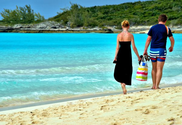
This couple enjoyed strolling along the crescent-shaped beach at Half Moon Cay while the surf gently lapped against their bare feet. They did not have a care in the world, except for carrying their flips flops and a beach bag. If only every day were this wonderful and carefree.
Half Moon Cay, Bahamas Enlarge/Slideshow See On Map Directions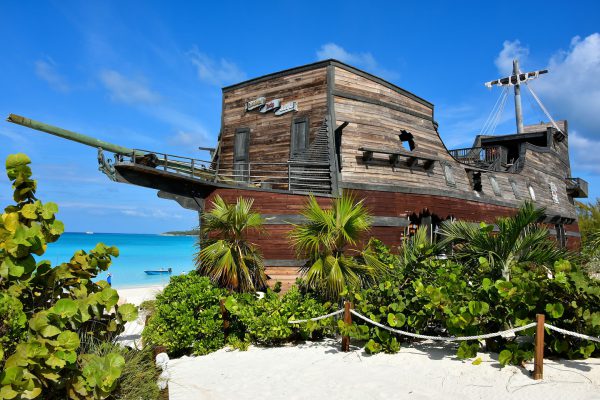
This full-sized, wooden pirate ship looks like it was beached after losing a battle against the Spaniards. It actually houses “On The Rocks,” the largest bar on Half Moon Cay. Inside the schooner is a full-service tavern where you can relax with great views of the beach and lagoon while listening to calypso music.
Half Moon Cay, Bahamas Enlarge/Slideshow See On Map Directions
If you like water, you will love Atlantis Paradise Island. For starters, the property offers 17 swimming pools. The 141 acre Aquaventure features a mile long water ride, five themed water slides, 14 lagoons, more than 50,000 marine animals plus a marina. With all of that activity, the adjacent Paradise Beach is virtually empty. It is a perfect place for a relaxing stroll all the way to the lighthouse on the western edge of Paradise Island.
One Casino Drive, N-3728, Paradise Island, Bahamas Enlarge/Slideshow See On Map Directions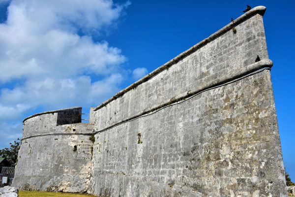
Few people left more historical fingerprints on Nassau than John Murray, better known as Lord Dunmore. He was the British governor of Virginia when he offered male slaves their freedom in exchange for fighting in the Revolutionary War. A few years after the British defeat, he became Bahama’s governor from 1787 until 1796. Fort Fincastle, named in honor of his title Viscount Fincastle, is one of two fortresses he commissioned in Nassau during the late 18th century. The limestone exterior has a unique, ship-prow appearance similar to a paddle wheel boat. Inside are replicas of cannons pointing towards the harbor.
Greenwich St & Prison Lane Nassau, The Bahamas Enlarge/Slideshow See On Map Directions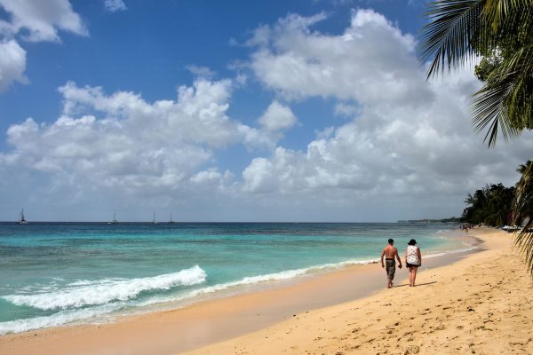
Your road trip from Bridgetown along the western coast begins at Paynes Bay. It is one of the best beaches in western Barbados. Paynes Beach is located along the “Platinum Coast” in the middle of Saint James Parish. This area also has the island’s major golf courses (it is where Tiger Woods got married) and is lined with very exclusive resorts for the rich and famous. If you see someone resembling Robyn Fenty, say hello because she probably is Rihanna. She has a home at Sandy Lane and was born in the neighboring parish of Saint Michael.
Hwy 1 & White House Terrace, Barbados Enlarge/Slideshow See On Map Directions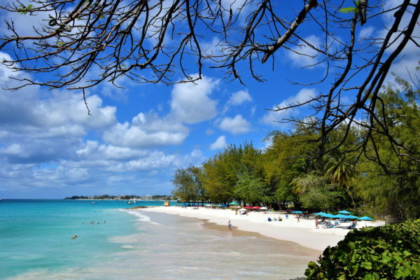
Just when you think there could not possibly be another attractive beach in the tiny town of Oistins, you come across Enterprise Beach. Barbadians prefer the name Miami Beach, but it is a far cry from the one in Florida. This area is lovely. The north end is partially protected from the waves, making the shallow water idea for swimming. The other end appeals to bodyboarders and an occasional surfer. On weekends, locals spend their time beneath umbrellas and the shade trees or having parties around the picnic tables. These social events never get too crazy because of the attentive lifeguards and a police station located along the shoreline.
Miami Beach, Enterprise Beach Rd, Oistins, Barbados Enlarge/Slideshow See On Map Directions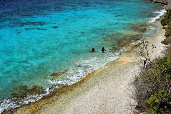
Conduct online research of the best scuba diving locations in the world and Bonaire will consistently rank toward the top. Among the island’s 86 dives sites, 1000 Steps is considered one of the best of the best. The underwater scenery is spectacular! Snorkelers enjoy it too. However, its name is a misnomer: there are only 67 limestone-carved steps down to this beach. So why do they call it 1000 Steps? After you carry your gear back up to the car, your lungs will tell you the answer.
1000 Steps, Queen's Highway, Rincón, Caribbean Netherlands Enlarge/Slideshow See On Map Directions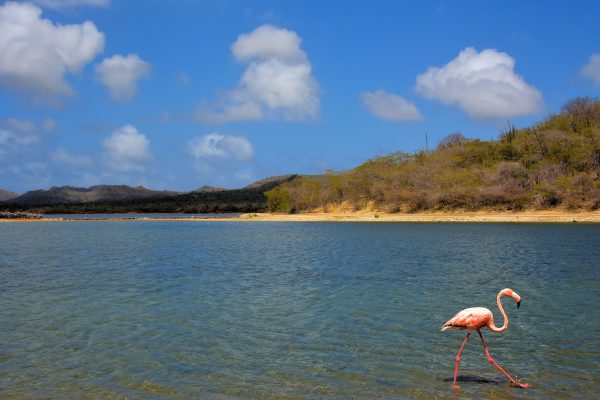
I had never seen Caribbean flamingos living in the wild. So it was a real treat to watch Bonaire’s national bird and symbol in their natural habitat at Lake Gotomeer. It is located in the northwest section of the island. Thousands of these crimson birds have also been known to gather at the Pekelmeer Sanctuary on the south end of the island.
Kaminda Goto Rincon, Caribbean Netherlands Enlarge/Slideshow See On Map Directions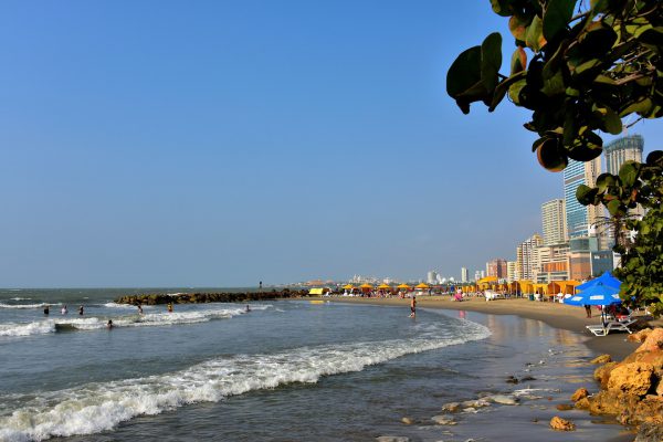
If “Caribbean Beach” conjures up images of secluded white sand beneath swaying palm trees, then you will be disappointed in the Bocagrande beach facing the Caribe. It resembles a gritty Miami Beach. The narrow shore in the shadow of endless high-rises is jammed with tourists and hawkers. The waves are rough despite rings of breakwaters. Yet it is close to the new major hotels so it is convenient for a quick dip or tanning in the sunshine.
Cra. 1 #812, Cartagena, Bolívar, Colombia Enlarge/Slideshow See On Map Directions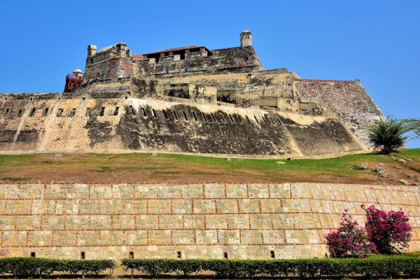
Cartagena’s landmark fort was first built on the Hill of San Lázaro during the early 16th century. When the citadel was significantly expanded in 1657, it was named in honor of Felipe IV. He was the king of Spain from 1621 until 1665. The Castillo has the distinction of being the largest military fortification ever built within the Spanish colonies. It is easy to see how these massive walls repelled an attack by over 23,500 British soldiers in 1741. The Castillo San Felipe de Barajas was declared a UNESCO World Heritage Site in 1984.
Cra. 17 #30-35, Cartagena, Bolívar, Colombia Enlarge/Slideshow See On Map Directions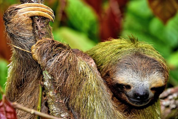
The three-toed sloth is the perfect animal to photograph in the wild: they don’t move fast and they are always smiling. For a chance to see a Bradypus variegatus in the forest, walk the trails at either the Refugio Gandoca Manzanillo or Parque Nacional Cahuita. Both parks are south of Limón. You might also spot this brown-throated sloth hanging from trees during a boat ride along the Tortuguero Canal north of the city. For a guaranteed close up, visit the Jaguar Rescue Center near Puerto Viejo or the Sloth Sanctuary close to Cahuita.
Canal del Tortuguero, Limón Province, Costa Rica Enlarge/Slideshow See On Map Directions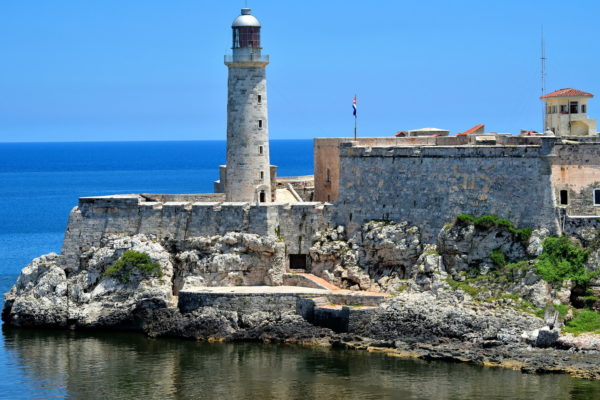
Three fortresses were built during the 16th and early 17th centuries to protect Havana. The Fuera, Morro and Punta castles are featured in Havana’s coat of arms. This is Castle of Tres Reyes del Morro located at the north entrance of the harbor. Construction of the Castle of the Three Kings lasted 41 years. When it was finished in 1630, El Morro was considered impenetrable. History proved that assumption wrong. The 82 foot tall Faro Castillo del Morro was built in 1845, making it the oldest of Cuba’s approximate 50 lighthouses.
Parque Histórico Militar Morro-Cabaña, La Habana, Cuba Enlarge/Slideshow See On Map Directions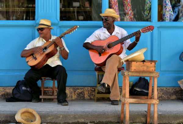
Street musicians in Old Havana are plentiful, talented and licensed by the state to perform in public. They range from a single guitarist to ensembles including drums and a rickety keyboard. These two old men – who have played the same Cuban songs for decades- were entertaining on Calle Obispo, a pedestrian-only street. Stop, listen and enjoy this intricate part of Cuba’s culture. You will be smiling while your toes are tapping. Then show your appreciation with a few coins in the hat.
Calle Obipso and Habana Street, La Habana, Cuba Enlarge/Slideshow See On Map Directions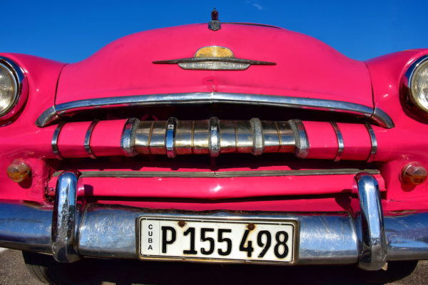
Fans of classic cars from the 1940s and 1950s love visiting Havana. They are everywhere, especially on the streets in La Habana Vieja. Some are rusted and aged while others appear in factory condition like this pink, 1954 Plymouth Belvedere. Yet under the hood may be black-market parts from Russia, China and U.S. or built with Cuban ingenuity. Why the time warp? In 1961, importing foreign cars were banned. Although the embargo has been recently lifted, new cars sell for eight times their market value – unaffordable at Cuban salaries.
Malecón Near Parque Luz Caballero, La Habana, Cuba Enlarge/Slideshow See On Map Directions
Most of Curaçao’s best beaches are protected from the Caribbean waves by seawalls consisting of giant boulders. These barriers create calm, crescent-shaped lagoons. They are ideal for swimming like this one at Cabana Beach. The breakwaters also make the perfect spot to sit with your partner while soaking up the sun.
The Beach House z/n Bapor Kibrá, Willemstad, Curaçao Enlarge/Slideshow See On Map Directions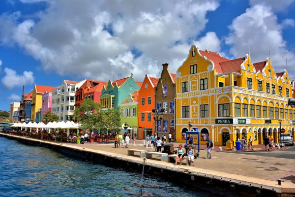
The beautiful hallmark of Willemstad is Dutch architecture in a kaleidoscope of colors like these along Handelskade. This charming characteristic dates back to 1816 when Governor Albert Kikkert blamed his migraine headaches on the sun reflecting off the white buildings. He issued a degree demanding everything be painted any color but white. Within three years the town became a rainbow. After he died in 1819, it was learned Kikkert owned a majority share of the only local paint company.
1 Heerenstraat, Willemstad, Curaçao Enlarge/Slideshow See On Map Directions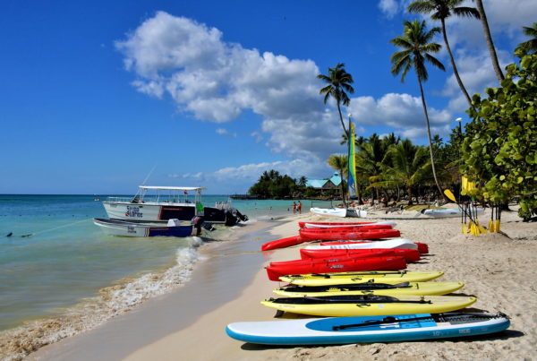
There are two stretches of white sand and mild surf around Bayahibe. About three miles south of town is Dominicus Beach. The best spot for sun worshipers is Bayahíbe Beach. Although both are populated by resorts, a delightful section of each is reserved for the public. This is the shoreline of Hilton La Romana Resort adjoining Playa Publica Bayahibe. All you need for a perfect day is a swimsuit, suntan lotion and a smile.
Playa Publica Bayahibe, Carr. a Bayahibe 1, 23000, Dominican Republic Enlarge/Slideshow See On Map Directions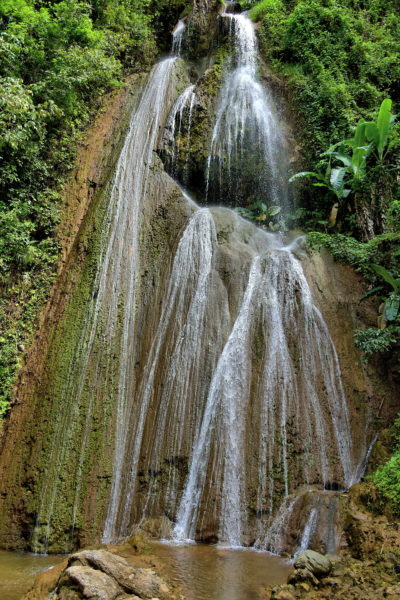
The Arroyo Chico river forms in the Sierra de Samaná before plunging 130 feet down a rockface at El Limón. There is a wooden platform so you can admire the action and beauty of this fan waterfall. The silver and white ribbons of water tumble into a round, shaded pool. Bring your bathing suit. You will want to take a refreshing dip before your 1.5 mile return trip through the forest.
Cascada Limón, El Limón 32000, Dominican Republic Enlarge/Slideshow See On Map Directions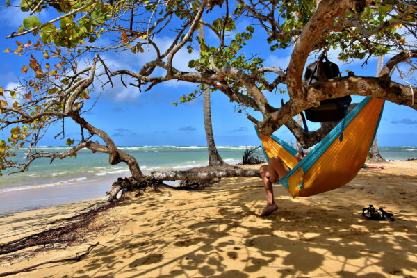
The energy level picks up at Playa Punta Popy near Las Terrenas. This is the center for water activities. Windsurfers and kitesurfers compete for the waves, along with occasional paddle boarders. Sailboats float along the horizon. Beneath the water are plenty of scuba divers and snorkelers. Then there are contrarians who come to relax. His formula was: buy a hammock, find the perfect tree, hang backpack, remove sandals and curl up in tropical solitude.
Playa Punta Popy, Las Terrenas 32000, Dominican Republic Enlarge/Slideshow See On Map Directions
If you want to relish the finest public beach in Punta Cana, set your GPS headed north to Playa Macao. There are no resorts here … yet. Very few amenities except for a couple laidback restaurants, a surfing school plus vendors selling their crafts. The rest of this seashore is undeveloped. Nothing but flawless sand under a canopy of palm trees. UNESCO considers Macao Beach to be among the best in the Caribbean. No wonder it is popular among tourists and Dominicans.
Playa Macao, Punta Cana 23000, Dominican Republic Enlarge/Slideshow See On Map Directions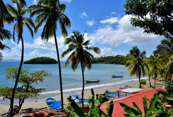
The southwestern coast of Samaná Peninsula is gorgeous. There is a long list of picturesque reasons why many top resorts are located along the shores of Samaná Bay. If you enjoy scenic drives yet are short on time, then follow Highway 5 from Samaná to Punta Balandra. The distance is less than ten miles. This means you can stop often to explore the coves, walk several beaches, view the islets offshore, grab a casual lunch and visit some shops. After reaching the western end of the peninsula, the return trip to Santa Bárbara de Samaná is less than a half hour.
Highway 5, Samaná 32000, Dominican Republic Enlarge/Slideshow See On Map Directions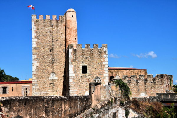
Fray Nicolás de Ovando had valid reasons to believe Santo Domingo was vulnerable to attack when he became governor in 1502. The riches from the gold rush of 1500 to 1508 had attracted the attention of potential French and British conquerors plus pirates. The enslaved Indigenous Taíno people were increasingly combative as their population shrank from disease and abuse while working the mines. So he ordered the construction of Ozama Fortress. The initial citadel was finished in 1508. The 59 foot Tower of Homage was added in 1509. Torre del Homenaje became the temporary residence of Diego Columbus (eldest son of Christopher) when he was appointed Governor of the Indies in the same year. Throughout most of the ensuing 500 years, Ozama Fortress was a prison. Many political adversaries were incarcerated and executed here until the 1960s.
Calle Las Damas 1, Santo Domingo 10210, Dominican Republic Enlarge/Slideshow See On Map Directions
When Sir Frances Drake landed on the island in 1586, he was delighted to discover an abundance of turtles. During the 17th and 18th centuries, the island gained a reputation among ships as an excellent port to replenish supplies including meat. As the turtle population dwindled, the locals satisfied the growing demand by selling hogs. This led to the town’s nickname of the Hogsties and the waterfront became – and still is – the Hog Sty Bay. On the left is the South Terminal and on the right is a portion of the North Terminal.
Cardinal Ave & Harbour Drive, George Town,Cayman Islands Enlarge/Slideshow See On Map Directions
If sun, sand and sea are the ingredients for your perfect vacation, then you must visit Seven Mile Beach. Technically, it is called West Bay Beach and is only 5.5 miles long. But don’t let the facts subtract from this quintessential Caribbean experience. To claim your spot on the pristine sand, you do not need to be a guest of one of the countless hotels, resorts or condos. The entire gorgeous coastline is public. Just look for an access sign with a swimmer symbol.
W Bay Rd & Earth Close George Town, Cayman Islands Enlarge/Slideshow See On Map Directions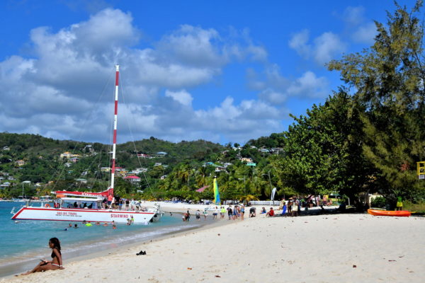
There are about 45 beaches on Grenada. You can quickly narrow down your options by remembering one name: Grand Anse Beach. It is located on the leeward side of the island just about a 12 minute cab ride south of St. George’s. A water taxi may get you there faster. What should you bring? Do you really need advice for a day at the beach of your dreams? What is there to do? Sitting in the perfect sand while sunbathing is a great option. Or stroll the heavenly two-mile shore. Stand and socialize with friends while sipping a libation or two (or three). Consider a sailing tour. Try water skiing, swimming, snorkeling or scuba diving. Shop at the local stores. Most of all, keep smiling. This is Grenada at its best.
Grand Anse Beach, Grand Anse Main Rd, The Lime, Grenada Enlarge/Slideshow See On Map Directions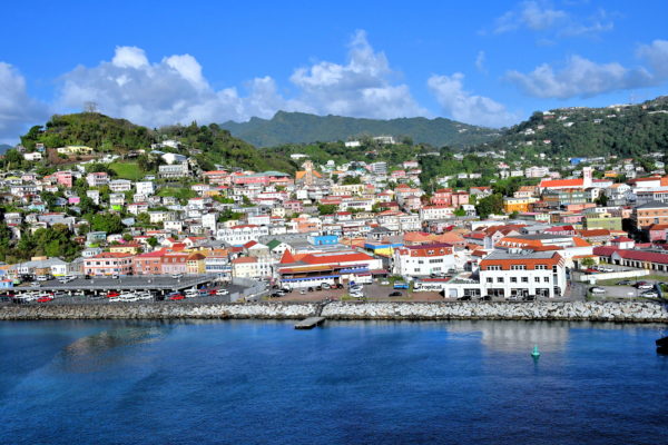
Imagine how different this coastline appeared on August 15, 1498, when Christopher Columbus sailed by during his third voyage to the New World. He named his discovery La Concepción. A year later, Alonso de Ojeda – a Spanish conquistador and Columbus competitor – traveled by here. He called the island Mayo. The name continued to evolve by the Spanish in the 1520s (Granada), by the French in 1652 (La Grenade) and finally by the British in 1763 (Grenada). Now, as you are sailing into this picturesque Caribbean island, you decide the appropriate superlative(s) to call it.
St. George’s Bay, St. George's, Grenada Enlarge/Slideshow See On Map Directions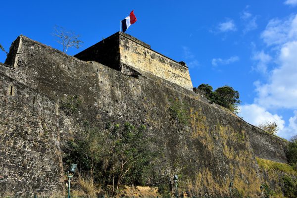
The first governor of Martinique ordered the building of a fortress in 1638 to protect the island. It was rebuilt in 1669 and then suffered numerous attacks by the Dutch and British for nearly 150 years. Over the centuries, it has been called Fort Edward, Fort Royal and Fort de la Republique. Today, Fort Saint Louis is an active base for the French National Navy. Sections of the historic fort can be toured.
Boulevard Alfassa & D42 Fort-de-France, Martinique Enlarge/Slideshow See On Map Directions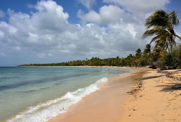
One look at Salines Beach and it is easy to see why this stretch of flawless seascape is always rated as one of the top beaches, if not the best, in Martinique. Located along the southern tip of the island near the town of Sainte-Anne, the peninsula offers a kilometer of white sand facing the Caribbean Sea. This section, called Grande Anse des Salines, is the most popular. It can get crowded midday, especially on weekends. But once you find a place to park, you will enjoy every minute of this tropical paradise.
Les 97227, Pnt des Salines, Sainte-Anne, Martinique Enlarge/Slideshow See On Map Directions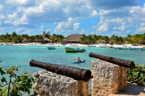
In 1741, the Spanish ship El Matancero sunk in a reef near Akumal. Most of the crew were enslaved by the Mayans and soon died. However, Gonzalo Guerrero thrived among the Mayans, married a priestess and taught the Indigenous people how to defend themselves. The merchant ship was discovered in 1959 by Pablo Bush Romero. He was so enthralled with the area that he purchased extensive land around the bay and founded the Centro Ecológico Akumal. These cannons from that shipwreck aim towards Akumal Beach near their headquarters.
Las Casitas Akumal, Q. R., Mexico Enlarge/Slideshow See On Map Directions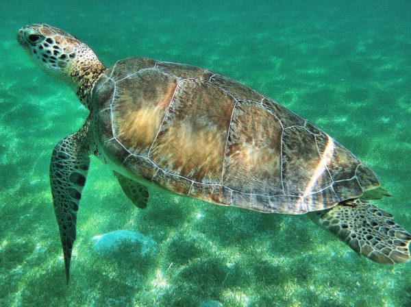
Along the Riviera Maya on the Yucatán Peninsula of Mexico is the small town of Akumal. In Mayan this means “place of the turtle.” It is well named because you can swim along with green sea turtles at Akumal Bay. It is estimated they lay 70,000 eggs during their breeding season of May through October. At maturity they reach five feet and hundreds of pounds. Simply gorgeous! But look and don’t touch them or their habitat. They are endangered and their ecosystem is fragile.
1 Akumal Bay, 77710 Akumal, Q. R., Mexico Enlarge/Slideshow See On Map Directions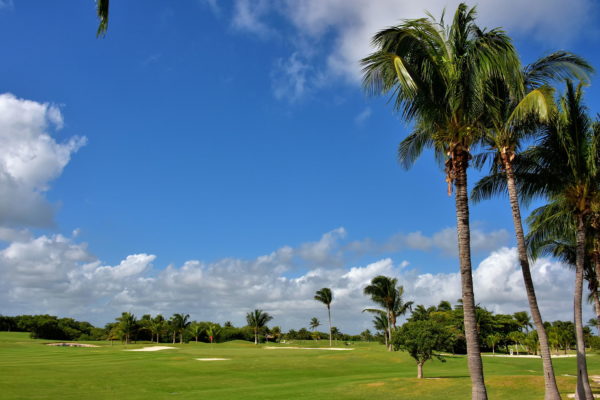
Cancun has six golf courses with prices ranging from $35 to $100 for 18 holes. The cost may be higher at courses connected to a resort for non-guests. Several offer great views of Nichupté Lagoon, the Caribbean or both. Two of them have the best reviews. The Puerto Cancun Golf Club (7107 yards, par 72) opened in 2013 based on a Tom Weiskopf design. The Riviera Cancun Golf Club (7,060 yards par 72) was designed by Jack Nicklaus in 2008. This is the Iberostar Club, part of the five-star Iberostar Cancún resort (formally the Hilton). After experiencing all of the links at Cancun, consider driving down to Playa del Carmen or the Riviera Maya for additional courses.
Iberostar Cancun Golf Club, Blvd. Kukulcan, KM 17.7, Zona Hotelera, 77500 Cancún, QROO, Mexico Enlarge/Slideshow See On Map Directions
Next to CoCo Bongo is a walkway along the outer edge of Plaza Forum By The Sea leading to the Caribbean. The archway declares it is Mandala Beach. Yet maps identify it as Playa Gaviota Azul (Blue Seagull Beach), Playa Lagarto and Playa de Cancún and locals often call it City Beach or Forum Beach. A few bare-foot steps to the south is Playa Chac Mool, named after the famous reclining figures discovered at Chichen Itza. Confused? Don’t be. This crescent-shaped, public beach adjoining the Party Zone is why you came to Cancun. So simply call it spectacular and enjoy the day of sunshine with a friend!
Playa Gaviota Azul, Blvd. Kukulcan, KM 8.5, Zona Hotelera, 77500 Cancún, QROO, Mexico Enlarge/Slideshow See On Map Directions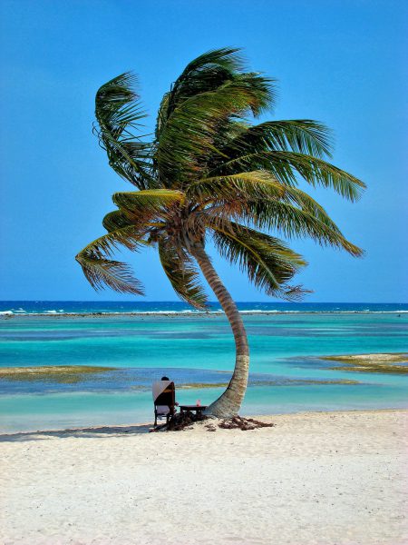
The prescription for a perfect afternoon: sit on a gorgeous beach in a lounge chair under a palm tree while staring at the ocean waves with a cold beverage at your side. There are no known harmful side effects except occasional sunburn. So, repeat as necessary. Fill the prescription at Costa Maya, Mexico, or the tropical getaway of your choice.
Cruise Port, Costa Maya, 77940 Q.R., Mexico Enlarge/Slideshow See On Map Directions
San Miguel’s main tourist district runs along the waterfront on Avenue Rafael E. Melgar. Here you will find the major shops, restaurants and attractions such as the Museo de la Isla de Cozumel on the right. This is a natural and human history museum with fascinating displays from the pre-Columbian and colonial periods. The street’s namesake is Brigadier General Rafael Eustace Melgar. After his critical military service during the Mexican Revolution, he became a powerful politician. Towards the end of his career, he was the Mexican ambassador to the Netherlands and then a national senator from 1952 until 1958.
Av. Rafael E. Melgar & Calle 6 Nte, Centro, San Miguel de Cozumel, Q.R., Mexico Enlarge/Slideshow See On Map Directions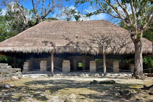
San Gervasio is one of several spectacular Mayan archeological sites on the Yucatán Peninsula but the largest and best preserved on Cozumel. Dating back to the Early Classic period (250 – 500 AD), this community flourished through the Post Classic period (1200 – 1539 AD). The park covers 1.25 miles yet only District 1 of four is open to the public. This thatched building is the first you will see on your walking tour. Called the Little Hands Elite Residence, it was the home of the halach uinic (supreme ruler) including Ah Huneb Itza. The small, red handprints on the inside walls gave the building its name. They are still visible.
Archaeological Zone of San Gervasio, Km 7.5, Carretera Transversal, Centro, 77600 Cozumel, Q.R., Mexico Enlarge/Slideshow See On Map Directions
The Riviera Maya has 75 miles of beaches … plenty of space to enjoy your spot in the tropics. If your hotel or resort is in Playa del Carmen, then you will probably do most of your swimming and sunning at the coastline parallel to downtown. The Caribbean laps along the shore for about 20 blocks from Calle 1 Sur to this view of Panama Jack Resorts at Avenue Constituyentes. A lounger located here gives you plenty of access to whatever you need.
Panama Jack Resorts Gran Porto, Av. Constituyentes, 77720 Playa del Carmen, QROO, Mexico Enlarge/Slideshow See On Map Directions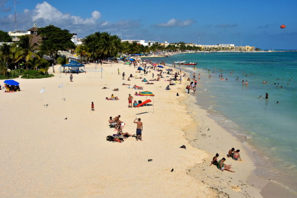
Welcome to Playa del Carmen in the heart of Riviera Maya located midway between Cancun and Tulum. The population of 150,000 qualifies as the second largest city (ciudad) in Quintana Roo. The tourist district is very compact and consists of two marvelous features stretching for about three miles. One is Avenida 5. This is a pedestrian walkway filled with shopping and entertainment. The second is sand, sand and more sand facing the aquamarine waters of the Caribbean Sea.
Muelle Playa del Carmen, Centro, 77710 Playa del Carmen, QROO, Mexico
Please remove your shoes before reading about Puerto Morelos’ best feature: the beach. The sand is soft and expansive. Except for a racing stripe of seagrass, it is also pristine. The warm glistening water is an incredible blend of aquamarine and turquoise. The barrier reef provides a protective breakwater so the surf is usually gentle. The environment is peaceful – no blaring music, spring breakers or annoying peddlers here – so you can enjoy the sounds of bobbing fishing boats and seabirds. This is the place where your bare feet dream about during the winter.
Rafael E. Melgar 4, Puerto Morelos, 77580, QROO, Mexico Enlarge/Slideshow See On Map Directions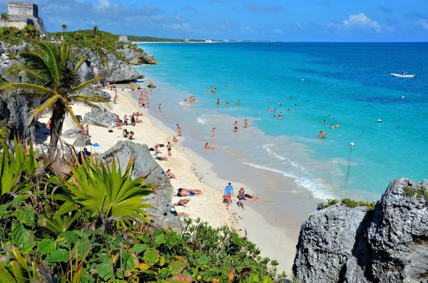
People who visit the Mayan ruins at Tulum are quickly surprised by the heat. The average, year-round temperature is 88° and the site offers no shade from the intense Mexican sun. So bring your bathing suit. When you get too hot, walk down the staircase, go for a refreshing dip in the Caribbean Sea and then spread your towel on the sandy beach. What a perfect combination: ancient ruins without ruining your sunbathing time.
Carretera federal 307 Cancún - Chetumal Km 230, 77780 Tulum, Q.R., Mexico Enlarge/Slideshow See On Map Directions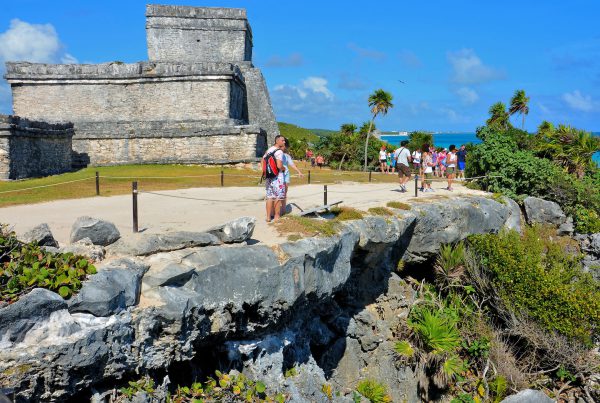
The Mayan ruins at Tulum are located about 80 miles from Cancun. This historic attraction is visited by about two million people a year, making it Mexico’s third most popular archaeological site. So, if you want to avoid throngs of people, it is best to arrive early in the morning. You will also avoid the afternoon heat.
Carretera federal 307 Cancún - Chetumal Km 230, 77780 Tulum, Q.R., Mexico Enlarge/Slideshow See On Map Directions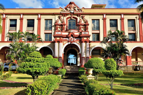
The origin of the Washington Hotel dates back to 1870 when it was built for workers from the Panama Railroad Company. In 1910, during an inspection tour of the Panama Canal’s progress, President William Howard Taft complained of inadequate accommodations. He authorized a grant for a new hotel. It opened in 1913 and remained under management of the U.S. government until 1954. In its prime, it was a social epicenter of Panama’s Caribbean coast. Today, the Hotel Washington is past its prime but its façade is still lovely. Next to it is the New Hotel Washington.
Cl. 1era. AVE. Bolivar, Colón, Panama Enlarge/Slideshow See On Map Directions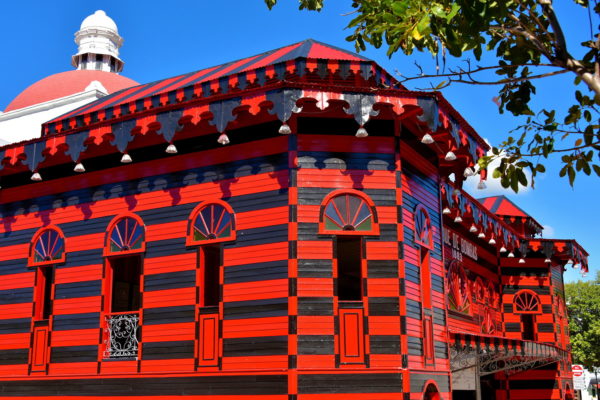
This former pavilion was designed by Maximo de Meana y Guridi for the 1882 Exhibition Trade Fair. The following year, it was transformed into a firehouse, a role it retained until 1990. Parque de Bombas translates to Pumps Park. The landmark station is now a firefighting museum. The vibrant black and red façade reflects the city’s official colors. This stunning building located at Plaza Las Delicias is the most photographed in Ponce.
75 PR-1, Ponce, 00730, Puerto Rico Enlarge/Slideshow See On Map Directions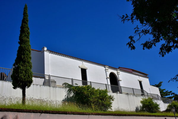
In 1609, Dominican monks established a monastery here named El Convento de Santo Domingo de Porta. The 17th century adjacent chapel was replaced by this church named Porta Coéli. This means Gateway to Heaven. It is believed to be the second oldest religious property in the Americas. The complex was transferred to the Puerto Rican government in 1949. In 1960, the Church of Porta Coéli was refurbished by the Institute of Puerto Rican Culture.
Cll Ruiz Belvis & Calle Rama, San Germán, 00683, Puerto Rico Enlarge/Slideshow See On Map Directions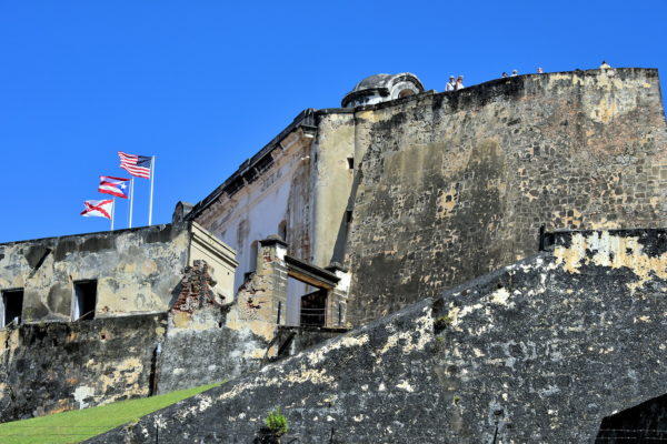
During the 16th through the 18th centuries, the Spanish built countless fortresses in the Caribbean and South America. The largest was Castillo San Cristóbal (Saint Christopher Fort). This formidable defense spanned 27 acres of Old San Juan. Fort San Cristóbal was constructed from 1765 until 1783, a remarkably short time for such a huge undertaking. The citadel engaged in battle twice. The first was in 1797 when a British onslaught was repelled. The second was 101 years later when their cannons fired against the USS Yale. This ill-fated move engaged Puerto Rico into the Spanish-American War. Before the end of the year, Spain ceded Puerto Rico to the United States in the Treaty of Paris. Notice the three flags. They represent the United States, Puerto Rico and the Spanish Empire. Do not miss visiting this San Juan National Historic Site. The fort is also designated a UNESCO World Heritage Site.
Castillo San Cristóbal, 501 Calle Norzagaray, San Juan, 00901, Puerto Rico Enlarge/Slideshow See On Map Directions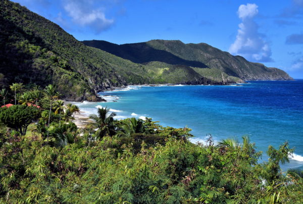
As you continue motoring along River Road (Highway 69), you will soon encounter The Beast. This is a dreaded hill among triathlon runners. The rapid ascent climbs for nearly 300 feet followed by an immediate downward slope with a grade of 27%. But from inside your car, this peak is your introduction to the North Shore. You are about to enjoy one of the most scenic drives in the Caribbean. Your first glimpse of picturesque perfection is Davis Bay. This cove is embraced by etched mounts covered by a lush rainforest. The 1,000 feet of Davis Beach is always highly rated. However, you will have to share your sandbox with the guests of the Carambola Beach Resort.
Davis Beach, Estate Davis Bay, St Croix 00850, USVI Enlarge/Slideshow See On Map Directions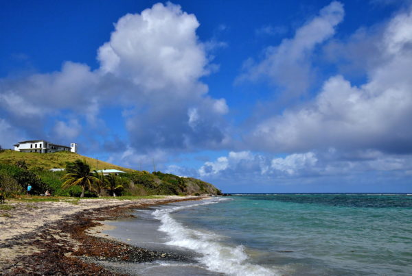
On November 14, 1493, Christopher Columbus moored his ships near the mouth of the Salt River. He called the island Santa Cruz meaning Holy Cross. He dispatched two dozen men to explore their discovery. Soon after they set foot on this beach, they were attacked by a tribe of Kalinago, also known as Island Caribs. The landing party made a hasty retreat (one later died of his wounds). In disgust, Columbus called this point Cabo de la Flecha (Cape of the Arrow). This was the first battle among Europeans and any Indigenous people of the New World. It was also the only time Christopher Columbus’ crew set foot on what would become United States soil. In the upper left corner is the Salt River Bay Visitor Station.
Columbus Landing Site, Christiansted, St Croix 00820, USVI Enlarge/Slideshow See On Map Directions
Exquisite! That is just one of several superlatives you will use to describe Half Moon Bay on the Atlantic Ocean coastline. Facing the crescent-shaped cove are a host of rental villas, resorts (including St. Kitts Marriott, the island’s largest hotel), a golf course, casino, a range of bars and restaurants plus 24 hour scenery. Rolling waves lap along North Frigate Beach. This amazing panorama can be enjoyed from Timothy Hill Overlook. The lookout point is located on an elevated, narrow isthmus at the start of the Southeast Peninsula.
Timothy Hill Overlook, Southeast Peninsula, St. Kitts & Nevis Enlarge/Slideshow See On Map Directions
Another spectacular beach at the tip of the Southeast Peninsula embraces the shore of Banana Bay. This is the epitome of Caribbean perfection. Soft white sand. Gentle lapping waves. Transparent, warm and shallow water with glistening shades of blue and green. Equally impressive is the view. In the background is Nevis. This sister island of Saint Kitts is small – measuring only 36 square miles – with less than 12,000 residents. The name comes from a Spanish acronym meaning Our Lady of the Snows. You can access Nevis aboard the Sea Bridge ferry. Six daily trips make the three-mile journey between the islands. The departure point on Saint Kitts is at the end of the Southeast Peninsula facing Majors Bay.
Banana Bay Beach, Southeast Peninsula, Saint Kitts & Nevis Enlarge/Slideshow See On Map Directions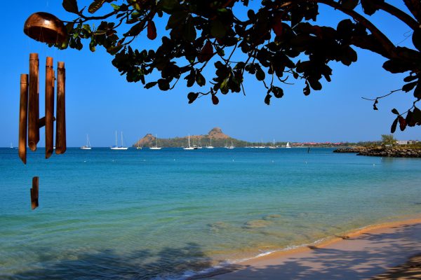
This crescent-shaped Rodney Bay is defined in the north by Pigeon Island seen in the background. In between these points are the calm, aquamarine waters of the Caribbean Sea. This location is THE spot for an ideal vacation on Saint Lucia. It is also the source of glorious dreams before you arrive and wonderful memories when you return home.
Reduit Beach Ave & Flamboyant Dr, Rodney Bay, St. Lucia Enlarge/Slideshow See On Map Directions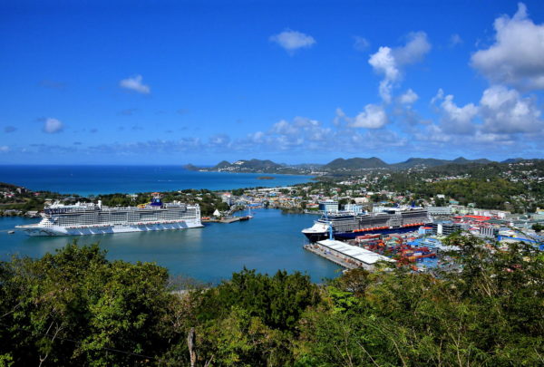
Your exploration of the southwest coast of Saint Lucia begins with a stunning view of Castries and the harbor. This camera-worthy overlook is called Morne Fortune Layby. Your driving tour travels as far as the town of Soufrière and the majestic Pitons dormant volcanoes. The one-way distance from the cruise terminal is only 25 miles or about 40 minutes. But plan for at least half a day or longer. You will want to savor the incredible scenery, historic locations and numerous places of interest recommended in this travel guide.
Morne Fortune Layby, Government House Rd, Charlotte, St. Lucia Enlarge/Slideshow See On Map Directions
There are five beaches along Orient Bay. This is Bikini Beach. Its name is a bit of a misnomer because in true French Rivera style, many female sun worshipers are topless. A bit further south is the famous Club Orient, a naturist resort. This means most of their guests are au natural. If you plan on visiting these clothing optional sections, then you’d better bring a very good sunblock.
Hotel Mont Vernon, Rue du Mont Vernon , St Martin Enlarge/Slideshow See On Map Directions
Imagine a beach with warm white sand and aquamarine water on a tropical island. That accurately describes Maho Beach near Phillipsburg in Sint Maarten. That sounds like the perfect place to idle away a sunny afternoon, doesn’t it? It is except your paradise is interrupted every half hour by the roar of very low flying planes coming in for a landing and the jet blasts of those taking off. The Princess Juliana International Airport is located just behind where this photo was taken. In the background is the Sonesta Maho Beach Resort and Casino.
Maho Beach, Beacon Hill Road, Sint Maarten Enlarge/Slideshow See On Map Directions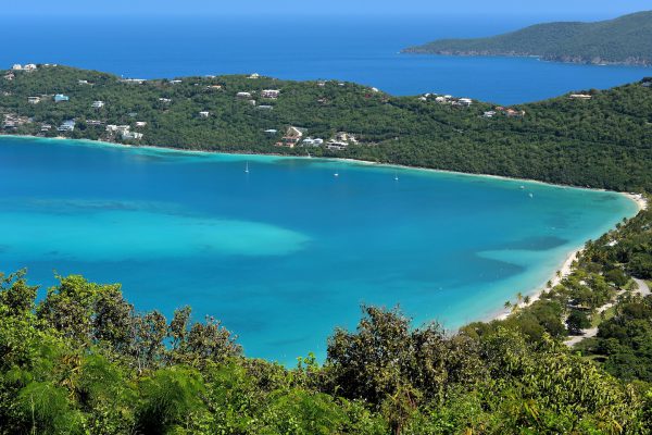
Sir Francis Drake was a 16th century sea captain and the first Englishman to sail around the world. In England he was a hero but the Spaniards considered him a pirate for plundering their ships in the West Indies. According to legend, he used an elevated spot on the Northside of St. Thomas as a lookout for arriving vessels. In 1933, Arthur Fairchild created an overlook there and called it Drake’s Seat. It provides a stunning view of Magens Bay in the foreground and Lovenlund Bay on the other side of the Peterborg Point peninsula.
Drake's Seat Rte 37, St Thomas 00802, USVI Enlarge/Slideshow See On Map Directions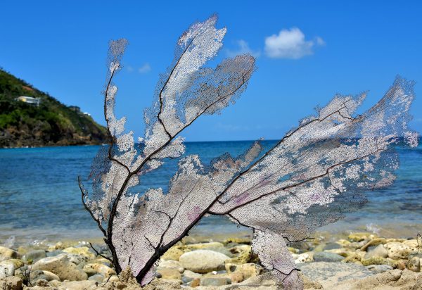
The water surrounding Saint Thomas is blessed with healthy reefs that are home to more than 40 types of coral. This is a visual paradise for snorkelers and scuba divers. But if you explore deserted beaches like the one at Mandahl Bay, you might find sea fans that have washed ashore. Called a gorgonian or alcyonacea, this sea whip is actually a colony of tiny, living polyps.
21B-2 MANDAHL, Box 600166, St. Thomas, 00801, USVI Enlarge/Slideshow See On Map Directions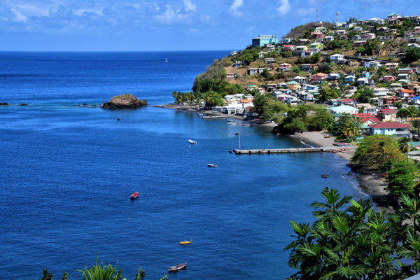
Step out of your car and savor this elevated view of Barrouallie. You will immediately understand why the earliest French settlers selected this idyllic spot in 1719. They quickly established plantations in the area manned by African slaves. Soon, Barrouallie evolved into the epicenter for sugarcane. This booming economy came to a crashing halt for two reasons. The slaves were freed in 1838. At the same time, sugarcane prices dropped when Europe began relying on their own sugar beets.
Leeward Hwy, Barrouallie, St. Vincent & Grenadines Enlarge/Slideshow See On Map Directions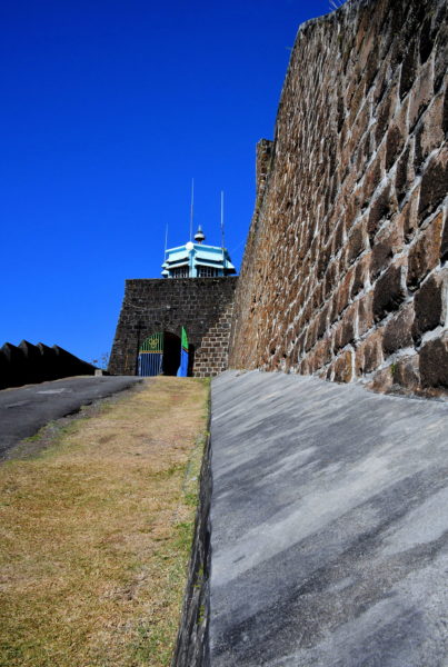
The Seven Years’ War ended in 1763 with the Treaty of Paris. As part of the agreement, France ceded many colonies in the Americas to Great Britain including Saint Vincent. The British immediately began building a fortification near Kingstown. They named it Fort Charlotte in honor of King George III’s wife. During the 43 years of construction – from 1763 until 1806 – the island witnessed several battles between the British and Indigenous people. Most noteworthy were the First Carib War (1769 – 1773) and battles with the Black Caribs (1793 – 1796). In between these events, the British lost control of Saint Vincent to the French from 1779 and 1783. In short, the colonial years during the second half of the 18th century were tumultuous at best.
Fort Charlotte, Edinboro Road, Clare Valley, St. Vincent & Grenadines Enlarge/Slideshow See On Map Directions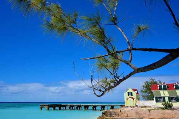
The waterfront along Cockburn Town is accented by an old wooden salt pier. This is where ships were loaded with salt beginning in the late 17th century. By 1725, as many as 1,000 salt rakers worked in the 227 acres of salinas. The quality of Turks Island salt was so exceptional it was exported across the world until the early 1960s.
Front St & Market St, Cockburn Town TKCA 1ZZ, Turks and Caicos Islands Enlarge/Slideshow See On Map Directions
Five main beaches stretch contiguously along the western shoreline of Grand Turk. The most popular are (from south to north) Cruise Center, Governor’s and Pillory Beaches. They are also the most crowded. If a secluded paradise is more your style, just look for signs along Duke Street reading, “Columbus Landfall National Park Beach Access.” They are your pathway to a tropical nirvana. Enjoy the view!
Columbus Landfall National Park, Beach Access Pond St, Cockburn Town TKCA 1ZZ, Turks and Caicos Islands Enlarge/Slideshow See On Map Directions