Blue Mountains, NSW, Australia

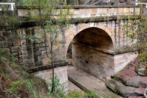
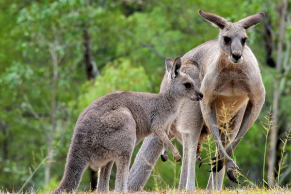
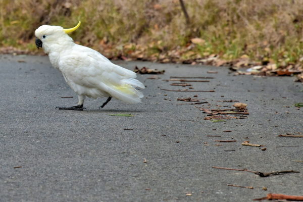
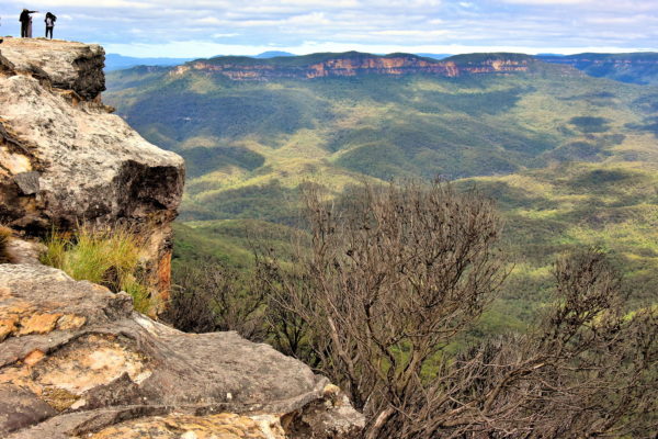
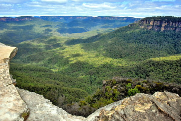
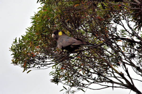
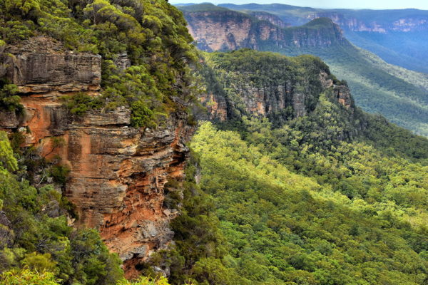
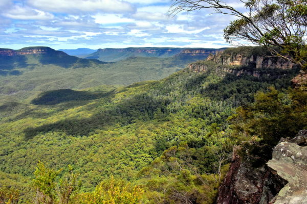
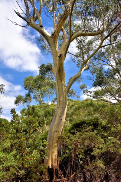
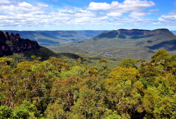
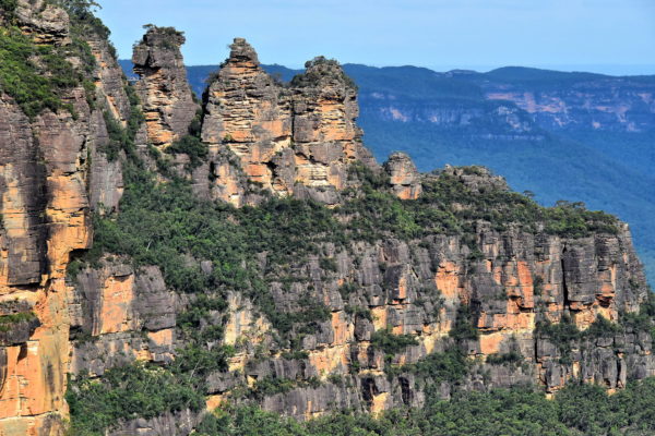
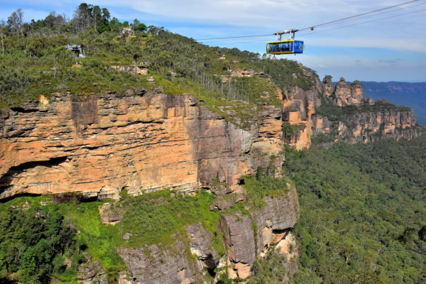
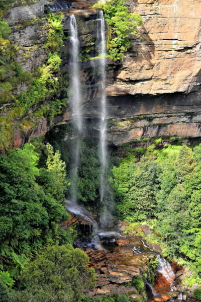
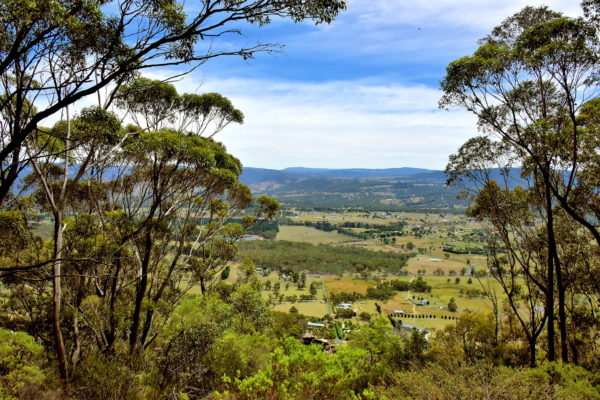
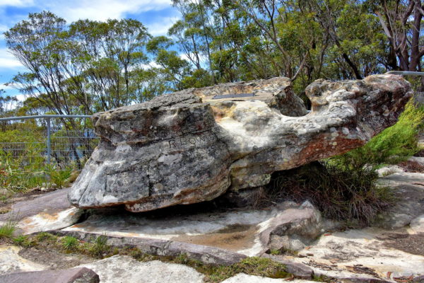
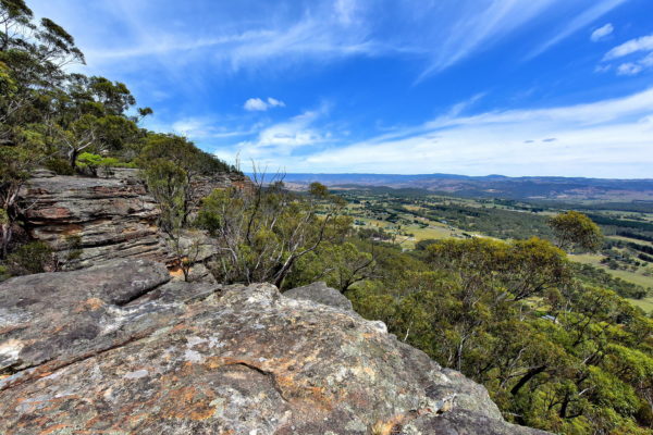
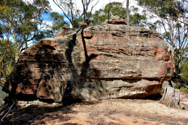
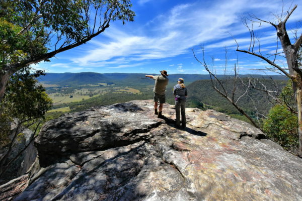
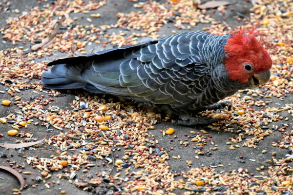
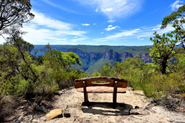
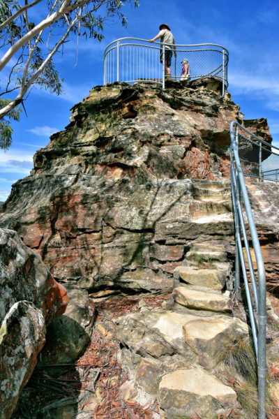
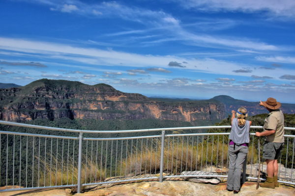
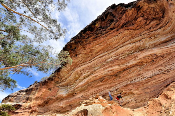
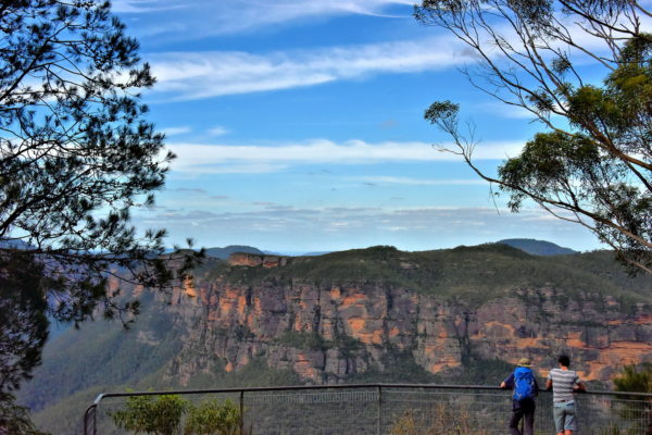
The Greater Blue Mountains Area is 2.5 million acres of stunning plateaus, ridges, gorges and valleys. The landscape is blanketed by eucalyptus trees, flowing rivers and cascading waterfalls. The scenery is incredible! This sacred land of the Aboriginal people richly deserves its designation as a World Heritage Site.

Share this
Lennox Bridge near Glenbrook in Blue Mountains, Australia - Encircle Photos

1 Lennox Bridge near Glenbrook in Blue Mountains, Australia

The distance from Sydney to Glenbrook – the east gateway to Blue Mountains National Park – is about 40 miles. Your main route will be The Great Western Highway. It is an easy drive now but almost impassable before the 19th century. In 1831, General Major Thomas Mitchell was commissioned to build a road up the eastern escarpment of the Blue Mountains. He hired stone mason David Lennox to become the Superintendent of Bridges. When a team of convicts finished his first project in 1833, the bridge was named after him. Lennox Bridge is the oldest stone arch bridge on Australia’s mainland.

Lennox Bridge, Mitchells Pass, Glenbrook NSW 2773, Australia
Enlarge/Slideshow See On Map Directions
Eastern Grey Kangaroos at Euroka Clearing near Glenbrook in Blue Mountains, Australia - Encircle Photos

2 Eastern Grey Kangaroos at Euroka Clearing near Glenbrook in Blue Mountains, Australia

If you are not an Aussie, then you may have seen a kangaroo in a zoo but never in the wild. Here is your chance. Go to Euroka Clearing campground. A mob of roos are typically grazing in the grasslands just after sunrise and before dusk. These are eastern grey kangaroos. This adult male (called a buck, jack or boomer) was keeping a vigilant eye over the young joey.

Euroka Campground, Fern Glen Walking Track, Glenbrook NSW 2787, Australia
Enlarge/Slideshow See On Map Directions
Burial Tree at Euroka Clearing near Glenbrook in Blue Mountains, Australia - Encircle Photos

3 Burial Tree at Euroka Clearing near Glenbrook in Blue Mountains, Australia

Euroka Clearing is a popular campground adjacent to Nepean River. There are 40 sites within five sections. It has few amenities. But what better way to experience tenting in the bush? This area was inhabited by the Aboriginal people for thousands of years. These carved trees at Appletree Flat are evidence of its continued importance. The Darug community calls this Nye Gnorang meaning Spiritual Place. They traditionally remove bark of a tree near a loved one’s grave and then carve in the family’s symbol or totem. To experience Aboriginal rock art, take a trail from Euroka Clearing to the Red Hands Cave. The handprints there date back 500 to over 1,000 years.

Euroka Campground, Fern Glen Walking Track, Glenbrook NSW 2787, Australia
Enlarge/Slideshow See On Map Directions
Sulphur-crested Cockatoo at Euroka Clearing near Glenbrook in Blue Mountains, Australia - Encircle Photos

4 Sulphur-crested Cockatoo at Euroka Clearing near Glenbrook in Blue Mountains, Australia

It is exciting to see a sulphur-crested cockatoo for the first time. Their plumage is a bright white with a distinctive yellow crest. Where there is one, there are several. Soon you begin to take them for granted unless you are trying to sleep in at the Euroka Clearing campground. Their loud squawking is guaranteed to wake you at dawn

Euroka Campground, Fern Glen Walking Track, Glenbrook NSW 2787, Australia
Enlarge/Slideshow See On Map Directions
Gregory Blaxland Statue in Blaxland in Blue Mountains, Australia - Encircle Photos

5 Gregory Blaxland Statue in Blaxland in Blue Mountains, Australia

Blaxland is a small town of 7,500 people. Originally called Wascoe, it was renamed in 1914 as a tribute to Gregory Blaxland. Born in Kent, England in 1778, Blaxland immigrated to Sydney in 1806 on the promise he would be granted land and convicts for slave labor. Like many Sydney famers in the early 19th century, he wanted more agriculture property to add to his existing 4,700 acres. However, the Blue Mountains were a confining barrier. With the permission of Governor Lachlan Macquarie, he plus William Larson and William Wentworth tried crossing the Great Dividing Range. On the third attempt in 1813, he was successful. His reward was 1,000 acres on the other side of the Blue Mountains. This bust by Terrance Plowright was erected in 1913 to mark the accomplishment’s centennial.

146 Great Western Hwy, Blaxland NSW 2774, Australia
Enlarge/Slideshow See On Map Directions
Aboriginal Rock Engraving in Lawson in Blue Mountains, Australia - Encircle Photos

6 Aboriginal Rock Engraving in Lawson in Blue Mountains, Australia

Aboriginal people lived in the area surrounding today’s Sydney for over 20,000 years. The clans who resided in the Blue Mountains were the Darug and Gundungurra. There are several examples of their engravings. Some are about 5,000 years old. This “simple figurative” carving of a kangaroo is at the Kangaroo Street Aboriginal Site in Lawson. It was probably chiseled into the sandstone using a pointed shell or rock. Archaeologists believe this may have been an “increase site” created during a ceremony to wish for more food such as kangaroo meat

5 Kangaroo St, Lawson NSW 2783, Australia
Enlarge/Slideshow See On Map Directions
Kihilla Retreat & Conference Centre in Lawson in Blue Mountains, Australia - Encircle Photos

7 Kihilla Retreat & Conference Centre in Lawson in Blue Mountains, Australia

This ochre bungalow provides a peek into late 19th century Arts and Crafts Movement architecture in the Blue Mountains. The original landowner of these 25 acres overlooking the Lower Blue Mountains was Robert Fitzstubbs, an auctioneer from Sydney. His brother built the Main House in 1882. In 1890, brewmaster James Mitchell added a wing, stables and coach house. It was then owned by an English architect and his successors through 1953. Elsie McPhee was the last occupant until 1967. It is now the Kihilla Retreat & Conference Centre plus an office of The Church Army in Australia.

5-17 Queens Road, Lawson NSW 2783, Australia
Enlarge/Slideshow See On Map Directions
Lincoln’s Rock in Wentworth Falls in Blue Mountains, Australia - Encircle Photos

8 Lincoln’s Rock in Wentworth Falls in Blue Mountains, Australia

Lincoln’s Rock is one of the least visited yet most dramatic lookouts in the Blue Mountains. You can approach the unprotected edge for a vertigo-inducing view of the eucalypt forest below encircled by sandstone cliffs. This was previously called Flat Rock or Honeymoon Rock. The Geographic Names Board officially changed that in 2013. Its namesake is former local resident and mountaineer Lincoln Ross Hall. In 2007, he wrote the book “Dead Lucky” about his presumed death on Mt. Everest at 28,200 feet.

31 Little Switzerland Dr, Wentworth Falls NSW 2782, Australia
Enlarge/Slideshow See On Map Directions
Jamison Valley below Lincoln’s Rock in Wentworth Falls in Blue Mountains, Australia - Encircle Photos

9 Jamison Valley below Lincoln’s Rock in Wentworth Falls in Blue Mountains, Australia

From the Lincoln’s Rock lookout is a vista of the dense green Jamison Valley and Creek. This landscape is 2.5 miles long and 6.2 miles wide. They were named by Lachlan Macquarie, the Governor of New South Wales from 1810 to 1821, as a tribute to John Jamison. Jamison was a Royal Navy physician who served on the famous HMS Agamemnon under the command of Vice Admiral Horatio Nelson. After arriving in New South Wales in 1814, Jamison became a significant land owner and the country’s first titled free settler.

31 Little Switzerland Dr, Wentworth Falls NSW 2782, Australia
Enlarge/Slideshow See On Map Directions
Yellow-Tailed Black Cockatoo in Wentworth Falls in Blue Mountains, Australia - Encircle Photos

10 Yellow-Tailed Black Cockatoo in Wentworth Falls in Blue Mountains, Australia

The yellow-tailed black cockatoo is a fairly common sight in forests along southeast Australia and Tasmania. They typically perch, roost and nest in old eucalyptus, an abundant tree in the Blue Mountains. This cockatoo’s distinctive characteristic accenting its brown-black plumage is a yellow cheek patch. The white beak indicates this is a female. Males have black beak. The parrot tends to measure 22 to 26 inches with a foot long tail. While you are hiking, you will soon recognize their shrill call sounding like “kee-ow.”

51 Little Switzerland Dr, Wentworth Falls NSW 2782, Australia
Enlarge/Slideshow See On Map Directions
Kedumba Pass in Wentworth Falls in Blue Mountains, Australia - Encircle Photos

11 Kedumba Pass in Wentworth Falls in Blue Mountains, Australia

The magnificent Kedumba Valley lies below your feet at this overlook in Wentworth Falls. This was home to the Gundungurra people for tens of thousands of years. According to their legend called Gunyunggalung (Far Past Times), this secret valley was part of a 100 mile area formed by Gurangatch (a giant eel) while escaping pursuit by Mirrigan (a tiger quoll). The first European to meet this clan of hunters and gathers was in 1802. They clashed bitterly for control during the first half of the 19th century. Today, the Gundungurra Tribal Council, headquartered in Katoomba, has a registered claim over their traditional land and are custodians of the Blue Mountains.

Kedumba Pass, Wentworth Falls NSW 2787, Australia
Enlarge/Slideshow See On Map Directions
Gordon Falls Lookout in Leura in Blue Mountains, Australia - Encircle Photos

12 Gordon Falls Lookout in Leura in Blue Mountains, Australia

The town of Leura has been called the Jewel in the Mountains Crown. Views like this one prove the slogan is warranted. Gordon Falls Lookout delivers a panoramic view over Jamison Valley. Mount Solitary is on the left, the backside of Three Sisters is on the right and Kings Tableland is in the distance. The nearby Leura Cascades, Leura Falls and Gordon Falls with its 650 foot drop are all worth exploring. Hikers are thrilled by the Prince Henry Cliff Walk. This moderate trail connects Leura and Katoomba while providing incredible scenery for 4.5 miles.

Gordon Falls Lookout, Gordon Falls Walking Track, Leura NSW 2780, Australia
Enlarge/Slideshow See On Map Directions
White Eucalyptus at Gordon Falls in Leura in Blue Mountains, Australia - Encircle Photos

13 White Eucalyptus at Gordon Falls in Leura in Blue Mountains, Australia

93% of the 4,000 square miles of the Greater Blue Mountains Area is forested with eucalypt vegetation. When the temperature rises, the oil of these eucalyptus trees evaporate into the air, casting a blue haze over the landscape. This phenomenon gave the region its name. It is estimated 100 eucalypt species grow in the Blue Mountains. The tallest at nearly 200 feet is the blue gums. This distinctive white gum averages 50 feet in height.

Gordon Falls Lookout, Gordon Falls Walking Track, Leura NSW 2780, Australia
Enlarge/Slideshow See On Map Directions
Scenic Gableway at Scenic World in Katoomba in Blue Mountains, Australia - Encircle Photos

14 Scenic Gableway at Scenic World in Katoomba in Blue Mountains, Australia

Katoomba Scenic World is a very popular visitor destination in the Blue Mountains. It offers three rides including Scenic Cableway. This visually-exciting cable car – Australia’s steepest – descends 1,673 feet down the escarpment. When you disembark, you arrive at Scenic Walkway. This is a 1.5 mile, raised boardwalk through the dense rainforest. This easy path lets you experience the unique flora of the Blue Mountains.

Violet St & Cliff Drive, Katoomba NSW 2780, Australia
Enlarge/Slideshow See On Map Directions
Lookout at Scenic World in Katoomba in Blue Mountains, Australia - Encircle Photos

15 Lookout at Scenic World in Katoomba in Blue Mountains, Australia

Scenic World is an enjoyable tourist attraction but there is an admission fee. If you are only looking for incredible scenery, then you can have it for free. On the second floor is the Terrace Café & Lookout. After climbing the steps, you are rewarded with this vision of the expansive Jamison Valley. Breathtaking is an overused superlative. In this case it applies. On the left are the Three Sisters. In the distance is Mount Solitary. The mountain’s plateau is 3.1 miles wide and reaches an elevation of 3,120 feet. The Aboriginal people call it Korowal meaning Strong One.

Violet St & Cliff Drive, Katoomba NSW 2780, Australia
Enlarge/Slideshow See On Map Directions
Three Sisters at Scenic World in Katoomba in Blue Mountains, Australia - Encircle Photos

16 Three Sisters at Scenic World in Katoomba in Blue Mountains, Australia

The Blue Mountains most famous landmark is Three Sisters. These dramatic rock columns form a ridge jutting into the northern edge of Jamison Valley. Let’s meet the girls. On the left is Meehni, the tallest at 3,025 feet. The middle child is Wimlah at 3,012 feet. Baby sister is Gunnedoo at 2,972 feet. According to a Dreamtime legend, these siblings were part of the Kotoombra clan. Their father turned them to stone to protect them from three suitors belonging to the rival Nepean tribe. When he died, no one could bring the three sisters back to life. Many believe this story was a marketing scheme created in the 1920s.

Eagle Hawk Lookout, 122A Cliff Dr, Katoomba NSW 2780, Australia
Enlarge/Slideshow See On Map Directions
Scenic Skyway at Scenic World in Katoomba in Blue Mountains, Australia - Encircle Photos

17 Scenic Skyway at Scenic World in Katoomba in Blue Mountains, Australia

Scenic Skyway has been delighting passengers since 1958. The ride travels 2,362 feet across the Kedumba River valley. The large windows provide a terrific perspective of the Three Sisters. A glass floor gives you an unobstructed view of the gorge and Katoomba Falls 885 feet below you. This car is headed towards the Skyway East Station. The terminus connects to the Prince Henry Cliff Walk. Along this winding trail are several amazing lookouts. Echo Point and Spooners Lookout provide the closet view of the Three Sisters. If you are super ambitious and physically fit, consider the Three Sisters Hike. But be forewarned. This difficult trail reaches an elevation of 7,000 feet and forms a 48 mile circle.

Violet St & Cliff Drive, Katoomba NSW 2780, Australia
Enlarge/Slideshow See On Map Directions
Katoomba Falls at Scenic World in Katoomba Blue Mountains, Australia - Encircle Photos

18 Katoomba Falls at Scenic World in Katoomba Blue Mountains, Australia

Kedumba River is short – only about 12 miles long – but it makes a dramatic entry into Jamison Valley. Katoomba Falls segments into two ribbons before descending 150 feet. This ledge waterfall is visible from two places along the Prince Henry Cliff Walk. This photo was taken on the west bank of the valley. Just follow the free Katomba Falls Access Track adjacent to Scenic World. On the opposite side, your best view is from the Cliff View Lookout.

Reids Plateau Lookout, Katoomba NSW 2780, Australia
Enlarge/Slideshow See On Map Directions
Obelisk on Mount York near Mount Victoria in Blue Mountains, Australia - Encircle Photos

19 Obelisk on Mount York near Mount Victoria in Blue Mountains, Australia

Arthur Phillip, the First Governor of NSW (1788 – 1792), was impressed when he saw the vast, open land on the other side of the Great Dividing Range. He wanted to reach this promising agricultural land. A journal entry from his 1789 expedition called it the Blue Mountains. A former convict named John Wilson may have been the first to discover a pass in 1797. But during a subsequent attempt sponsored by Governor Hunter, Wilson could not prove his claim. Several other explorers tried and failed. Then the team of Gregory Blaxland, William Larson and William Wentworth hacked their way along the ridgelines for 21 days. On May 28, 1813, their expedition was successful. This obelisk on Mount York was erected in 1900 to commemorate the first crossing of the Blue Mountains. Three local towns are also named in recognition of the men.

Mount York Lookout, Mount Victoria NSW 2786, Australia
Enlarge/Slideshow See On Map Directions
Hartley Valley West View from Mount York near Mount Victoria in Blue Mountains, Australia - Encircle Photos

20 Hartley Valley West View from Mount York near Mount Victoria in Blue Mountains, Australia

Imagine how thrilling it was for Blaxland, Larson and Wilson to stand on this summit – they called it the “edge of the precipice” – and behold this fertile green landscape. In 1815, two years after their discovery of a pass over the Blue Mountains, their sponsor Governor Macquarie named the scenery 800 feet below the Vale of Clwydd. Now it is called the Hartley Valley. In the background is Mount Bindo. At 4,459 feet, it is the highest peak in the region.

Bardens Lookout, Mount York Road, Mount Victoria NSW 2786, Australia
Enlarge/Slideshow See On Map Directions
Eddy Rock on Mount York near Mount Victoria in Blue Mountains, Australia - Encircle Photos

21 Eddy Rock on Mount York near Mount Victoria in Blue Mountains, Australia

Among the numerous historic monuments at Mount York Reserve is Eddy Rock. In November of 1895, a committee of local residents made a presentation to Edward Miller Gard Eddy at this large boulder. This event was held a few weeks before E. M. G. Eddy left his post as Chief Commissioner of the N.S.W. Government Railways. He was credited for making substantial improvements to the rail system while creating benevolent programs for workers and their dependents during a period of regional depression. A few steps in front of this marker is the Eddy Rock Lookout.

Eddy’s Rock, Mount Victoria NSW 2786, Australia
Enlarge/Slideshow See On Map Directions
Hartley Valley North View from Mount York near Mount Victoria in Blue Mountains, Australia - Encircle Photos

22 Hartley Valley North View from Mount York near Mount Victoria in Blue Mountains, Australia

The sandstone ridge where Blaxland, Larson and Wilson discovered passage over the Blue Mountains is triangular. This provides two panoramas of Hartley Valley: towards the west (shown earlier) and this northern vista. In 1815, Lachlan Macquarie, the 5th Governor of NSW (1810 to 1821), named the plateau you are standing on Mount York. This was a tribute to the Duke of York and Albany, a title of Great Britain nobility appointed by the monarch from 1716 until 1827. Mount York has an elevation of 3,481 feet.

Coxs Road, Mount Victoria NSW 2786, Australia
Enlarge/Slideshow See On Map Directions
Coxs Road on Mount York near Mount Victoria in Blue Mountains, Australia - Encircle Photos

23 Coxs Road on Mount York near Mount Victoria in Blue Mountains, Australia

Finding a pass over the Blue Mountains was one thing. Reaching the valley below was equally challenging. Governor Macquarie first hired George Evans to survey the land. Then, in 1814, William Cox was retained to build a road down the mountainside. Cox managed 30 convicts for the task. Using pickaxes and shovels for 27 weeks, they carved Coxs Road, a treacherous and narrow trail averaging 12 inches wide. At this section called The Pass of Mount York, you can see scars on boulders created during the laborious construction. There is also a plaque nearby about James Watsford. He was the first mail carrier to travel over this steep and uneven slope in 1832. He accomplished this dangerous task by tying rocks to the wheels of his stagecoach to prevent a rapid and uncontrolled descent.

Coxs Road, Mount Victoria NSW 2786, Australia
Enlarge/Slideshow See On Map Directions
Recommended Tour Guide on Mount York near Mount Victoria in Blue Mountains, Australia - Encircle Photos

24 Recommended Tour Guide on Mount York near Mount Victoria in Blue Mountains, Australia

Blue Mountains is a fascinating destination. It is also a confusing labyrinth of winding roads, small towns and isolated lookouts … extremely challenging to navigate by yourself without missing the highlights. It is best to hire a local guide. I highly recommend Graham Chapman. He is passionate, knowledgeable, engaging and does a spectacular job showcasing the landscapes he loves. He is one of the best guides I have ever had the pleasure of working with. Reach him at: [email protected]

Coxs Road, Mount Victoria NSW 2786, Australia
Enlarge/Slideshow See On Map Directions
Gang-gang Cockatoo near Blackheath in Blue Mountains, Australia - Encircle Photos

25 Gang-gang Cockatoo near Blackheath in Blue Mountains, Australia

What an unexpected delight to see this gang-gang cockatoo feeding in the Blue Mountains forest. The distinguishable marking of this small cockatoo is the scalloped grey plumage. The male sports the bright red head and crest. Females are predominately grey. The range for this handsome parrot is limited to a narrow sliver in the southeast corner of New South Wales. Because they are so rare, your best chance of seeing a gang-gang is as the bird emblem for the Australian Capital Territory.

Anvil Rock Road & Perrys Lookdown Road, Blackheath NSW 2787, Australia
Enlarge/Slideshow See On Map Directions
Memorial Bench on Anvil Rock Trail near Blackheath in Blue Mountains, Australia - Encircle Photos

26 Memorial Bench on Anvil Rock Trail near Blackheath in Blue Mountains, Australia

Anvil Rock Trail is an easy, 750 foot path near Blackheath. During your winding, ridgeline walk, you will be treated to gorgeous, elevated views of the Grose Valley. One of the best overlooks is at this bench. It is a memorial to Joyce Brister, who died in 2010 at the age of 94. This native of Sydney and later a resident of Blackheath was an accomplished geologist, botanist, teacher and author. The plaque reads, “At home in the bush.”

Anvil Rock Track, Blackheath NSW 2787, Australia
Enlarge/Slideshow See On Map Directions
Anvil Rock near Blackheath in Blue Mountains, Australia - Encircle Photos

27 Anvil Rock near Blackheath in Blue Mountains, Australia

Nature carved this tall, impressive sandstone platform into the shape of a blacksmith’s tool. In 1938, the Blackheath Council named it Anvil Rock. A decade later, Stan Miller from Bradford Kendall Industries affixed one of their anvils on top. The company even appointed a custodian to monitor it. In 1970, the 672 pound hunk of steel disappeared. The anvil’s fate was a mystery for 35 years until it was discovered almost 1,000 feet below the cliff. In 2008, it was airlifted by helicopter and returned to the top of Anvil Rock Lookout.

Anvil Rock Lookout, Anvil Rock Track, Blackheath NSW 2787, Australia
Enlarge/Slideshow See On Map Directions
Anvil Rock Lookout near Blackheath in Blue Mountains, Australia - Encircle Photos

28 Anvil Rock Lookout near Blackheath in Blue Mountains, Australia

Now climb the staircase affixed to Anvil Rock Lookout and savor the expansive Grose River Valley, a visual highlight of Blue Mountains National Park. Below you are an impressive maze of forested canyons and ravines. Directly across from this great divide is Banks Wall, a 1,670 foot sandstone cliff. This escarpment is part of Mount Banks. The reddish/brown caps (red podzolics) are exposed Blue Mountains basalt, remnants of volcanic lava flow from over 17 million years ago. The tour guide Graham Chapman is pointing toward Mount Hay. The mountain’s dome peaks at 3,097 feet. If this scenery entices you to stay awhile, then consider pitching your tent at nearby Perrys Lookdown Campground.

Anvil Rock Lookout, Anvil Rock Track, Blackheath NSW 2787, Australia
Enlarge/Slideshow See On Map Directions
Wind Eroded Cave near Blackheath in Blue Mountains, Australia - Encircle Photos

29 Wind Eroded Cave near Blackheath in Blue Mountains, Australia

Now backtrack along Anvil Rock Trail until it forks at Wind Eroded Walking Track. Within a 1,300 foot hike you will discover Wind Eroded Cave. This massive, concave overhang has been etched with layers of intricate patterns thanks to sandblasting by nature for thousands of years. Wave Rock is impressive when admired from afar. The colorful ribbons of rock become awe-inspiring while climbing along the ridges.

Wind Eroded Walking Track, Blue Mountains National Park NSW 2787, Australia
Enlarge/Slideshow See On Map Directions
Evans Lookout near Blackheath in Blue Mountains, Australia - Encircle Photos

30 Evans Lookout near Blackheath in Blue Mountains, Australia

South of Anvil Rock and closer to Blackheath is Evans Lookout. A short distance from the parking lot is this observation deck with another dazzling perspective of Mounts Banks and Hay. The Walford Gully was forged by the flow of three creeks over millions of years. If you are wearing a good pair of hiking shoes, then give them an adventure by walking along the Grand Canyon Track. This four-mile loop has a few steep hills as you wind pass sandstone walls, eucalypts trees, lush vegetation and along Greaves Creek. You will also enjoy a few waterfalls plus the changing gorge scenery from the clearings.

Evans Lookout Parking Area, Evans Lookout Rd, Blackheath NSW 2785, Australia
Enlarge/Slideshow See On Map Directions
The Carrington Hotel in Katoomba in Blue Mountains, Australia - Encircle Photos

31 The Carrington Hotel in Katoomba in Blue Mountains, Australia

You can try seeing the Blue Mountains during a daylong trip from Sydney. But that is equivalent to eating from one section of a buffet. You will miss many of the best parts. So stay awhile by camping or selecting among several local B&Bs. A wonderful choice is the historic and highly-rated Carrington Hotel in Katoomba. The Great Western opened in 1883 and was renamed a few years later as a tribute to Lord Charles Carrington, the governor of New South Wales from 1885 through 1890. The Grand Old Lady was a premier Blue Mountains resort until it closed in 1985. After an extensive restoration renewed her Victorian charms, she reopened in 1998.

15-47 Katoomba St, Katoomba, Blue Mountains NSW 2780, Australia
Enlarge/Slideshow See On Map Directions
TOP