The 90 miles along the Big Sur coast from San Simeon to Carmel is one of the world’s most remote and scenic drives. You will be amazed at how many beautiful ways the Santa Lucia Mountains plunges into the ragged shores of the Pacific Ocean.
The 90 miles along the Big Sur coast from San Simeon to Carmel is one of the world’s most remote and scenic drives. You will be amazed at how many beautiful ways the Santa Lucia Mountains plunges into the ragged shores of the Pacific Ocean.
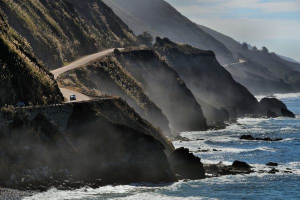
Big Sur was one of the most inaccessible coastlines in the U.S. until the 90 mile Carmel-San Simeon Highway was finished in 1937. Prisoners labored 18 years to construct this incredible seaside road. Today, you can enjoy its unspoiled natural beauty as California Route 1 twists and turns between the Santa Lucia Mountains and the crashing surf of the Pacific Ocean.
Cabrillo Hwy & Plasket Ridge Rd, Big Sur, California Enlarge/Slideshow See On Map Directions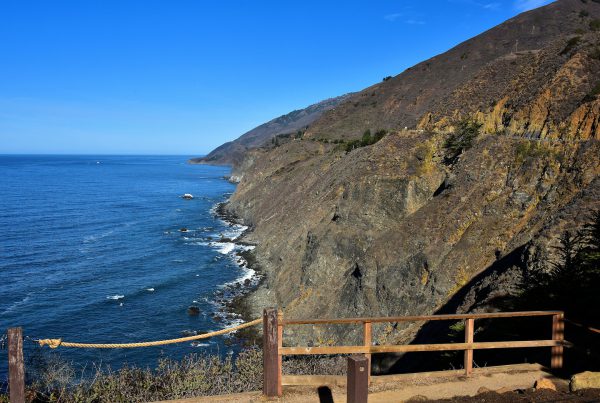
Ragged Point Overlook should be your first stop heading north along the Big Sur coastline. This viewing platform is about 15 miles beyond Hearst Castle and a short distance before crossing into Monterey County. While there, it is a good idea to stock up at the convenience store and fill up at the gas station because there are very few options during the rest of your exhilarating trip.
19019 CA-1, Ragged Point, CA 93452 Enlarge/Slideshow See On Map Directions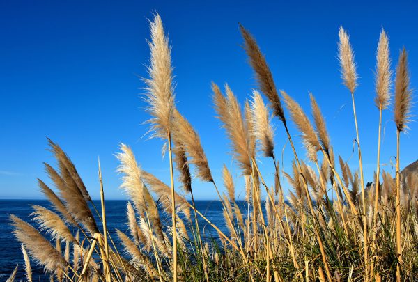
A botanist will thoroughly enjoy their visit to Big Sur because the corridor hosts over 340 varieties of trees, plants, scrub and grasses. They are clustered into 19 different “plant communities” based on the diverse terrain and microclimates. These barnyard foxtails are considered “New Native.” This means they were accidentally introduced by early pioneers who settled here in the late 19th century after Mexico ceded Alta California to the United States in 1848.
Cabrillo Hwy & Plasket Ridge Rd, Big Sur, California Enlarge/Slideshow See On Map Directions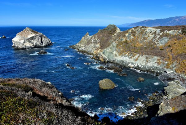
Treasure hunters enjoy searching for green precious gemstones that gave this Big Sur inlet its name: Jade Cove. Be careful not to collect a pocketful of serpentine. This is another green mineral found here but with no commercial value. The way to tell them apart is the latter scratches easily.
Cabrillo Hwy & Plasket Ridge Rd, Big Sur, California Enlarge/Slideshow See On Map Directions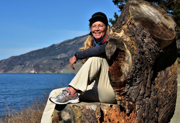
Someone was gracious enough to carve this chair in a large stump at the Mill Creek Picnic Ground. When you sit down, you instantly feel like royalty on a throne while the kingdom at your feet is the vast Pacific Ocean.
Cabrillo Hwy & Mill Creek Rd, Big Sur, CA 93920 Enlarge/Slideshow See On Map Directions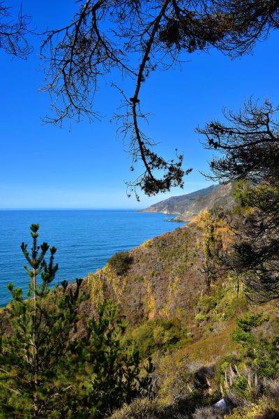
When you mention Big Sur, most people immediately think of the Santa Lucia cliffs that plunge into the rocky shores of the Pacific Ocean. But parallel to the coastline is the northern division of the Los Padres National Forest. It offers more than 300 miles of hiking trails plus 11 campgrounds among its pristine wilderness.
62400 CA-1, Big Sur, CA 93920 Enlarge/Slideshow See On Map Directions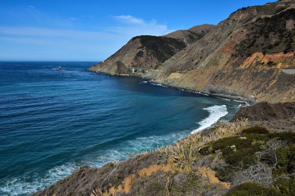
This section of Big Sur is the Landels-Hill Big Creek Reserve. The area consists of over 4,000 acres stretching for several miles along the coast plus one mile offshore. The University of California manages the seascape in order to conduct archeology, environmental and marine research.
Landels-Hill Big Creek Reserve CA-1, Big Sur, CA 93920 Enlarge/Slideshow See On Map Directions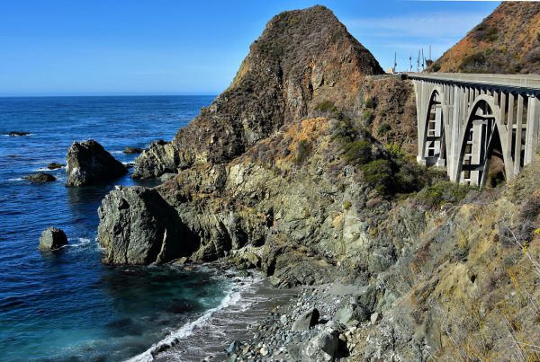
33 bridges were built along this 90 mile stretch of California State Route 1 before the Big Sur Coast was opened for cars in 1937. Big Creek Bridge is one of seven that are a concrete, double-arched design.
Landels-Hill Big Creek Reserve CA-1, Big Sur, CA 93920 Enlarge/Slideshow See On Map Directions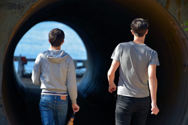
After parking at the Julia Pfeiffer Burns State Park, it is a short walk through a large culvert beneath Route 1 before you are rewarded with a view of the McWay Falls. The waterfall drops 80 feet onto a beach and then pours into the Pacific Ocean.
McWay Waterfall Trail, Big Sur, CA 93920 Enlarge/Slideshow See On Map Directions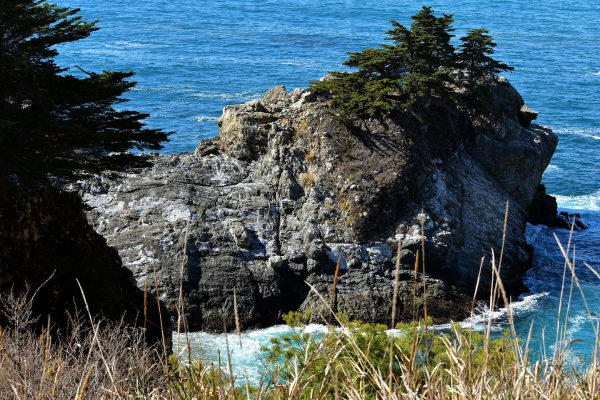
Circa 1870, Christopher McWay owned the Saddle Rock Ranch which was named after this formation that looks like a horse saddle. He sold it to Lathrop and Hellen Brown in the 1920s. 40 years later, they donated 1,800 acres to California with the specification that the park be named after Julia Pfeiffer Burns who was an early settler of the area.
McWay Waterfall Trail, Big Sur, CA 93920 Enlarge/Slideshow See On Map Directions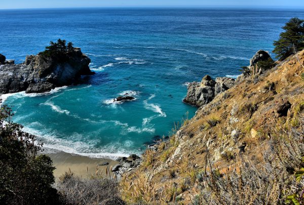
McWay Cove is the scenic heart of the Julia Pfeiffer Burns State Park. On the left (just off camera) is where the waterfall plunges onto the sand and then mixes with the ocean waves. Unfortunately, access to this idyllic beach is restricted except by boat.
McWay Waterfall Trail, Big Sur, CA 93920 Enlarge/Slideshow See On Map Directions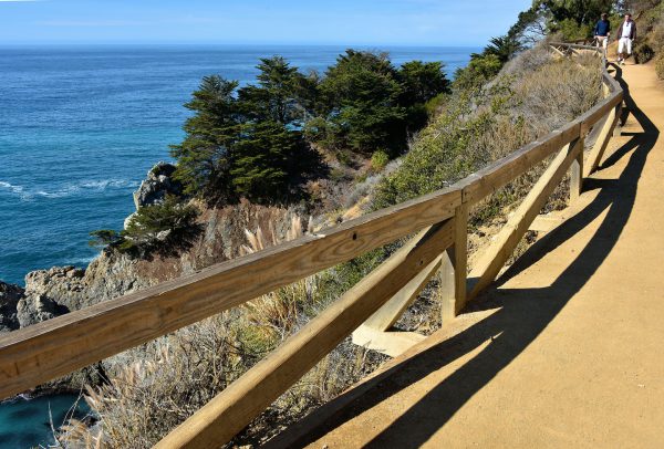
It can be challenging for the physically impaired to explore Big Sur’s rugged coastline. But a great option is this half-mile Overlook Trail at the Julia Pfeiffer Burns State Park. It is paved, easy to navigate and offers panoramic views of the waterfalls, the cove and the shoreline.
McWay Waterfall Trail, Big Sur, CA 93920 Enlarge/Slideshow See On Map Directions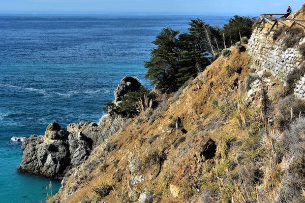
If you visit the Julia Pfeiffer Burns State Park during December or January, you might see gray whales swim by during their southern migration. Also watch for sea otters and harbor seals. But even if you don’t catch a glimpse of these marine animals, you will not be disappointed by the views from this overlook.
McWay Waterfall Trail, Big Sur, CA 93920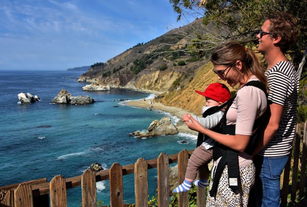
Some parents travel a long way in order to introduce their children to California’s beautiful coast. This young family came from Europe. The husband explained he had visited Big Sur as a child and couldn’t wait to show it to his son. His wife did not speak English but her happy smile did not require a translation.
McWay Waterfall Trail, Big Sur, CA 93920 Enlarge/Slideshow See On Map Directions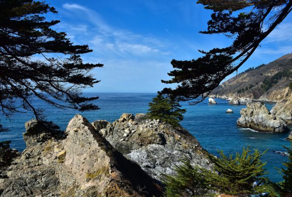
This view clearly shows why Sunset Magazine named Julia Pfeiffer Burns State Park one of the “best spots to pitch a tent on the coast.” Imagine how wonderful it is to fall asleep at night while listening to the hypnotic sound of the rolling surf. But the number of campsites is limited so advance reservations are recommended. And don’t bring your pet; neither dogs nor campfires are allowed to keep you warm at night.
McWay Waterfall Trail, Big Sur, CA 93920 Enlarge/Slideshow See On Map Directions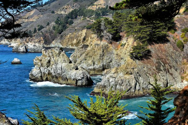
In addition to the rocky cliff and pounding surf, the Julia Pfeiffer Burns State Park is blessed with over 3,750 acres of oak, evergreens, chaparral and some giant redwoods that are hundreds of years old. If you are ambitious and in good shape, then follow the trails east of Highway 1 toward the 3,000 foot ridge overlooking the ocean.
McWay Waterfall Trail, Big Sur, CA 93920 Enlarge/Slideshow See On Map Directions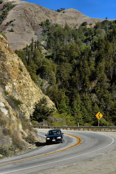
If you are behind the wheel during your Big Sur road trip, your passengers will enjoy seeing all of the natural beauty while you see lots of yellow: yellow warning signs and yellow road dividers. If you want to see fewer car bumpers, then plan your visit during an autumn weekday when the crowds are gone. September and October are also ideal because it is typically warm (daytime in the 70°s) and there is less fog along the coast.
51700 Cabrillo Hwy, Big Sur, California Enlarge/Slideshow See On Map Directions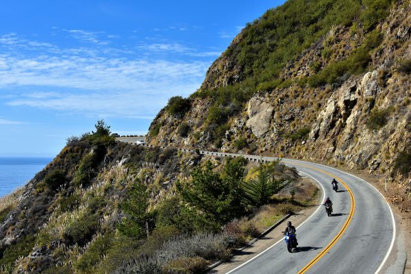
Three million people annually drive this All American Road along the coast of Big Sur, California. Unlike most trips, the goal is not the destination at either Carmel or San Simeon. The journey is your awe-inspiring reward with the spectacular scenery along the way. If you are a bit squeamish about heights, your best bet is to travel south to north so you don’t need to look down while your vehicle hugs the guard rails.
49901 CA-1, Big Sur, CA 93920 Enlarge/Slideshow See On Map Directions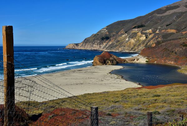
This is one of the few sandy beaches you’ll see during your drive along the Big Sur coast but unfortunately it is restricted by a fence. Yet even if this pristine sand and tide pool were accessible, swimming is not advised because the water is cold, the waves are unpredictable, and the strong currents can be dangerous.
CA-1, Monterey, CA 93940 Enlarge/Slideshow See On Map Directions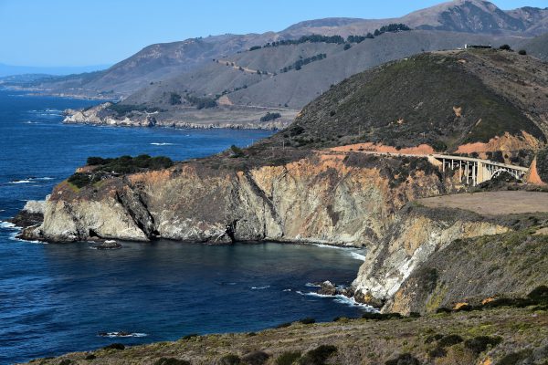
Bixby Creek Bridge’s 714 foot length makes it the longest bridge along Big Sur. Its handsome concrete arch spanning this point called Dinosaur Rock also makes it the most photographed. The scenic landmark – seen here from Hurricane Point – opened in 1932. That was five years before the rest of Highway 1 was built to reach San Simeon about 75 miles to the south.
Cerro Hill Trailhead 39320 Coast Rd, Monterey, CA 93940 Enlarge/Slideshow See On Map Directions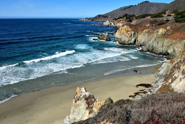
This promontory with its vivid colors, pounding surf and sandy beach is Rocky Point. It is about ten miles south of Carmel which means your northerly drive along Big Sur is almost over. But if you want to linger awhile longer and savor the sights, then there is a fifty year old restaurant nearby that sits on a cliff with outdoor seating, great views and equally great reviews.
38198 CA-1 Monterey, CA 93940 Enlarge/Slideshow See On Map Directions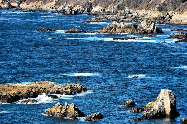
Most of the Big Sur coastline must be appreciated from the road as it winds around cliffs that can tower over 1,000 feet. For a closer view, head to Garrapata State Park. It is less than seven miles south of Carmel. Among its 3,000 acres are two miles of beachfront trails where you can enjoy the sounds of the ocean and the mist in your face.
26473 CA-1 Monterey, CA 93940 Enlarge/Slideshow See On Map Directions